
Puerto Rico Highway 501
Highway in Puerto Rico / From Wikipedia, the free encyclopedia
Dear Wikiwand AI, let's keep it short by simply answering these key questions:
Can you list the top facts and stats about Puerto Rico Highway 501?
Summarize this article for a 10 year old
SHOW ALL QUESTIONS
Puerto Rico Highway 501 (PR-501) is a tertiary[3] state highway in Ponce, Puerto Rico. The road runs north to south, and mostly alongside Rio Pastillo in barrio Marueño. It southern terminus is at PR-123, just off Calle 18 of Urbanización Las Delicias in barrio Magueyes, and its northern end is also at PR-123 but in barrio Guaraguao.
 Southern terminus of PR-501 at entrance to Barrio Magueyes, Ponce
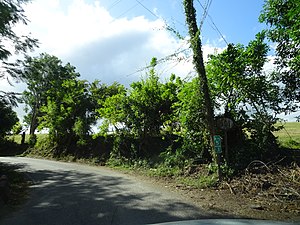 PR-501 south in Barrio Marueño
.jpg)
.jpg)
Quick Facts Highway 501, Route information ...
Highway 501 | ||||
|---|---|---|---|---|
| Ruta 501 | ||||
.svg) | ||||
| Route information | ||||
| Maintained by Puerto Rico DTPW | ||||
| Length | 10.3 km[1][2] (6.4 mi) | |||
| Southern segment | ||||
| South end | ||||
| Major intersections | ||||
| North end | Sector La Jagua in Marueño | |||
| Northern segment | ||||
| South end | Sector Las Lomas in Marueño | |||
| North end | ||||
| Location | ||||
| Country | United States | |||
| Territory | Puerto Rico | |||
| Municipalities | Ponce | |||
| Highway system | ||||
| ||||

Close