Soufrière River
River in Soufrière Quarter, Saint Lucia From Wikipedia, the free encyclopedia
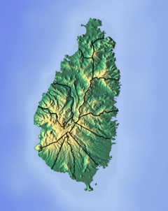
The Soufrière River (French la Soufrière) is a river in the Soufrière Quarter on the island country of Saint Lucia.[1] The French term "Soufrière" is a generic one referring to "Sulphury" volcanic peaks called La Soufrière or Soufrière Hills on each of St. Vincent, St. Lucia, Dominica, Guadeloupe.[2][3][4]
| Soufrière river | |
|---|---|
 | |
| Location | |
| Country | Saint Lucia |
| Region | Soufrière Quarter |
| Physical characteristics | |
| Mouth | Soufrière Bay, Caribbean Sea |
• location | Soufrière, Saint Lucia |
• coordinates | 13°51′21″N 61°03′38″W |
Course
The Soufrière River empties into Soufrière Bay on the Caribbean Sea. A river separates the town of Soufrière from the Fond Beniere area.[5] A section of the river above the town was canalised and realigned in 1972; the river was realigned again in 1994.[6][7]
Tributaries of the Soufrière River in the interior include the Jeremy and Migny rivers.
See also
References
Wikiwand in your browser!
Seamless Wikipedia browsing. On steroids.
Every time you click a link to Wikipedia, Wiktionary or Wikiquote in your browser's search results, it will show the modern Wikiwand interface.
Wikiwand extension is a five stars, simple, with minimum permission required to keep your browsing private, safe and transparent.

