Top Qs
Timeline
Chat
Perspective
1963 Kuril Islands earthquake
Earthquake east of the Kuril Islands, Soviet Union From Wikipedia, the free encyclopedia
Remove ads
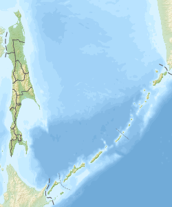
The 1963 Kuril Islands earthquake occurred at 05:17 UTC, on October 13.[2] The earthquake had a magnitude of 8.5 and was followed by a Mw 7.8 event seven days later.[3] Both earthquakes triggered tsunamis that were observed around the northern part of the Pacific Ocean.
Remove ads
Tectonic setting
The Kuril Islands form part of the island arc formed above the subduction zone, where the Pacific plate is being subducted beneath the North American plate. This convergent boundary has been the site of many large megathrust earthquakes, including the second largest earthquake ever recorded.
Damage
No damage, deaths, or injuries were recorded for these two earthquakes or their associated tsunamis.
Characteristics
Earthquake
The megathrust earthquake ruptured a 250 km-long section of the Kuril–Kamchatka Trench which based on pulses of shock registered on seismometer records, found to have contained three particular areas of asperity with high amounts of slip inside the torn subduction interface, each roughly 50 km in length and Mw 7.5 in energy.[4]
Tsunami
The tsunami triggered by the earthquake of October 13, caused a 4.5 m wave locally. The tsunami was also observed in Canada, Japan, Mexico, Hawaii, Alaska, California, and on many islands across the northern Pacific Ocean. The tsunami associated with the October 20 event was larger in the nearby area, with a maximum recorded run-up of 15 m at Urup, but was only observed in the western part of the northern Pacific.[1]
See also
References
External links
Wikiwand - on
Seamless Wikipedia browsing. On steroids.
Remove ads
