Top Qs
Timeline
Chat
Perspective
Abraham Allard
Dutch map engraver (1676–1725) From Wikipedia, the free encyclopedia
Remove ads
Abraham Allard (8 January 1676, Amsterdam - 26 January 1725, Amsterdam) was a Dutch map engraver active in Amsterdam.[1]
The topic of this article may not meet Wikipedia's notability guideline for biographies. (August 2016) |
Remove ads
Maps
 Map Duchy of Brabant (c. 1750) by Abraham Allard, published in Amsterdam by Johannes Covens (1720-1772) and Cornelis Mortier (1720-1772).
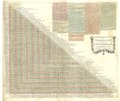 Steden distancie meet tafel van Nederland, tot Paris toe (c. 1710) by Abraham Allard.
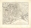 Les Bas Sevennes, dans le Languedoc ou Le diocese de Montpellier (c. 1700) by Abraham Allard.


References
External links
Wikiwand - on
Seamless Wikipedia browsing. On steroids.
Remove ads