Top Qs
Timeline
Chat
Perspective
Abu Kamal District
District in Deir ez-Zor, Syria From Wikipedia, the free encyclopedia
Remove ads
Abu Kamal District (Arabic: منطقة البوكمال, romanized: manṭiqat Albūkamāl) is a district of the Deir ez-Zor Governorate in northeastern Syria. The administrative centre is the city of Abu Kamal. At the 2004 census, the district had a population of 265,142.[1]
The Euphrates divides the district, with Hajin and As-Souseh subdistricts being part of Jazira (Upper Mesopotamia) while Abu Kamal and Al-Jalaa subdistricts are part of the Shamiyah (the Syrian Desert).[2][3] Abu Kamal is an economically prosperous farming region with cattle-breeding, cereals, and cotton crops. It is home to the historical site Dura-Europos and the tell of the ancient kingdom of Mari.
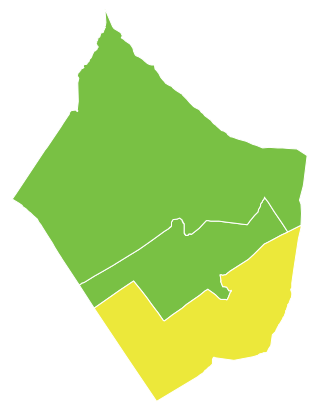
The administrative center of Abu Kamal Subdistrict shown above is the city of Abu Kamal.
The administrative center of Al-Jalaa Subdistrict shown above is the city of Al-Jalaa.
The administrative center of Hajin Subdistrict shown above is the city of Hajin.
The administrative center of Al-Susah Subdistrict shown above is the city of Al-Susah.
Remove ads
Subdistricts
The district of Abu Kamal is divided into four subdistricts or nawāḥī (population as of 2004[1]):
- Abu Kamal Subdistrict (ناحية البوكمال): population 92,031.[4]
- Hajin Subdistrict (ناحية هجين): population 97,870.[5]
- Al-Jalaa Subdistrict (ناحية الجلاء): population 29,255.[6]
- Al-Susah Subdistrict (ناحية السوسة): population 45,986.[7]
References
Wikiwand - on
Seamless Wikipedia browsing. On steroids.
Remove ads


