Top Qs
Timeline
Chat
Perspective
Albert County, New Brunswick
County in New Brunswick, Canada From Wikipedia, the free encyclopedia
Remove ads
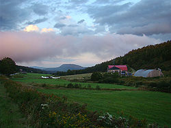
Albert County (2021 population 30,749)[1] is New Brunswick's third-youngest county, located on the Western side of the Petitcodiac River on the Chignecto Bay in the Bay of Fundy; the shire town is Hopewell Cape. The county was established in 1845 from parts of Westmorland County and Saint John County, and named after Prince Albert.[2] Since the abolition of county municipal governments in 1967, its best-known use is as a census division.
Wikimedia Commons has media related to Albert County, New Brunswick.
The mineral albertite was discovered a few miles away in 1849, giving rise to Albert Mines.[3]
Remove ads
Census subdivisions
Summarize
Perspective
Municipalities
There are four municipalities within Albert County (listed by 2021 population):[4]
Parishes
The county's six parishes serve as rural census subdivisions, which do not include the municipalities within them (listed by 2021 population):[4]
Remove ads
Demographics
As a census division in the 2021 Census of Population conducted by Statistics Canada, Albert County had a population of 30,749 living in 12,913 of its 13,476 total private dwellings, a change of 5.5% from its 2016 population of 29,158. With a land area of 1,806.23 km2 (697.39 sq mi), it had a population density of 17.0/km2 (44.1/sq mi) in 2021.[1]
Language
Remove ads
Access Routes
Highways and numbered routes that run through the county, including external routes that start or finish at the county limits:[8]
Protected areas and attractions

- Fundy National Park
- Chignecto North
- Headquarters
- Point Wolfe
- Visitors Centre
- Hopewell Rocks
- Shepody National Wildlife Area
- Wilson Brook Natural Protected Area
- Cape Enrage
- Albert County Museum
Notable people
See also
Notes
References
External links
Wikiwand - on
Seamless Wikipedia browsing. On steroids.
Remove ads


