Top Qs
Timeline
Chat
Perspective
Bakun, Benguet
Municipality in Benguet, Philippines From Wikipedia, the free encyclopedia
Remove ads
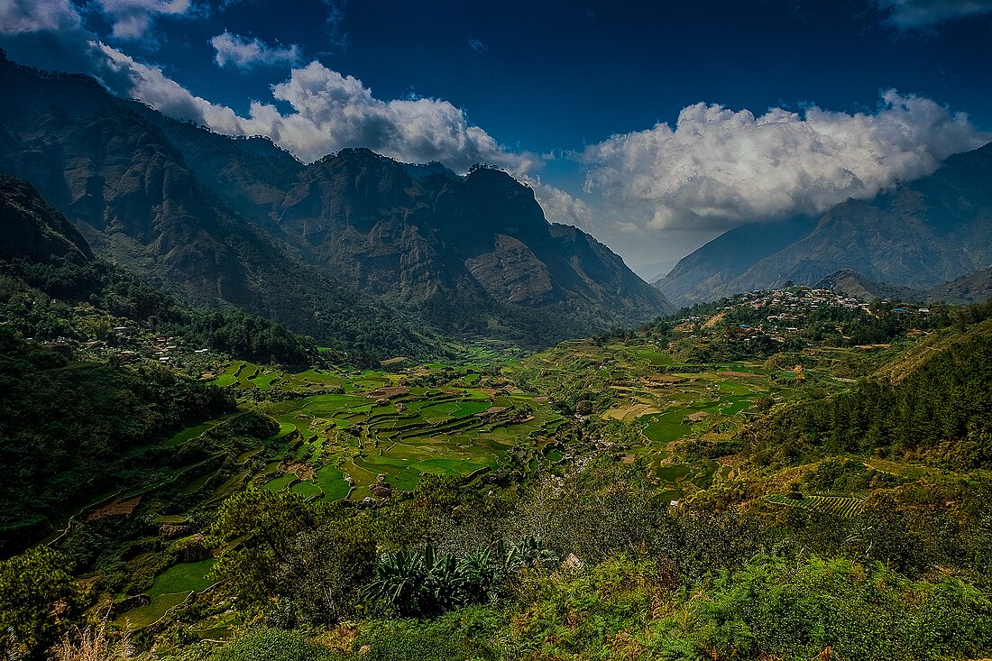
Bakun, officially the Municipality of Bakun, (Ilocano: Ili ti Bakun; Tagalog: Bayan ng Bakun), is a municipality in the province of Benguet, Philippines. According to the 2020 census, it has a population of 14,535 people.[5]
Remove ads
History
During the Spanish Period, Bakun was a rancheria of the Commandancia Politico-Militar de Amburayan. Ampusongan (currently a barangay of Bakun) was a rancheria of the Commandancia Politico Militar de Tiagan, Distrito de Benguet.[6]
When the United States took control of the Philippines, the American Congress issued Act No. 48 in November 1900, placing Bakun under the province of Amburayan, and Ampusongan under the province of Benguet.[7] On August 13, 1908, Benguet became a subprovince of the newly established Mountain Province with the enactment of Act No. 1876, and the municipal districts of Bakun and Ampusongan became part of the subprovince.[8]
In 1917, the Bureau of Non-Christian Tribes recommended that the western border of the Mountain Province be pushed eastward, such that the entire subprovince of Amburayan and large slices of Lepanto and Benguet would be made part of Ilocos Sur and La Union. In early 1937, Ampusongan was merged with Bakun, the latter carrying the name of the township while the former became a barangay.[6] The issuance of Republic Act No. 4695 in 1966 included Bakun as a regular municipality in the newly created province of Benguet.[9]
Remove ads
Geography
Summarize
Perspective
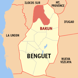
The Municipality of Bakun is located at 16°47′33″N 120°39′41″E, at the northwestern tip of Benguet. It is bounded by Mankayan on the east, Buguias on the southeast, Kibungan on the south, Sugpon on the south-west, Alilem on the north-west, and Cervantes on the north.
According to the Philippine Statistics Authority, the municipality has a land area of 286.91 square kilometres (110.78 sq mi) [10] constituting 10.36% of the 2,769.08-square-kilometre- (1,069.15 sq mi) total area of Benguet.
Bakun is situated 78.55 kilometres (48.81 mi) from the provincial capital La Trinidad, and 334.33 kilometres (207.74 mi) from the country's capital city of Manila.
Barangays
Bakun is politically subdivided into 7 barangays.[11] Each barangay consists of puroks and some have sitios.
Climate
Remove ads
Demographics
In the 2020 census, Bakun had a population of 14,535.[19] The population density was 51 inhabitants per square kilometre (130/sq mi).
Economy
Poverty incidence of Bakun
10
20
30
40
50
60
70
2000
60.72 2003
41.39 2006
17.00 2009
53.65 2012
26.48 2015
10.01 2018
17.92 2021
15.88 Source: Philippine Statistics Authority[20][21][22][23][24][25][26][27] |
Government
Local government
Bakun, belonging to the lone congressional district of the province of Benguet, is governed by a mayor designated as its local chief executive and by a municipal council as its legislative body in accordance with the Local Government Code. The mayor, vice mayor, and the councilors are elected directly by the people through an election which is being held every three years.
Elected officials
Remove ads
Education
Summarize
Perspective
The Bakun Schools District Office governs all educational institutions within the municipality. It oversees the management and operations of all private and public, from primary to secondary schools.[29]
Public schools
As of 2015, Bakun has 30 public elementary schools and 4 public secondary schools.[30][31][32]
Remove ads
Notes
References
External links
Wikiwand - on
Seamless Wikipedia browsing. On steroids.
Remove ads


