Top Qs
Timeline
Chat
Perspective
Bansgadhi
Municipality in Lumbini, Nepal From Wikipedia, the free encyclopedia
Remove ads
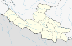
Bansgadhi (Nepali: बाँसगढी) is a municipality in the Bardiya District in southwestern Nepal.
Bansgadhi was established on 2 December 2014.[1] The city covers 206 square kilometers[2] and is located in Terai, 20 kilometers north of Nepalganj. The highway Mahendra Rajmarg runs through Bansgadhi.
Remove ads
Demographics
At the time of the 2011 Nepal census, Bansgadhi Municipality had a population of 55,875. Of these, 50.0% spoke Nepali, 46.1% Tharu, 1.5% Awadhi, 0.7% Urdu, 0.5% Hindi, 0.3% Magar, 0.2% Maithili, 0.2% Raji, 0.2% Newar, 0.1% Gurung, 0.1% Tamang and 0.1% other languages as their first language.[3]
In terms of ethnicity/caste, 46.6% were Tharu, 18.1% Chhetri, 10.4% Hill Brahmin, 8.0% Kami, 4.8% Thakuri, 3.5% Magar, 2.3% Damai/Dholi, 1.3% Yadav, 1.2% Musalman, 0.9% Sanyasi/Dasnami, 0.5% Gurung, 0.4% Sarki, 0.3% Newar, 0.3% Rajbanshi, 0.2% Badi, 0.2% Raji, 0.2% Tamang, 0.1% Chepang/Praja, 0.1% other Dalit, 0.1% Darai, 0.1% Gharti/Bhujel, 0.1% Kumal, 0.1% other Terai and 0.1% others.[4]
In terms of religion, 96.5% were Hindu, 1.6% Christian, 1.2% Muslim and 0.6% Buddhist.[5]
In terms of literacy, 66.4% could read and write, 2.4% could only read and 31.2% could neither read nor write.[6]
Remove ads
References
Wikiwand - on
Seamless Wikipedia browsing. On steroids.
Remove ads

