Blanzat

Commune in Auvergne-Rhône-Alpes, France From Wikipedia, the free encyclopedia

Blanzatmap

Blanzat (French pronunciation: [blɑ̃za]) is a commune in the Puy-de-Dôme department in Auvergne-Rhône-Alpes in central France.[4]

Quick Facts Country, Region ...
Blanzat
Thumb
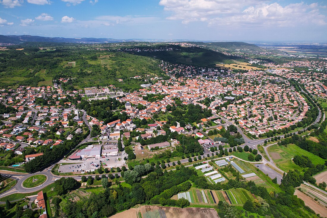
Aerial view of Blanzat
Thumb
Location of Blanzat
Thumb
Thumb
Blanzat
Thumb
Blanzat
Coordinates: 45°49′44″N 3°04′34″E
CountryFrance
RegionAuvergne-Rhône-Alpes
DepartmentPuy-de-Dôme
ArrondissementClermont-Ferrand
CantonCébazat[1]
IntercommunalityClermont Auvergne Métropole
Government
  Mayor (20202026) Richard Bert[2]
Area
1
6.96 km2 (2.69 sq mi)
Population
 (2022)[3]
3,729
  Density540/km2 (1,400/sq mi)
Time zoneUTC+01:00 (CET)
  Summer (DST)UTC+02:00 (CEST)
INSEE/Postal code
63042 /63112
Elevation360–611 m (1,181–2,005 ft)
1 French Land Register data, which excludes lakes, ponds, glaciers > 1 km2 (0.386 sq mi or 247 acres) and river estuaries.
Close

Geography

Thumb
Town hall of Blanzat.

It is located about 8 kilometres (5.0 mi) north of Clermont-Ferrand, within both the former French province of Auvergne and the modern region of Auvergne-Rhône-Alpes.

Population

More information Year, Pop. ...
Historical population
YearPop.±% p.a.
1921853    
1936946+0.69%
1946960+0.15%
19621,176+1.28%
19681,696+6.29%
19752,277+4.30%
YearPop.±% p.a.
19823,566+6.62%
19903,522−0.16%
19993,918+1.19%
20073,906−0.04%
20123,778−0.66%
20173,749−0.15%
Source: EHESS[5] and INSEE[6]
Close

See also

References

Loading related searches...

Wikiwand - on

Seamless Wikipedia browsing. On steroids.