Top Qs
Timeline
Chat
Perspective
Burgenlandkreis
District of Saxony-Anhalt, Germany From Wikipedia, the free encyclopedia
Remove ads
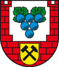
Burgenlandkreis (German pronunciation: [ˈbʊʁɡn̩lantˌkʁaɪs]) is a district in Saxony-Anhalt, Germany. Its area is 1,414.0 km2 (545.9 sq mi).[2]
Remove ads
History

The district was established as Landkreis Burgenland by the merger of the former Burgenlandkreis and Landkreis Weißenfels as part of the reform of 2007. On 16 July 2007, the district parliament decided to change the name to Burgenlandkreis, which came into effect on 1 August 2007.[3]
In 2015 the skeletal remains of an ancient inhabitant of Karsdorf dated from the Early Neolithic (7200 BP) were analyzed; he turned out to belong to the paternal T1a-M70 lineage and maternal lineage H1.[4][5]
Remove ads
Towns and municipalities

The Burgenlandkreis consists of the following subdivisions:[6][7]
Free towns
The district's free towns are Hohenmölsen, Lützen, Naumburg, Teuchern, Weißenfels, and Zeitz.
Free municipalities
The only free municipality is Elsteraue.
Verbandsgemeinden
- An der Finne, consisting of the following municipalities:
- Droyßiger-Zeitzer Forst, consisting of:
- Unstruttal, consisting of:
- Wethautal, consisting of:
1 seat of the Verbandsgemeinde ('association community'); 2 town
Remove ads
References
External links
Wikiwand - on
Seamless Wikipedia browsing. On steroids.
Remove ads


