Top Qs
Timeline
Chat
Perspective
C14 road (Namibia)
Secondary route in Namibia From Wikipedia, the free encyclopedia
Remove ads
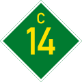
The C14, also the MR 36, is an untarred road in Namibia.
Remove ads
Geography
It starts in Walvis Bay and goes south-east through Solitaire, Maltahöhe, Helmeringhausen and ends in Goageb. It is 643 kilometres (400 mi) long and rises up to an altitude of 1,528 metres (5,013 ft) above sea level. The steepest gradient is 1:9.[2]
The C14 is one of the major tourist routes in Namibia, leading to the tourist attractions Vogelfederberg, Kuiseb River and Canyon, Gaub River Canyon, the Tropic of Capricorn road sign (23°30′00″S 15°46′19″E), Solitaire and Helmeringhausen.[3] It touches the Namib-Naukluft National Park and also serves an access road to Sossusvlei, Sesriem, Duwisib Castle, and the Fish River Canyon.[2][4]
Remove ads
C14 Challenges
The C14 is frequently in bad condition, with tourist travel by sedan "not advisable".[2] Even though it would also be a much shorter connection between the major ports of Lüderitz and Walvis Bay, there are no plans to tar this road due to fears of unsustainability.[5]
References
Wikiwand - on
Seamless Wikipedia browsing. On steroids.
Remove ads


