Top Qs
Timeline
Chat
Perspective
Coward, South Carolina
Town in South Carolina, United States From Wikipedia, the free encyclopedia
Remove ads
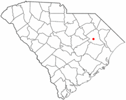
Coward is a town in Florence County, South Carolina, United States. The population was 752 at the 2010 census,[5] up from 650 in 2000. It is part of the Florence Metropolitan Statistical Area.
Remove ads
History
The town was likely named after either Captain Solomon Coward, a major land owner in the region or former Confederate Colonel Asbury Coward who would later become Commandant of the South Carolina Military Academy.[6]
Much of Coward's pre-incorporation economy centered around cash crops like tobacco or cotton. The town's economy was also supported by a local sawmill.
The town was incorporated in 1963.
In recent years the town has been troubled by rising water levels in the Lynches River and increased flooding as a result.[7]
Remove ads
Geography
Coward is in south-central Florence County at 33°58′32″N 79°44′50″W.[8] U.S. Route 52 runs through the center of town, leading north 16 miles (26 km) to Florence, the county seat, and south 7 miles (11 km) to Lake City. South Carolina Highway 541 leads west from Coward 12 miles (19 km) to Olanta.
According to the United States Census Bureau, the town of Coward has a total area of 3.5 square miles (9.1 km2), of which 0.637 acres (2,576 m2), or 0.03%, is water.[5] The town is in the watershed of the Lynches River, a tributary of the Pee Dee River.
Remove ads
Demographics
Summarize
Perspective
As of the census[3] of 2000, there were 650 people, 246 households, and 178 families residing in the town. The population density was 189.9 inhabitants per square mile (73.3/km2). There were 263 housing units at an average density of 76.8 per square mile (29.7/km2). The racial makeup of the town was 84.15% White, 14.00% African American, 0.15% Asian, 0.62% from other races, and 1.08% from two or more races. Hispanic or Latino of any race were 1.38% of the population.
There were 246 households, out of which 32.9% had children under the age of 18 living with them, 56.1% were married couples living together, 12.2% had a female householder with no husband present, and 27.6% were non-families. 24.8% of all households were made up of individuals, and 8.1% had someone living alone who was 65 years of age or older. The average household size was 2.64 and the average family size was 3.17.
In the town, the population was spread out, with 26.2% under the age of 18, 9.7% from 18 to 24, 28.8% from 25 to 44, 25.5% from 45 to 64, and 9.8% who were 65 years of age or older. The median age was 35 years. For every 100 females, there were 98.8 males. For every 100 females age 18 and over, there were 94.3 males.
The median income for a household in the town was $28,182, and the median income for a family was $30,208. Males had a median income of $28,977 versus $17,039 for females. The per capita income for the town was $12,711. About 16.1% of families and 24.4% of the population were below the poverty line, including 37.2% of those under age of 18 and 43.2% of those aged 65 or over.
References
External links
Wikiwand - on
Seamless Wikipedia browsing. On steroids.
Remove ads
