Top Qs
Timeline
Chat
Perspective
Cyanika
Rwandan town From Wikipedia, the free encyclopedia
Remove ads
Cyanika is a village in Rwanda. It sits adjacent to Kyanika, across the international border with neighboring Uganda.[2] Cyanika, also refers to Cyanika Sector, one of the 17 administrative divisions of Burera District.[3]
Remove ads
Location
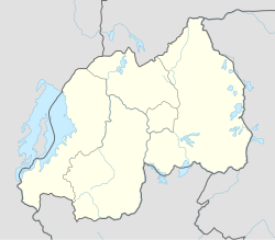
Cyanika is located in Cyanika Sector, Burera District, Northern Province, approximately 121 kilometres (75 mi), by road, north-west of Kigali, the capital and largest city of Rwanda.[4] The geographical coordinates of Cyanika, Burera District, Rwanda are: 1°20'40.0"S, 29°44'32.0"E (Latitude:-1.344444; Longitude:29.742222).[5] Cyanika sits at an average elevation of 1,957 metres (6,421 ft), above sea level.[6]
Remove ads
Overview
Cyanika/Kyanika is one of the three major road crossings between Rwanda to the south and Uganda to the north. The other to are Gatuna/Katuna and Kagitumba/Mirama Hills.[7]
In February 2019, Rwanda closed its borders to Ugandans and Ugandan goods, including at the Chanika/Kyanika border crossing. As a result, the annual trade worth approximately US$180 million to Uganda and about US$10 million to Rwanda came to a halt.[8] As of February 2020, attempts by the presidents of Angola, João Lourenço and of the Democratic Republic of the Congo, Félix Tshisekedi, have not yet resolved the impasse.[9]
Remove ads
Points of interest
The border crossing is in close proximity to Volcanoes National Park in Rwanda, Mgahinga Gorilla National Park in Uganda, and Virunga National Park, in the Democratic Republic of the Congo.[2]
References
External links
Wikiwand - on
Seamless Wikipedia browsing. On steroids.
Remove ads
