Top Qs
Timeline
Chat
Perspective
Deli Serdang Regency
Regency in North Sumatra, Indonesia From Wikipedia, the free encyclopedia
Remove ads
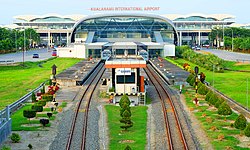
Deli Serdang Regency (Indonesian: Kabupaten Deli Serdang; Jawi: دلي سردڠ) is a regency in the Indonesian province of North Sumatra. It surrounds the city of Medan, and also borders to the west the city of Binjai, which is effectively a bedroom community for Medan. The entire regency lies within the Medan metropolitan area. It occupies an area of 2,592.40 km2 (964.38 sq miles). Its administrative center is Lubuk Pakam, which is located approximately 30 km east of Medan. The national census of 2000 recorded 1,573,987 people, but by 2010 the regency's population increased by 13.76% to 1,790,431,[2] and at the 2020 Census the total was 1,931,441.[3] The official estimate as at mid 2024 was 2,080,408, of whom 64.7% lived in the western 53.8% of the area, surrounding Medan city, while 35.3% lived in the eastern 46.2% of the area.[1] Medan's Kualanamu International Airport is located in this regency, 23 kilometres (14 mi) east of downtown Medan.
Deli Serdang is the most populous regency in Indonesia outside the island of Java, with 2,080,408 inhabitants in mid 2024.[1] Its population is comparable to the U.S state of Nebraska.
Remove ads
Neighbouring areas
The external boundaries of the regency are with:
- To the north: the Langkat Regency and the Strait of Malacca.
- To the south: the Karo Regency and Simalungun Regency.
- To the east: the Serdang Bedagai Regency and the Strait of Malacca.
- To the west: the Karo Regency, Langkat Regency and the city of Binjai.
The major city of Medan is a semi-enclave within the regency (except in the north, where the city reaches the Malacca Strait at Belawan).
Remove ads
Administrative districts
Summarize
Perspective
The regency is divided into twenty-two districts (kecamatan), tabulated below with their areas (in km2) and their 2010 Census[2] and 2020 Census[3] populations, and the official estimates as of mid 2024.[1] The table also includes the locations of the district administrative centres, the number of administrative villages within each district (totaling 380 rural desa, and 14 urban kelurahan), and its post code:
Notes: (a) Deli Tua, Deli Tua Barat and Deli Tua Timur. (b) Kenangan and Kenangan Baru. (c) Galang Kota. (d) Pekan Tanjung Morawa.
(e) Cemara, Lubuk Pakam I, II Lubuk Pakam Pekan, Lubuk Pakam III, Paluh Kemiri, Petapahan and Syahmad.

Plantations
Plantation commodities in Deli Serdang in 2024 demonstrated diverse yields, with oil palm being the leading crop. Oil palm plantations were spread across all sub-districts, covering an area of 18,162.23 hectares, and production reached 51,666.29 tons. The sub-districts of S.T.M. Hilir, S.T.M. Hulu, and Hamparan Perak, Deli Serdang, were the main palm oil producing areas, with planted areas of 3,736.11 hectares, 1,984.00 hectares, and 2,114.96 hectares, respectively. Rubber contributed 4,564 tons of production from a planted area of 5,164 hectares. Coconut is another important commodity with 3,247 tons of yield from a planted area of 3,841 hectares, dominated by the Districts of Hamparan Perak and Percut Sei Tuan. Cocoa plants recorded a production of 2,072.43 tons with an area of 2,666.33 hectares, mostly produced from Kutalimbaru and Sinembah Tanjung Muda Hilir.[26]
Remove ads
Television
See also
References
Wikiwand - on
Seamless Wikipedia browsing. On steroids.
Remove ads


