Top Qs
Timeline
Chat
Perspective
District Council of Mount Barker
Local government area in South Australia From Wikipedia, the free encyclopedia
Remove ads
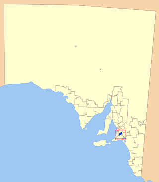
The Mount Barker District Council is a local government area, centred on the Adelaide hills town of Mount Barker, just outside the Adelaide metropolitan area in South Australia.
Remove ads
History
The council was established in October 1853.[3] In May 1935, it expanded to four times its original size as part of a major series of council amalgamations, absorbing the District Council of Nairne and parts of the District Council of Echunga and the District Council of Macclesfield.[4]
Council
Summarize
Perspective
This section needs to be updated. (June 2025) |
Members of the council are:[when?][5]
Remove ads
Towns and localities
Towns and localities in the Mount Barker District Council include:[7]
- Biggs Flat
- Blakiston
- Bradbury (part)
- Bridgewater (part)
- Brukunga
- Bugle Ranges
- Bull Creek (part)
- Callington (part)
- Chapel Hill
- Dawesley
- Dorset Vale (part)
- Echunga
- Flaxley
- Green Hills Range
- Hahndorf
- Harrogate
- Hay Valley (part)
- Jupiter Creek
- Kangarilla (part)
- Kanmantoo
- Kuitpo (part)
- Littlehampton
- Macclesfield (part)
- Meadows
- Mount Barker
- Mount Barker Junction (part)
- Mount Barker Springs
- Mount Barker Summit
- Mount Torrens (part)
- Mylor (part)
- Nairne
- Paechtown
- Paris Creek (part)
- Petwood
- Prospect Hill (part)
- St Ives
- Totness
- Verdun (part)
- Wistow
- Woodside (part)
See also
References
External links
Wikiwand - on
Seamless Wikipedia browsing. On steroids.
Remove ads


