Top Qs
Timeline
Chat
Perspective
Districts of Hungary
From Wikipedia, the free encyclopedia
Remove ads
Districts of Hungary are the second-level divisions of Hungary after counties. They replaced the 175 subregions of Hungary in 2013.

There are 174 districts in the 19 counties, and there are 23 districts in Budapest. Districts of the 19 counties are numbered by Arabic numerals and named after the district seat, while districts of Budapest are numbered by Roman numerals and named after the historical towns and neighbourhoods. In Hungarian, the districts of the capital and the rest of the country hold different titles. The districts of Budapest are called kerületek (lit. district, pl.) and the districts of the country are called járások.
Remove ads
By county
Baranya County

Bács-Kiskun County

Békés County

Borsod-Abaúj-Zemplén County

Csongrád-Csanád County

Fejér County

Győr-Moson-Sopron County

Hajdú-Bihar County

Heves County

Jász-Nagykun-Szolnok County

Komárom-Esztergom County

Nógrád County

Pest County

Somogy County

Szabolcs-Szatmár-Bereg County

Tolna County

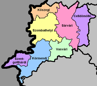
Vas County

Veszprém County

Zala County

Remove ads
Statistics
Summarize
Perspective
- Not including districts in Budapest.
By area
|
|
By population
|
|
By pop. density
|
|
By municipalities
|
|
Remove ads
See also
- Regions of Hungary
- Counties of Hungary
- Districts of Hungary (from 2013)
- Subregions of Hungary (until 2013)
- Administrative divisions of the Kingdom of Hungary (until 1918)
- Administrative divisions of the Kingdom of Hungary (1941–1945)
- List of cities and towns of Hungary
- NUTS:HU
Wikiwand - on
Seamless Wikipedia browsing. On steroids.
Remove ads
