Top Qs
Timeline
Chat
Perspective
Elazığ Province
Province of Turkey From Wikipedia, the free encyclopedia

Remove ads
Elazığ (Turkish pronunciation: [eˈlazɯː]) is a city in the Eastern Anatolia region of Turkey, and the administrative centre of Elazığ Province and Elazığ District.[3] Founded in and around the former city of Harput, it is located in the uppermost Euphrates valley. The plain on which the city extends has an altitude of 1,067 metres (3,501 ft). Elazığ resembles an inland peninsula surrounded by the natural Lake Hazar and reservoirs of Keban Dam, Karakaya Dam, Kıralkızı and Özlüce.[4] Its population is 387,072 (2022).[2]

Remove ads
History
Summarize
Perspective
In 1927 the office of the Inspector General was created, which governed with martial law.[5] The province was included in the first Inspectorate General (Umumi Müfettişlik, UM) over which the Inspector General ruled. The UM spanned over the provinces of Hakkâri, Siirt, Van, Mardin, Bitlis, Şanlıurfa, Elazığ and Diyarbakır.[6]
In December 1935, the Tunceli Law was passed, which demanded a more powerful Government in the region.[7] In January 1936 the Elazığ Province was transferred under the authority of the newly established Fourth Inspectorate General, which span over the provinces of Elazığ, Erzincan, Bingöl and Tunceli[8] and its seat was in the city of Elazığ.[9] The fourth UM was governed by a Governor-Commander. Most of the employees in the municipalities had to be from the military and the Governor-Commander had the authority to evacuate whole villages and resettle them in another part of the province.[10] In 1946 the Tunceli Law was abolished and the state of emergency removed but the authority of the fourth UM was transferred to the military.[10]
The Inspectorates General were dissolved in 1952 during the Government of the Democrat Party.[11]
The province has experienced many earthquakes, including a magnitude 6.1 earthquake on 8 March 2010 and a magnitude 6.7 earthquake on 24 January 2020.[12]
Remove ads
Geography
Elazığ stretches in a general west-southwest to east-northeast direction, along the line of equal geographic latitude and longitude. The source of the Euphrates river is located in this province. 826 km2 (319 sq mi) of its area is covered by reservoirs and natural lakes.[13][14]
Districts

Elazığ province is divided into 11 districts (capital district in bold):
Economy
Historically, Elazığ Province produced silver, which ceased being mined in 1885. The Turkish government attempted to modernize the mines; however, the cost of fuel and energy caused the shut down. There was a silver mine still producing in 1903 in Palu, as with coal. Coal is also found in other areas of the province. Gold and salt was also produced.[15]
Education
Education is provided by the Elazığ Provincial Directorate for National Education. It currently views over 442 educational institutions, both formal and informal ones.[16]
Archaeology
Altınova, Elazığ was an important archaeological site in the Altınova plain that was excavated in the 1970s. It was later flooded by the Keban Dam. Other sites in the Altınova plain were also Tepecik, Korucutepe, Değirmentepe, and Körtepe.
Gallery
 Elazığ Train Station
 Palu and the Murat river
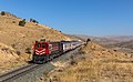 DE 24 184 of TCDD (Türkiye Cumhuriyeti Devlet Demiryollari) at Pınarlı, Turkey.
 Culture Park
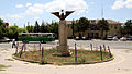
 City view at night
 Stone Bridge, Palu


See also
References
External links
Wikiwand - on
Seamless Wikipedia browsing. On steroids.
Remove ads