Top Qs
Timeline
Chat
Perspective
Geography of Gozo
From Wikipedia, the free encyclopedia
Remove ads
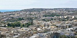
The geography of Gozo, is dominated by water as it is the second largest island in the Maltese archipelago[1] and is made up out of limestone. There are several islands which fall under Gozitan jurisdiction and thus are additions to the overarching Maltese archipelago. The main island of Gozo is located 7 kilometres (4.3 mi) northwest of the main island of Malta.[2] It is mostly known for its multitude of low-lying hills.[3] The highest point in Gozo is Ta' Dbiegi hill, which falls under the San Lawrenz local council.[4] The island of Comino, which is also the third largest island in Malta, falls under Gozo.[5]
Remove ads
Extreme Points of Gozo
Lantern Point and Sultan Rock are both found on Comino.[10][11]
San Dimitri Point and Reqqa Point are the westernmost and northernmost points of the entirety of the Maltese islands.[6][7]
The lowest altitude of Gozo is obviously 0 metres (0 ft) above sea level as the island is surrounded by the Mediterranean Sea.[12][1]
Remove ads
Index of hills in Gozo
Remove ads
References
Wikiwand - on
Seamless Wikipedia browsing. On steroids.
Remove ads


