Top Qs
Timeline
Chat
Perspective
Ghizer district
District of Gilgit-Baltistan administered by Pakistan From Wikipedia, the free encyclopedia
Remove ads
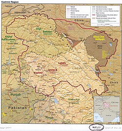
Ghizer District (Urdu: ضلع غذر) is a district of the Pakistan-administered territory of Gilgit-Baltistan, in the larger disputed Kashmir region.[1] It is one of the 14 districts of Gilgit-Baltistan. The former Ghizer District that existed from 1974 to 2019 spanned the entire upper Gilgit River Valley (also known as the Ghizer River Valley). In 2019, the former district was divided into the Gupis-Yasin District in the west and the present, smaller Ghizer District in the east.[3] Less than 13.5% of the district consists of alpine pastures, with over 83% of remaining area being barren or permanently snow covered.[4]
Remove ads
History
Before inclusion in Gilgit Agency by the British, the area was part of Chitral under Kho Khushwaqt Mehtar ("ruler").

Geography
Summarize
Perspective
The Ghizer District is bounded on the north by the Upper Chitral District of Pakistan's Khyber Pakhtunkhwa Province and the Wakhan District of Afghanistan's Badakhshan Province, on the east by the Hunza District, the Nagar District, and the Gilgit District, on the south by the Tangir District, on the south-west by the Darel District, and on the west by the Gupis-Yasin District.
The highest peak of Ghizer District is Koyo Zom (6,871 m) (Hindu Kush Range range), which lies on the boundary between Ghizer District and Chitral.
Some of the main places in the district are Koh-i-Ghizer, Ishkoman and Yasin valleys. Other places include Gupis, Chatorkhand, Imit, Pingal, Shahmaran and Utz.
Some of the passes in the district are:
- Bichhar Pass (on the boundary of Ghizer and Gilgit Districts)
- Chillingi Pass
- Hayal Pass and Naltar Pass (on the boundary of Ghizer and Gilgit Districts)
- Kalandar Pass
- [Thui Pass between Yasin and Yarkhun Valley]
- [Darkot Pass that connects Broghil Valley to Yasin in the Ghizer Valley]
There are several more Passes like [Attar Pass, Punji Pass, Korumbar Pass, Assumbar Pass, Chumakhand Pass, Nazbar and Zagar Passes they connect Mastuj to Ghizer Valley. There charismatic trekking routes with fascinating camping sites and stunning views of Hindukush and Hindu Raj Mountains.
The main river in the district is the Gilgit River. The other tributaries include the Qurumbar River, Phakora River, Hayal River, Singul River and Yasin River, Phander River tributary which also joins the main stream at different points.[citation needed]

Remove ads
Administration
The present Ghizer District consists of four tehsils:
The district headquarters is the town of Gahkuch.
Education
According to the Alif Ailaan Pakistan District Education Rankings of 2015, Ghizer was ranked 10 out of 148 districts in terms of education. For facilities and infrastructure, the district was ranked 17 out of 148. The biggest contribution in the region in education is "Agha Khan Education Service Pakistan"(AKESP).[5]
Notes
References
Wikiwand - on
Seamless Wikipedia browsing. On steroids.
Remove ads


