Top Qs
Timeline
Chat
Perspective
Hadhramaut Mountains
Mountain range in Yemen From Wikipedia, the free encyclopedia

Remove ads
The Hadhramaut Mountains (Arabic: جِبَال حَضْرَمَوْت, romanized: Jibāl Ḥaḍramawt),[2] also known as the "Mahrat Mountains"[1] (Arabic: جِبَال ٱلْمَهْرَة, romanized: Jibāl Al-Mahrah), are a mountain range in Yemen.[3] They are contiguous with the Omani Dhofar Mountains to the northeast,[4] and James Canton considered Aden in the southwest to be in the mountains' recesses.[5]


Historically, the area was ruled by Qu'aiti and Kathiri sultanates. The tribal society (Hadramatis) grows wheat and millet, produces also dates, coconuts, and coffee. The area was also known for its frankincense.[6]
Remove ads
Geology
The south side of the mountains touches the Gulf of Aden, with steep cliffs descending onto a narrow and arid coastal plain. The northern slopes are lowering onto the Rub' al Khali desert (the "Empty Quarter"). The broad mountain plateau is intersected by deep wadis cut by seasonal streams that generally flow in the northern and northeastern direction emptying into a main channel (Wadi Hadhramaut, changing the name to Wadi Masila downstream)[7] that makes a southeast swing of 500 miles (800 kilometres) to the ocean.[6][8] Despite seasonality of the streams, the water is generally available year-round sub-surface in the wadis.[8]
 The city of Tarim
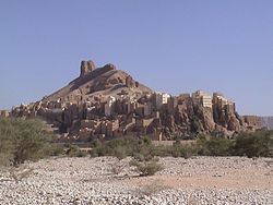 Hajjarin in Wadi Dawan
 Shibam in Wadi Hadhramaut, with mountains in the background


Remove ads
See also
- Al Mahrah Governorate – partly covered by the range
- Hajhir Mountains
- Hadhramaut Governorate
- Hadhramaut Region
References
Bibliography
External links
Wikiwand - on
Seamless Wikipedia browsing. On steroids.
Remove ads