Top Qs
Timeline
Chat
Perspective
Ilibalyk
Medieval Silk Road city in modern southeast Kazakhstan From Wikipedia, the free encyclopedia
Remove ads
Ilibalyk ('i:lɪbɑlɪk), also spelled Ilanbalyk or Ilibaly, was a major medieval Silk Road city in the Ili River valley of present-day southeastern Kazakhstan. Occupied from the 9th through the 14th centuries, the site comprises a fortified administrative core (shahristān), extensive suburbs (rābāds), and a large contemporary Nestorian necropolis.[1]
Remove ads
Etymology
The name “Ilibalyk” derives from Turkic "Ili-balyq", literally “city on the Ili (River).” Medieval Persian and Armenian chronicles record variants such as Ilanbalyk and Ilibaly.[2]
Location and geography
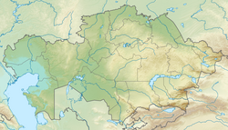
Ilibalyk is located near the modern village of Usharal (Üsharal), Panfilov District, Jetisu Region, approximately 45 kilometres (28 mi) north of the present Ili River channel. The site spans some 5 km² of floodplain and a low ridge, commanding a route through the northern Tien Shan corridor.[1][3]
Historical context
From the 9th century, Ilibalyk lay within the eastern frontier of the Turkic Karakhanid realm; following the Mongol conquests it formed part of the Chagatai Khanate. Contemporary travelers, including Armenian King Hetum I (1255), mention Ilibalyk as a fortified riverine caravanserai and market town on the route between Central Asia and Almaliq in China.[2]
Archaeological research
Summarize
Perspective
Discovery and survey
A carved Church of the East gravestone discovered in 2014 near Usharal, Kazakhstan prompted a systematic archaeological survey of the site.[1] Since 2016, annual field campaigns have investigated the medieval city's core, including a fortified shahristān (approximately 380 x 350 m) and surrounding rābāds. Excavations have also documented a Christian necropolis measuring roughly 60 x 70 m, with over 110 graves excavated to date, as well as the remains of an associated funerary chapel.[3][4]
Necropolis (Nestorian cemetery)
Excavations beginning in 2016 uncovered an extensive medieval cemetery outside the western wall, with over 110 graves excavated to date (estimated total ~500). All burials adhere to east-west alignment, typifying Church of the East funerary practice; several contained grave goods (beads, bracelets, occasional silver pendants).[5]

Fifty-five grave markers (kayrāks) have been found bearing variants of the Nestorian cross, a few with Syriac inscriptions, some transliterating Old Turkic or Persian. A mud brick funerary chapel structure adjacent to the graves suggests communal liturgical activity. DNA and radiocarbon analyses are underway to determine the cemetery's demographic composition and chronology.[4]
Material culture
Surface collection and trenching have yielded:
- Numismatics: ~175 coins, predominantly Karakhanid (12th c.) and Chagatai (13th-14th c.), including issues from Almalyk (capital of the Chagatai Khanate)[3]
- Ceramics: Glazed wares, unglazed tablewares, lamps, vessels, dating 11th-14th c.
- Metallurgy: Iron tools (knife blades, horse fittings) and small silver ornaments.
- Jewelry: Beads, bracelets, rings, earings.
- Textile: Boqtaq-style headdress.
Architecture and bathhouse
Excavations of the shahristān revealed mudbrick ramparts (original height up to 6 m) and a monumental bathhouse (hamām) built with fired bricks and hypocaust heating. Adjacent ceramic kilns attest to on-site brick production during the Karakhanid-Chagatai period.[3]
Remove ads
Significance
Ilibalyk is one of the largest medieval sites in Zhetysu, illuminating Silk Road urbanism, Turkic-Mongol statecraft and the eastward spread of Church of the East Christianity. Its multi-ethnic material record add to current understanding of cultural interconnections in 13th-14th c. Central Asia.[1]
See also
References
External links
Wikiwand - on
Seamless Wikipedia browsing. On steroids.
Remove ads

