| Name |
Image |
Location |
County |
Description |
| Bash Building |
|
Fort Wayne
41.0813°N 85.1413°W / 41.0813; -85.1413 (Bash Building) |
Allen |
|
| Montgomery and Edith Beaver House |
|
Fort Wayne
41.0604°N 85.1467°W / 41.0604; -85.1467 (Montomergy and Edith Beaver House) |
Allen |
|
| Fox Island Nature Preserve Archaeological District |
|
Fort Wayne
41.0193°N 85.2370°W / 41.0193; -85.2370 (Fox Island Nature Preserve Archaeological District) |
Allen |
|
| William and Louise Thiel House |
|
Fort Wayne
41.0787°N 85.1615°W / 41.0787; -85.1615 (William & Louise Thiel House) |
Allen |
|
| Lambert-Noblitt House |
|
Columbus
39.2174°N 85.9221°W / 39.2174; -85.9221 (Lambert-Noblitt House) |
Bartholomew |
|
| Issac and Lula Breeding Farm |
|
Edinburgh
39.318°N 85.9546°W / 39.318; -85.9546 (Issac and Lula Breeding Farm) |
Bartholomew |
|
| George and Elizabeth Newlin House |
|
Columbus
39.2288°N 85.9204°W / 39.2288; -85.9204 (George and Elizabeth Newlin House) |
Bartholomew |
|
| Howard School |
 |
Perry Township
39.9309°N 86.3825°W / 39.9309; -86.3825 (Howard School) |
Boone |
|
| Jacob Jones House |
|
Lebanon
40.0495°N 86.4687°W / 40.0495; -86.4687 (Jacob Jones House) |
Boone |
|
| Jackson Township School Gymnasium |
|
Camden
40.6100°N 86.5378°W / 40.6100; -86.5378 (Jackson Township School Gymnasium) |
Carroll |
|
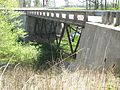
| Carroll County Bridge#85 |
 |
Delphi
40.5951°N 86.6787°W / 40.5951; -86.6787 (Carroll County Bridge #85) |
Carroll |
Also known as the Paint Creek Bridge. |
| Reed Case House |
 |
Delphi
40.5917°N 86.6805°W / 40.5917; -86.6805 (Reed Case House) |
Carroll |
|
| Law Offices and Pharos Newspaper Building |
|
Logansport
40.7545°N 86.3659°W / 40.7545; -86.3659 (Law Offices and Pharos Newspaper Building) |
Cass |
| People's Bank Building |
|
Logansport
40.7521°N 86.3667°W / 40.7521; -86.3667 (People's Bank Building) |
Cass |
|
| Walton-Tipton Township Public Library |
 |
Walton
40.6611°N 86.2427°W / 40.6611; -86.2427 (Walton-Tipton Township Public Library) |
Cass |
|
| Montrose (John McCulloch House) |
|
Clarksville
38.3051°N 85.7767°W / 38.3051; -85.7767 (Montrose (John McCulloch House)) |
Clark |
|
| Schwartz-Voigt Farm |
|
Jeffersonville
38.3398°N 85.6906°W / 38.3398; -85.6906 (Schwartz-Voigt Farm) |
Clark |
|
| Avery House |
|
Frankfort
40.2808°N 86.5166°W / 40.2808; -86.5166 (Avery House) |
Clinton |
|
| Mary Ann Cole Archaeological Site |
|
Leavenworth
38.1827°N 86.3280°W / 38.1827; -86.3280 (Mary Ann Cole Archaeological Site) |
Crawford |
|
| Wolber-Stryker Stone Wall |
|
Lawrenceburg
39.1272°N 84.9099°W / 39.1272; -84.9099 (Wolber-Stryker Stone Wall) |
Dearborn |
|
| Second Dearborn County Courthouse and Offices |
|
Wilmington
39.0624°N 84.9454°W / 39.0624; -84.9454 (Second Dearborn County Courthouse and Offices) |
Dearborn |
|
| Charles Zoller House |
|
Greensburg
39.3363°N 85.4797°W / 39.3363; -85.4797 (Charles Zoller House) |
Decatur |
|
| Altona Baptist Church |
|
Altona
41.3511°N 85.1563°W / 41.3511; -85.1563 (Altona Baptist Church) |
DeKalb |
|
| Samuel DePew House |
|
Richland Township
41.3806°N 85.1712°W / 41.3806; -85.1712 (Samuel DePew House) |
DeKalb |
|
| Keyser Township District School 5 |
 |
Garrett
41.3301°N 85.1352°W / 41.3301; -85.1352 (Keyser Township District School 5) |
DeKalb |
|
| Robert Lindsey Bartlett House |
|
Salem Township
40.0958°N 85.5717°W / 40.0958; -85.5717 (Robert Lindsey Bartlett House) |
Delaware |
|
| High Street United Methodist Church |
|
Muncie
40.1922°N 85.3882°W / 40.1922; -85.3882 (High Street United Methodist Church) |
Delaware |
|
| McCain Archaeological Site |
|
|
Dubois |
|
| Johann Bernard Woebkenberg Farm |
|
|
Dubois |
|
| Dale-Zook House |
|
|
Elkhart |
|
| Elkhart River Race Industrial District |
|
|
Elkhart |
|
| Phelps House/Knickerbocker Weddings |
|
|
Elkhart |
|
| P. H. and F. M. Roots Company Factory |
|
|
Fayette |
|
| J.D. Fine Boggs House |
|
|
Fountain |
|
| Alley Ford Bridge#48 |
|
|
Franklin |
|
| Grass Creek Railroad Depot |
|
Grass Creek |
Fulton |
|
| Jasper Newton Davidson House |
|
|
Gibson |
|
| Moore Rockshelter Archaeological Site |
|
|
Gibson |
|
| Moss Opera House |
|
|
Greene |
|
| Arcadia Depot |
|
Arcadia |
Hamilton |
|
| Carmel Monon R.R. Depot |
|
Carmel |
Hamilton |
|
| Forest Park Log Cabin |
|
|
Hamilton |
|
| Old Carmel Library |
|
Carmel |
Hamilton |
|
| S. Waltz Farm |
|
|
Hamilton |
|
| Leora Brown School |
 |
Corydon |
Harrison |
|
| Squire Boone Gristmill |
 |
Mauckport
38°3′51″N 86°8′4″W |
Harrison |
Grist mill of Daniel Boone's brother Squire Boone |
| Walker School (Lincoln Township District School #1) |
|
Brownsburg |
Hendricks |
|
| North Salem Commercial Historic District |
 |
North Salem |
Hendricks |
|
| Wabash & Erie Canal |
 |
|
Huntington |
|
| William Ferris House |
|
|
Jay |
|
| Redkey City Building |
 |
Redkey |
Jay |
|
| Butler Elementary School |
|
|
Jennings |
|
| Jennings County Carnegie Library |
 |
North Vernon |
Jennings |
|
| Grafton-Peek Building |
|
|
Johnson |
|
| William Barringer Brown House |
|
|
Lake |
|
| Wicker Memorial Park |
|
|
Lake |
|
| Martin and Susan Wood House |
|
|
Lake |
|
| Charles Danitschek Log Cabin |
|
|
LaPorte |
|
| Haskell and Barker Car and Manufacturing Company |
|
|
LaPorte |
|
| Logan-Taylor House |
|
|
LaPorte |
|
| Long Beach Town Center Building |
 |
Long Beach |
LaPorte |
|
| Milwaukee Railroad Depot |
|
Bedford |
Lawrence |
|
| William Stickles Hotel |
|
Bedford |
Lawrence |
|
| Big Four Railroad Station |
|
Anderson
40.1012°N 85.6786°W / 40.1012; -85.6786 (Big Four Railroad Station) |
Madison |
|
| Interurban Depot Number 10 |
|
Summitville |
Madison |
|
| Mendon Episcopal Church |
|
|
Madison |
|
| Brookside Building |
|
Indianapolis
39.7816°N 86.1227°W / 39.7816; -86.1227 (Brookside Building) |
Marion |
|
| Charity Dye School No. 27 |
|
Indianapolis
39.7904°N 86.1474°W / 39.7904; -86.1474 (Charity Dye School No. 27) |
Marion |
|
| Charles W. Fairbanks House |
 |
Indianapolis
39.8097°N 86.1573°W / 39.8097; -86.1573 (Charles W. Fairbanks House) |
Marion |
|
| Chicago, Indianapolis, & Louisville Railroad Bridge#B178.9 |
 |
Indianapolis
39.8203°N 86.1366°W / 39.8203; -86.1366 (Chicago, Indianapolis, & Louisville Railroad Bridge #B178.9) |
Marion |
|
| Daubenspeck Farm |
|
Indianapolis
39.9173°N 86.1852°W / 39.9173; -86.1852 (Daubenspeck Farm) |
Marion |
|
| Edwards-Aufderheide House |
|
Indianapolis
39.8828°N 86.1542°W / 39.8828; -86.1542 (Edwards-Aufderheide) |
Marion |
|
| First German Reformed Church & School |
|
Indianapolis
39.7815°N 86.1120°W / 39.7815; -86.1120 (First German Reformed Church & School) |
Marion |
|
| Fisher House (Indianapolis) |
|
Indianapolis
39.8630°N 86.1791°W / 39.8630; -86.1791 (Fisher House) |
Marion |
|
| Florence Fay School No. 21 |
|
Indianapolis
39.7594°N 86.1158°W / 39.7594; -86.1158 (Florence Fay School No. 21) |
Marion |
|
| Fowler-Mundy Pioneer Cemetery |
|
Indianapolis
39.6603°N 86.2058°W / 39.6603; -86.2058 (Fowler-Mundy Pioneer Cemetery) |
Marion |
|
| General Motors Buick Showroom Building |
|
Indianapolis
39.7844°N 86.1579°W / 39.7844; -86.1579 (General Motors Buick Showroom Building) |
Marion |
|
| Holy Cross–Westminster Historic District |
 |
Indianapolis
39.7712°N 86.1335°W / 39.7712; -86.1335 (Holy Cross–Westminster Historic District) |
Marion |
|
| Hotel Barton |
 |
Indianapolis
39.7743°N 86.1538°W / 39.7743; -86.1538 (Hotel Barton) |
Marion |
|
| Indiana Dental College Building |
|
Indianapolis
39.7696°N 86.1547°W / 39.7696; -86.1547 (Indiana Dental College Building) |
Marion |
|
| Indianapolis Automobile Industry Thematic District |
|
Indianapolis, Speedway
(various locations) |
Marion |
|
| Julius Gally Wines & Cigars |
 |
Indianapolis
39.7802°N 86.1505°W / 39.7802; -86.1505 (Julius Gally Wines & Cigars) |
Marion |
|
| Kassebaum Building |
 |
Indianapolis
39.8704°N 86.1426°W / 39.8704; -86.1426 (Kassebaum Building) |
Marion |
|
| Lawrence High School (Indiana) |
|
Lawrence
39.8401°N 86.0219°W / 39.8401; -86.0219 (Lawrence High School) |
Marion |
|
| Minnie Hartmann School No. 78 |
|
Indianapolis
39.7732°N 86.1030°W / 39.7732; -86.1030 (Minnie Hartmann School No. 78) |
Marion |
|
| Oliver P. Morton School No. 29 |
|
Indianapolis
39.7963°N 86.1444°W / 39.7963; -86.1444 (Oliver P. Morton School No. 29) |
Marion |
|
| Paul C. Stetson School No. 76 |
|
Indianapolis
39.8096°N 86.1444°W / 39.8096; -86.1444 (Paul C. Stetson School No. 76) |
Marion |
|
| Reuben Wells |
 |
Indianapolis
The Children's Museum of Indianapolis
39°48′39″N 86°9′27″W |
Marion |
|
| Spring Valley Cemetery |
|
Lawrence
39.8584°N 86.0108°W / 39.8584; -86.0108 (Spring Valley Cemetery) |
Marion |
|
| West Park Christian Church |
|
Indianapolis
39.7662°N 86.2044°W / 39.7662; -86.2044 (West Park Christian Church) |
Marion |
|
| Culver Railroad Station |
|
Culver |
Marshall |
|
| District #3 Schoolhouse |
|
|
Marshall |
|
| Immanuel Lutheran Church |
|
|
Marshall |
|
| Lewis Brooks Home |
|
|
Martin |
|
| Paw Paw Church & Cemetery |
|
|
Miami |
|
| Saint Charles Borromeo Catholic Church |
|
|
Miami |
|
| Borland House & Furst Quarry |
|
|
Monroe |
|
| John Campbell House |
|
|
Monroe |
|
| North Indiana Avenue Historic District |
|
|
Monroe |
|
| Montgomery County Bridge#49 |
|
|
Montgomery |
|
| Jones Schoolhouse |
|
|
Morgan |
|
| Newton County Bridge#57 |
 |
The Conrad Bridge
41°06′11.2″N 87°26′58.3″W |
Newton |
|
| Wilmot Milling Company |
|
|
Noble |
|
| David Brown House |
 |
|
Ohio |
|
| Jeffrey and Janet Pickett Log House |
|
|
Ohio |
|
| James Alverson House |
|
|
Owen |
|
| J.J. Daniels House |
|
|
Parke |
J.J. Daniels House and former Rockville Motel |
| Governor Joseph Albert Wright House |
|
|
Parke |
|
| Clarence H. Martin House |
|
|
Porter |
|
| Bone Bank Archaeological Site |
|
|
Posey |
|
| Hovey Lake-Klein Archeological Site |
|
37°49′49″N 87°57′13″W |
Posey |
Archaeological site of the Mississippian culture |
| Medaryville Calaboose |
|
|
Pulaski |
|
| Highnote House |
|
|
Putnam |
|
| Julian Family Home |
|
|
Putnam |
|
| John Eckert & Sons Hardware Store |
|
|
Ripley |
|
| Hackleman Log Cabin |
|
|
Rush |
|
| Downtown South Bend Multiple Resources Area |
|
South Bend |
St. Joseph |
|
| Union Station (South Bend) |
 |
South Bend |
St. Joseph |
|
| Daniel Ward House |
|
|
St. Joseph |
|
| Vevay Historic District |
|
|
Switzerland |
|
| Agriculture Hall |
|
|
Tippecanoe |
|
| Joseph Hawkins House |
|
|
Tippecanoe |
|
| Hawkins-Bower House |
|
|
Tippecanoe |
|
| Levi & Lucy Morehouse Farm |
|
|
Tippecanoe |
|
| John Purdue Block |
|
|
Tippecanoe |
|
| Downtown Evansville Multiple Resource Area |
|
|
Vanderburgh |
|
| Old Fellows Temple |
|
Terre Haute |
Vigo |
|
| Alfred Pegg House |
|
|
Vigo |
|
| U.S. Trust Company Building |
|
|
Vigo |
|
| Hopewell Church |
|
|
Wabash |
|
| Presbyterian Church of Williamsport |
|
Williamsport |
Warren |
|
| Livonia Presbyterian Church |
|
Livonia |
Washington |
|
| Salem Presbyterian Church |
|
Salem |
Washington |
|
| Charles Deam House & Arboretum |
|
|
Wells |
|
| Leaman-Stewart Farm |
|
|
Whitley |
|
| Jonas Nolt Homestead |
|
|
Whitley |
|
| Swihart House |
|
|
Whitley |
|


.png)


_-_DPLA_-_b9620e58d63dc4e40f87380d340b06db.jpg)
_-_DPLA_-_5f5365fd93e40f14feee605305fb0aff.jpg)

_-_DPLA_-_fbaa47e1ad6430a3e0f4018f8fc15418.jpg)

_-_DPLA_-_48ceff87c6787cdd440a0c893033b4c9.jpg)


