Top Qs
Timeline
Chat
Perspective
Irondale, Georgia
Place in Georgia, United States From Wikipedia, the free encyclopedia
Remove ads
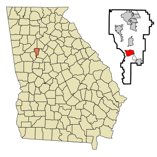
Irondale is an unincorporated community and census-designated place (CDP) in Clayton County, Georgia, United States. The population was 8,740 at the 2020 census.
Remove ads
Geography
Irondale is located south of the center of Clayton County at 33°28′32″N 84°21′37″W (33.475430, -84.360326).[4] U.S. Routes 19 and 41 form the eastern edge of the CDP and lead north 3 miles (5 km) to Jonesboro, the county seat. Downtown Atlanta is 20 miles (32 km) to the north.
According to the United States Census Bureau, the Irondale CDP has a total area of 3.2 square miles (8.3 km2), of which 3.2 square miles (8.2 km2) is land and 0.04 square miles (0.1 km2), or 1.47%, is water.[5]
Remove ads
Demographics
Summarize
Perspective
Irondale first appeared as a census designated place in the 1990 U.S. census.[16][15] At the 2020 United States census, there were 8,740 people, 2,298 households, and 1,796 families residing in the CDP. In 2000,[3] there were 7,727 people, 2,543 households, and 2,049 families residing in the CDP.
In 2000, the median income for a household in the CDP was $49,386, and the median income for a family was $51,152. Males had a median income of $35,967 versus $27,577 for females. The per capita income for the CDP was $18,186. About 7.2% of families and 8.8% of the population were below the poverty line, including 13.4% of those under age 18 and 5.6% of those age 65 or over.
Remove ads
References
Wikiwand - on
Seamless Wikipedia browsing. On steroids.
Remove ads

