Top Qs
Timeline
Chat
Perspective
Itaubal
Place in North, Brazil From Wikipedia, the free encyclopedia
Remove ads
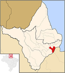
Itaubal (Brazilian Portuguese pronunciation: [itawˈbaw]), also Itaubal do Piririm,[1] is a municipality located in the southeast of the state of Amapá in Brazil. Its population is 5,617,[2] and its area is 1,704 square kilometres (658 sq mi). Itaubal is located 112 kilometres (70 mi) from the state capital of Macapá.[3]
Remove ads
History
Itaubal was built on the right bank of the Piririm River. First reports of habitation date from 1935. In 1940, more migrants settled in the village. In 1992, it became an independent municipality.[1] The economy is based on forestry, subsistence farming and livestock.[4]
It takes its name from the itaúba (Mezilaurus itauba), a valuable species of laurel. The tree was once found in great abundance in the region but is now endangered. Itaubal is bordered to the southeast by the delta of the Amazon River, and it is surrounded by Macapá to the southwest, west, and north.[3]
Remove ads
Climate
This city has a tropical monsoon climate (Köppen: Am). The wet season, typically occurring during February, is marked by heavy rainfall and high humidity.
See also
References
External links
Wikiwand - on
Seamless Wikipedia browsing. On steroids.
Remove ads


