Top Qs
Timeline
Chat
Perspective
Kalutara District
Administrative District in Western, Sri Lanka From Wikipedia, the free encyclopedia
Remove ads
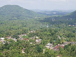
Kalutara District (Sinhala: කළුතර දිස්ත්රික්කය; Tamil: களுத்துறை மாவட்டம் Kaḷuttuṟai Māvaṭṭam) is one of the 25 districts of Sri Lanka, the second level administrative division of the country. The district is administered by a District Secretariat headed by a District Secretary (previously known as a Government Agent) appointed by the central government of Sri Lanka. The capital of the district is the city of Kalutara .
Remove ads
Geography
Kalutara District is located in the south-west of Sri Lanka and has an area of 1,598 square kilometres (617 sq mi).[1] It is bounded by Colombo District in the north, Ratnapura District in the east, Galle District in the south, and the Indian Ocean in the west.[4]
Administrative units
Summarize
Perspective
Kalutara District is divided into 14 Divisional Secretary's Division (DS Divisions), each headed by a Divisional Secretary (previously known as an Assistant Government Agent).[5] The DS Divisions are further sub-divided into 762 Grama Niladhari Divisions (GN Divisions).[5]
Remove ads
Demographics
Summarize
Perspective
Population
Kalutara District's population was 1,217,260 in 2012.[2] The majority of the population are Sinhalese, with a minority Sri Lankan Moor and Sri Lankan Tamil population.
Ethnicity
Religion
Religion in Kalutara District (2011)[10]
- Buddhism (83.5%)
- Islam (9.40%)
- Christianity (3.80%)
- Hinduism (3.30%)
See also
Notes
- Roman Catholic and Other Christian.
References
External links
Wikiwand - on
Seamless Wikipedia browsing. On steroids.
Remove ads


