Top Qs
Timeline
Chat
Perspective
Kamikitayama
Village in Kansai, Japan From Wikipedia, the free encyclopedia
Remove ads
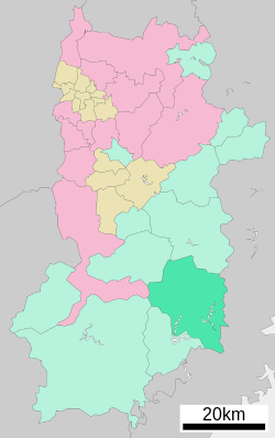
Kamikitayama (上北山村, Kamikitayama-mura) is a village located in Yoshino District, Nara Prefecture, Japan. As of 1 January 2025[update], the village had an estimated population of 380 and a population density of 1.4 persons per km2.[1] The total area of the village is 274.22 km2 (105.88 sq mi).

Remove ads
Geography
Summarize
Perspective
Kitakamiyama is located in the mountainous area in the southern part of Yoshino County. It is a mountain village rich in nature, with the ridge of the Omine Mountains to the west and the Daidaka Mountains and Odaigahara to the east. Wasamatayama Ski Resort, one of two ski resorts in the prefecture, is located in the north. There are many narrow roads, and it is not easy to access the village by any route other than National Route 169. Approximately 97% of the village's area is covered by forest.
Climate
Kamikitayama has a humid subtropical climate (Köppen climate classification Cfa) with hot summers and cool to cold winters. Precipitation is significantly higher in summer than in winter, though on the whole lower than most parts of Honshū. There is no significant snowfall. The average annual temperature in Kamikitayama is 13.5 °C (56.3 °F). The average annual rainfall is 2,909.3 mm (114.54 in) with September the wettest month. The temperatures are highest on average in August, at around 24.6 °C (76.3 °F), and lowest in January, at around 2.9 °C (37.2 °F).[2] The highest temperature ever recorded in Kamikitayama was 39.3 °C (102.7 °F) on 17 August 2020; the coldest temperature ever recorded was −9.3 °C (15.3 °F) on 28 February 1981.[3]
Demographics
The population has been consistently declining over the last 50 years.[4] The village has an ageing population.[citation needed]
Remove ads
History
The area of Kamikitayama was part of ancient Yamato Province. The village of Kitakamiyama was established on April 1, 1889, with the creation of the modern municipalities system.
Government
Kamikitayama has a mayor-council form of government with a directly elected mayor and a unicameral village council of eight members. Kamikitayama, collectively with the other municipalities of Yoshino District, contributes two members to the Nara Prefectural Assembly. In terms of national politics, the village is part of the Nara 3rd district of the lower house of the Diet of Japan.
Economy
The local economy is based on tourism and forestry. Due to the terrain, there is very little agriculture.
Education
Kitakamiyama has one public combined elementary/junior high school operated by the village government. The village does not have a high school.
Transportation
Railways
Kamikitayama has no passenger railway service. The nearest train station is Yamato-Kamiichi Station on the Kintetsu Yoshino Line in Yoshino.
Highways
References
External links
Wikiwand - on
Seamless Wikipedia browsing. On steroids.
Remove ads


