Top Qs
Timeline
Chat
Perspective
Katni district
District of Madhya Pradesh in India From Wikipedia, the free encyclopedia
Remove ads
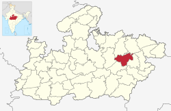
Katni District (Hindi pronunciation: [kəʈn̪iː]), also known as Murwara District (Hindi: [mʊɽʋaːɾaː]), is one of the 55 districts of Madhya Pradesh state in central India. The town of Katni (Murwara) is the District headquarters. The District is part of Jabalpur Division. The District occupies an area of 4949.59 km2.
Remove ads
Geography
Katni is located in the central part of Madhya Pradesh with the headquarters at Katni town. It is one of the district of Jabalpur division. Katni is conglomeration of culture from three different cultural states viz. Mahakausal, Bundelkhand, and Baghelkhand. There are three different stories which reveals why Katni is called Mudwara.[1] Katni River and Chhoti Mahanadi is Major Riveres of the District.
Remove ads
Economy
Katni is a town in Madhya Pradesh. It is also one of the largest rail junctions in the country and the second biggest diesel shed in the country is also located here. Katni is also a mineral-rich district, especially known for lime and bauxite.
Many Cement and Marbel's factories are located in Katni District. Railway's Electric loco shed and Ordinance Factory also situated in katni.[2]
In 2006 the Ministry of Panchayati Raj named Katni one of the country's 250 most backward districts (out of a total of 640).[3] It is one of the 24 districts in Madhya Pradesh currently receiving funds from the Backward Regions Grant Fund Programme (BRGF).[3]
Remove ads
Demographics
Summarize
Perspective
According to the 2011 census Katni District has a population of 1,292,042,[6] roughly equal to the nation of Estonia[7] or the US state of New Hampshire.[8] This gives it a ranking of 379th in India (out of a total of 640).[6]
The district has a population density of 261 inhabitants per square kilometre (680/sq mi).[6] Its population growth rate over the decade 2001-2011 was 21.38%.[6] Katni has a sex ratio of 948 females for every 1000 males[6] and a literacy rate of 73.62%. 20.41% of the population lives in urban areas. Scheduled Castes and Scheduled Tribes make up 12.05% and 24.59% of the population respectively.[6]
Kols are the largest tribal group which is 41% of the tribal population, while Gonds (34%) and Bharias (20%) are the other major tribes.[6]
At the time of the 2011 Census of India, 97.98% of the population in the district spoke Hindi and 1.56% Sindhi as their first language.[9]
Notable people
- Motilal Verma (1906–1993), political figure[10]
- Ramdas (politician), Indian Politician
- Pinky Maidasani, Singer and Rapper
- Sanjay Pathak, Indian Politician
- Akshat Khamparia, chess Player
- Giriraj Poddar, Indian Politician
Places of interest
Badera Chaturyug Dham Temple is a temple located in Badera Village of Katni district of Madhya Pradesh and is a very holy and popular religious place. This temple is just 15 K.M. away from Katni. This temple is a 5-story building, in which every floor has a temple of the deity of the Yugas(ages) mentioned in the Hindu scriptures.[11]
- Pushpawati Dham Bilahri
- Roopnath Dham, A religious site with a Panchaliga statue of Lord Shiva and inscriptions related to the Mauryan emperor Ashoka
- Vijayraghavgarh Fort, A 19th-century fort with historical significance, located about 35 km from Katni. It features temples, a rang mahal, and other structures.
- Sharda mata Mandir Vijayraghavgarh
- Vasudha Fall, A Significance and Beautiful water falls.
Remove ads
See also
References
External links
Wikiwand - on
Seamless Wikipedia browsing. On steroids.
Remove ads


