| [3] |
Landmark name |
Image |
Location |
County |
Culture |
Comments |
|---|
| 1 |
Archeological Site 36 LY 37[4] |
 |
Loyalsock Township: coextensive with Canfield Island
41°14′32″N 76°57′11″W |
Lycoming |
Multiple: Late Archaic through Susquehannock |
|
| 2 |
Big and Little Indian Rock Petroglyphs[5] |
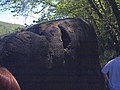
|
Conestoga Township: in the Susquehanna River, south of Safe Harbor
39°55′15″N 76°23′5″W |
Lancaster |
Unknown |
|
| 3 |
Book site (36 Jul)[6] |
 |
Beale Township: off Legislative Route 3019
40°28′44.5″N 77°30′2.4″W |
Juniata |
Clemson Island |
|
| 4 |
Calver Island[7] |
|
Swatara Township: in the Susquehanna River, southeast of Harrisburg
40°12′20″N 76°48′24″W |
Dauphin |
Multiple: Late Archaic through Early Woodland |
|
| 5 |
Carbaugh Run Rhyolite Quarry Site (36AD30)[8] |
|
Franklin Township: atop Snaggy Ridge, west of Carbaugh Run
39°53′2.4″N 77°27′26.4″W |
Adams |
Multiple: Late Archaic through Early Woodland |
|
| 6 |
Clemson Island Prehistoric District[9] |
|
Halifax Township: southern portion of Clemson Island in the Susquehanna River
40°26′59″N 76°56′41.5″W |
Dauphin |
Multiple: Early Archaic through Late Woodland |
Type site for the Clemson Island culture |
| 7 |
Conestoga Town[10] |
 |
Manor Township: junction of Safe Harbor and Indian Marker Rds., near Letort
39°57′35.4″N 76°24′1.4″W |
Lancaster |
Susquehannock |
|
| 8 |
Deffenbaugh Site (36FA57)[11] |
 |
Nicholson Township: on a saddle between two hills, along Old Frame Rd.
39°48′7.2″N 79°51′36″W |
Fayette |
Monongahela |
|
| 9 |
Duncan Island (36LA60,61)[12] |
|
Martic Township: in the Susquehanna River above Holtwood
39°51′41″N 76°21′49″W |
Lancaster |
Archaic |
|
| 10 |
Dykeman's Spring[13] |
 |
Shippensburg: Dykeman Rd., 0.25 miles (0.40 km) east of Pennsylvania Route 696
40°2′33″N 77°30′57″W |
Cumberland |
Multiple: Early Archaic through Woodland |
|
| 11 |
Fisher Farm site[14] |
 |
Unionville: along U.S. Route 220, straddling a rail line
40°54′15.6″N 77°52′40″W |
Centre |
Late Woodland |
|
| 12 |
Fisher Site (36GR21)[15] |
 |
Richhill Township: off Camp Resort Rd. along the Enlow Fork
39°57′36″N 80°28′0″W |
Greene |
Monongahela |
|
| 13 |
Richard T. Foley Site (36GR52)[16] |
 |
Jackson Township: along Job Creek
39°49′50.7″N 80°22′54″W |
Greene |
Monongahela |
|
| 14 |
Francis Farm Petroglyphs Site (36FA35)[17][18] |
 |
Jefferson Township: off Perry Road, 1 mile (1.6 km) west of the junction of Pennsylvania Routes 51 and 201
40°3′0″N 79°47′30″W |
Fayette |
Unknown |
|
| 15 |
Frey-Haverstick Site (36LA6)[19] |
 |
Manor Township: eastern side of the Susquehanna River at Washington Boro, north of Staman's Run
39°59′42″N 76°28′13.8″W |
Lancaster |
Multiple: Late Archaic through Susquehannock |
|
| 16 |
Household No. 1 Site (36WM61)[20] |
 |
Rostraver Township: off Timms Ln.
40°10′27.7″N 79°46′44.4″W |
Westmoreland |
Monongahela |
|
| 17 |
Houserville Site (36CE65)[21] |
 |
College Township: 1300 block of E. College Ave., east of State College
40°48′42″N 77°50′4″W |
Centre |
Early and Middle Archaic |
|
| 18 |
Indian God Rock Petroglyphs Site (36VE26)[22] |
 |
Rockland Township: on the eastern bank of the Allegheny River above Brandon
41°19′48″N 79°49′27″W |
Venango |
Unknown |
|
| 19 |
Byrd Leibhart Site (36YO170)[23] |
 |
Lower Windsor Township: Native Lands County Park
39°58′41.4″N 76°29′54″W |
York |
Susquehannock |
|
| 20 |
Oscar Leibhart Site (36YO9)[24] |
|
Lower Windsor Township: along the Susquehanna River, north of Klines Run
39°59′20.4″N 76°30′1″W |
York |
Susquehannock |
|
| 21 |
Locus 7 Site[25] |
 |
Washington Township: on a bluff above Downers Run north of Fayette City, 2,000 feet (610 m) east of the Monongahela River
40°6′24″N 79°50′13″W |
Fayette |
Monongahela |
|
| 22 |
Meadowcroft Rockshelter[26] |
 |
Independence Township: west of Avella
40°17′11″N 80°29′30″W |
Washington |
Multiple: Paleoindian through Late Woodland |
|
| 23 |
Memorial Park Site[27] |
 |
Lock Haven: on the southern bank of the Susquehanna River near the confluence of Bald Eagle Creek
41°8′19.2″N 77°25′4.3″W |
Clinton |
Clemson Island |
|
| 24 |
Minisink Archeological Site[28] |
 |
Dingman Township: in the vicinity of Minisink Island
41°17′26.2″N 74°49′44.4″W |
Pike |
Multiple: Early Archaic through Shawnee |
|
| 25 |
Murry Site[29] |
 |
Manor Township: 2 miles south of Washington Boro
39°58′44.4″N 76°27′10.8″W |
Lancaster |
Susquehannock |
|
| 26 |
North Warwick Historic and Archeological District[30] |
 |
Warwick Township: Pennsylvania Route 345 and Harmonyville, Bethesda, Hopewell, Piersol, Trythall, and Northside Rds.
40°11′18″N 75°46′8″W |
Chester |
Multiple: Late Archaic through Late Woodland |
|
| 27 |
Park Site 36La96[31] |
 |
Lancaster: on a knoll in Central Park, midway between the Conestoga River and Mill Creek
40°1′7″N 76°17′3.7″W |
Lancaster |
Susquehannock |
|
| 28 |
Roberts Farm Site (36LA1)[32] |
|
Manor Township: on a knoll above the Conestoga River, just above its confluence with the Susquehanna River, near Conestoga
39°56′42.4″N 76°22′26.8″W |
Lancaster |
Multiple: Late Archaic through Susquehannock |
|
| 29 |
Shawnee-Minisink Site[33] |
 |
Smithfield Township: confluence of Brodhead Creek and the Delaware River
40°59′25″N 75°8′2.7″W |
Monroe |
Multiple: Paleoindian through Late Archaic |
|
| 30 |
Shenks Ferry Site (36LA2)[34] |
|
Conestoga Township: along Grubbs Creek north of Pequea, ¾ mile above the Susquehanna River
39°54′18″N 76°21′36.7″W |
Lancaster |
Multiple: Shenks Ferry through Susquehannock |
Type site for the Shenks Ferry culture |
| 31 |
Shoop Site (36DA20)[35] |
|
Jackson Township: east of Enders
40°29′14″N 76°49′12″W |
Dauphin |
Paleoindian |
|
| 32 |
Shultz-Funk Site (36LA7 and 36LA9)[36] |
 |
Manor Township: above the Susquehanna River near Washington Boro, immediately south of Witmer's Run
39°58′6.4″N 76°27′17.9″W |
Lancaster |
Late Woodland |
|
| 33 |
Site 36BD90[37] |
 |
Bedford Township: on the grounds of Bedford Village
40°2′31.2″N 78°30′38.4″W |
Bedford |
Monongahela |
|
| 34 |
Sommerheim Park Archaeological District[38] |
 |
Millcreek Township: on bluffs above Sommerheim Dr. and Presque Isle Bay
42°6′49″N 80°8′42″W |
Erie |
Multiple: Early Archaic through Middle Woodland |
|
| 35 |
Squirrel Hill Site[39] |
 |
St. Clair Township: west of New Florence near the banks of the Conemaugh River
40°22′49″N 79°5′20.3″W |
Westmoreland |
Monongahela |
|
| 36 |
Strickler Site[40] |
 |
Manor Township: ¾ mile north of Creswell Station, and 1 mile south of Washington Boro
39°58′48″N 76°27′40″W |
Lancaster |
Susquehannock |
|
| 37 |
Sugar Grove Petroglyph Site (36GR5)[18][41] |
 |
Monongahela Township: off Pennsylvania Route 88, 0.7 miles (1.1 km) northwest of its bridge over Whiteley Creek
39°49′36″N 79°57′40″W |
Greene |
Unknown |
|
| 38 |
Tudek Site[42] |
 |
College Township: along Orchard Rd., northeast of State College
40°49′1″N 77°51′3″W |
Centre |
Early and Middle Archaic |
|


