Top Qs
Timeline
Chat
Perspective
List of State Protected Monuments in Rajasthan
From Wikipedia, the free encyclopedia
Remove ads
This is a list of State Protected Monuments as officially reported by and available through the website of the Archaeological Survey of India in the Indian state Rajasthan.[1] In 2016, 227 State Protected Monuments were recognized by the ASI Rajasthan.[2]
Map all coordinates using OpenStreetMap
- Download coordinates as KML
Subsequently Rajasthan State Tourism has revised this list; so the current list of State Protected Monuments lists 342 sites.[3]
In addition to this list of the State Protected Monuments, the list of Monuments of National Importance in this state has primary sites .
Remove ads
List of State Protected Monuments
Summarize
Perspective
More information SL. No., Description ...
| SL. No. | Description | Location | Address | District | Coordinates | Image |
|---|---|---|---|---|---|---|
| District-Ajmer |  Upload Photo | |||||
| S-RJ-1 | Akbar's Fort or Magazine or Daulata Khana | Ajmer | Ajmer | 26°27′39″N 74°38′01″E |  More images | |
| S-RJ-2 | Main Entrance of Akbar's Fort | Ajmer | Ajmer | 26°27′39″N 74°37′59″E |  | |
| S-RJ-3 | Toda and Digambaro Ki Jain Chhatries | Ajmer | Ajmer | 26°29′21″N 74°37′54″E |  | |
| S-RJ-4 | Chamunda Devi Temple | Ajmer | Ajmer | 26°26′19″N 74°36′05″E | Upload Photo | |
| S-RJ-5 | Santosh Bavala ki Chhatari | Pushkar | Ajmer | Upload Photo | ||
| S-RJ-6 | Gopinathji Temple | Sarwar | Ajmer | 26°03′46″N 75°00′40″E | Upload Photo | |
| S-RJ-7 | Ghantaghar | Ajmer | Ajmer | 26°27′24″N 74°38′12″E | Upload Photo | |
| S-RJ-8 | Nur Chashma | Ajmer | Ajmer | 26°26′06″N 74°36′42″E |  | |
| S-RJ-9 | Toran Stambh, village, Baghera | Baghera | Ajmer | 26°01′12″N 75°19′02″E | Upload Photo | |
| S-RJ-10 | Shukar Varah, Mandir, village, Baghera | Baghera | Ajmer | 26°01′20″N 75°18′57″E | Upload Photo | |
| S-RJ-11 | Agra gate | Ajmer | Ajmer | 26°27′53″N 74°37′55″E |  | |
| S-RJ-12 | Usari gate | Ajmer | Ajmer | 26°27′07″N 74°38′00″E | Upload Photo | |
| S-RJ-13 | Madar gate | Ajmer | Ajmer | 26°27′27″N 74°38′06″E | Upload Photo | |
| S-RJ-14 | Alwar gate | Ajmer | Ajmer | 26°26′45″N 74°38′51″E | Upload Photo | |
| S-RJ-15 | Shivling | Nand | Ajmer | 26°28′00″N 74°28′35″E | Upload Photo | |
| S-RJ-16 | Fort | Sarwar | Ajmer | 26°03′30″N 75°00′27″E | Upload Photo | |
| S-RJ-17 | Fort | Fatehgarh | Ajmer | 26°07′55″N 75°01′37″E | Upload Photo | |
| S-RJ-18 | Shiv Mandir | Ajaypal | Ajmer | 26°24′19″N 74°32′46″E | Upload Photo | |
| S-RJ-19 | Kotwali Gate | Ajmer | Ajmer | 26°27′45″N 74°37′59″E | Upload Photo | |
| S-RJ-20 | King Edward Memorial | Ajmer | Ajmer | 26°27′16″N 74°38′12″E | Upload Photo | |
| District-Alwar | Upload Photo | |||||
| (S-RJ-13) old number | Nogaja/Nangaj now included with 'N-RJ-142 Neelkanth Mahadev Temple' | Alwar | 27°14′46″N 76°20′57″E | Upload Photo | ||
| (S-RJ-17) old number | Someshwar Mahadeva place included in 'N-RJ-143 Bhangarh Fort' | Alwar | 27°05′43″N 76°17′12″E | Upload Photo | ||
| S-RJ-21 | Alwar Palace (including Govt. offices, Govt. Museum private parts of Maharaja & Zanana Palaces) | Alwar | Alwar | 27°34′11″N 76°35′39″E |  More images | |
| S-RJ-22 | Tripoliya | Alwar | Alwar | 27°34′04″N 76°35′57″E |  | |
| S-RJ-23 | Fateh Jang Gumbad | Alwar | Alwar | 27°33′45″N 76°37′22″E |  More images | |
| S-RJ-24 | Krishna Kunda | Alwar | Alwar | 27°34′31″N 76°35′36″E |  More images | |
| S-RJ-25 | Raj Garh Fort | Rajgarh | Alwar | 27°14′02″N 76°37′37″E |  More images | |
| S-RJ-26 | Bhartrhari Gumbad | Tijara | Alwar | 27°55′40″N 76°51′09″E |  More images | |
| S-RJ-27 | Indor Fort | Alwar | 28°05′05″N 76°56′49″E | Upload Photo | ||
| S-RJ-28 | Khanjnada Ki Kabaren | Alwar | 28°04′30″N 76°57′05″E | Upload Photo | ||
| S-RJ-29 | Ancient Palace of Bada Gujar | Rajgarh | Alwar | Upload Photo | ||
| S-RJ-30 | Pathan Kabrein | Tijara | Alwar | Upload Photo | ||
| S-RJ-31 | Cenotaph of Musi Maharani | Alwar | Alwar | 27°34′10″N 76°35′35″E |  More images | |
| S-RJ-32 | Bala kila | Alwar | Alwar | 27°34′29″N 76°35′15″E | More images | |
| District-Baran | Upload Photo | |||||
| S-RJ-33 | Shiv temple or Bhand Devara | Ramgarh | Baran | 25°19′59″N 76°37′31″E |  More images | |
| S-RJ-34 | Hindu Mandir | Baran | Baran | 25°06′03″N 76°30′58″E | Upload Photo | |
| S-RJ-35 | Group of Temples | Kakuni | Baran | 24°28′14″N 76°34′50″E | Upload Photo | |
| S-RJ-36 | Ramgarh Fort | Ramgarh | Baran | 25°19′21″N 76°36′50″E | Upload Photo | |
| S-RJ-37 | Temple | Bansthuni | Baran | 25°05′20″N 76°42′14″E | Upload Photo | |
| S-RJ-38 | Fort Nahargarh | Nahargarh | Baran | 24°55′17″N 76°50′32″E | Upload Photo | |
| S-RJ-39 | Old Temple | Khandela | Baran | 27°39′18″N 75°31′00″E | Upload Photo | |
| S-RJ-40 | Maszid (Mosque) | Shahabad | Baran | 25°14′56″N 77°09′09″E | Upload Photo | |
| S-RJ-41 | Badal Mahal | Shahabad | Baran | 25°14′55″N 77°09′07″E | Upload Photo | |
| S-RJ-42 | Fort | Shahabad | Baran | 25°14′01″N 77°07′58″E | Upload Photo | |
| S-RJ-43 | Fort | Kelwara | Baran | Upload Photo | ||
| S-RJ-44 | Shiv Mandir | Noorpur | Baran | Upload Photo | ||
| S-RJ-45 | Shiv Mandir | Nagada | Baran | 25°10′57″N 76°15′23″E | Upload Photo | |
| S-RJ-46 | Mandir | Badera | Baran | Upload Photo | ||
| S-RJ-47 | Mata Ka Mandir | Bara Khera | Baran | Upload Photo | ||
| S-RJ-48 | Mandir | Dhuman | Baran | Upload Photo | ||
| S-RJ-49 | Mandir | Bichalas | Baran | 24°48′38″N 76°33′30″E | Upload Photo | |
| S-RJ-50 | Group of Temples | Saharod | Baran | 24°57′24″N 76°31′02″E | Upload Photo | |
| S-RJ-51 | Shakti Sagar Talab | Mothpur | Baran | Upload Photo | ||
| S-RJ-52 | Cenotaphs of Bamulia Jagidar's | Baran | Baran | Upload Photo | ||
| S-RJ-53 | Deep Stambh | Niyana, Anta | Baran | Upload Photo | ||
| S-RJ-54 | Shergarh Ka Kila | Atru | Baran | 24°42′34″N 76°32′34″E | Upload Photo | |
| District-Barmer | Upload Photo | |||||
| S-RJ-55 | Kiradu Ke Mandir | Hatama | Barmer | 25°45′10″N 71°05′52″E |  More images | |
| S-RJ-56 | Fort of Siwana | Siwana | Barmer | 25°39′00″N 72°24′52″E |  More images | |
| S-RJ-57 | Mata Ka Mandir | Bisukala | Barmer | 26°15′43″N 71°18′48″E | Upload Photo | |
| S-RJ-58 | Sun Temple | Dewaka | Barmer | 26°20′51″N 71°12′49″E | Upload Photo | |
| S-RJ-59 | Jain Temple | Juna-Patarasar | Barmer | 25°39′07″N 71°13′25″E | Upload Photo | |
| District-Bharatpur | Upload Photo | |||||
| S-RJ-60 | Parts of Lohagarh Fort (others are protected as Monuments of National Importance): Fort – Kamara Khas, Kishori Mahal, Hansarani Mahal, Kachahari Kala, Chaman Bagichi, Hammam & mudwall gates ie. Mathura gate, Binarain gate, Atal Bandh gate, Anah gate, Kumher gate, Govardhan gate, Neemda gate, Chandpol gate, and bastion near Suraj pol. |
Bharatpur | Bharatpur | 27°13′12″N 77°29′43″E | .jpg) Fort – Kamara Khas, Kishori Mahal, Hansarani Mahal, Kachahari Kala, Chaman Bagichi, Hammam & mudwall gates ie. Mathura gate, Binarain gate, Atal Bandh gate, Anah gate, Kumher gate, Govardhan gate, Neemda gate, Chandpol gate, and bastion near Suraj pol. More images | |
| S-RJ-61 | Chauburza/Gadhi Khemkaran | Bharatpur | Bharatpur | 27°13′01″N 77°29′45″E | Upload Photo | |
| S-RJ-62 | Prachin Prasad | Kumher | Bharatpur | 27°18′54″N 77°22′45″E | Upload Photo | |
| S-RJ-63 | Jal Mahal | Kumher | Bharatpur | 27°18′53″N 77°22′52″E | Upload Photo | |
| S-RJ-64 | Fort (Deeg Fort) | Deeg | Bharatpur | 27°28′15″N 77°19′44″E |  More images | |
| S-RJ-65 | Kameshwar Mahadev Ka Mandir | Kaman | Bharatpur | 27°38′58″N 77°16′33″E | Upload Photo | |
| S-RJ-66 | Fort (Weir Fort) | Weir | Bharatpur | 27°00′59″N 77°10′34″E | Upload Photo | |
| S-RJ-67 | Palace and Vatika (Garden) | Weir | Bharatpur | 27°01′05″N 77°10′17″E | Upload Photo | |
| S-RJ-68 | Stone Sculpture at Baldevji Ka Mandir | Roopwas | Bharatpur | 26°59′51″N 77°37′00″E | Upload Photo | |
| S-RJ-69 | Mohammad Gauri Ke Senapati Ki Chhatri | Nadbai | Bharatpur | 27°13′06″N 77°11′58″E | Upload Photo | |
| S-RJ-70 | Cenotaphs of Holkar | Gangour Soti | Bharatpur | 27°20′57″N 77°21′42″E | Upload Photo | |
| S-RJ-71 | Ancient Palace and Chhatta | Deeg | Bharatpur | 27°28′20″N 77°19′25″E | Upload Photo | |
| S-RJ-72 | Ancient Palace | Kaman | Bharatpur | 27°38′56″N 77°16′00″E | Upload Photo | |
| S-RJ-73 | Akabar ke Kos Chinha | Kaman | Bharatpur | 27°38′33″N 77°16′26″E | Upload Photo | |
| S-RJ-74 | Akabar ke Kos Chinha | Kaman | Bharatpur | Upload Photo | ||
| S-RJ-75 | Temple of Surya | Satwas | Bharatpur | 27°43′02″N 77°16′37″E | Upload Photo | |
| S-RJ-76 | Kale Khan Ka Makbara | Bayana | Bharatpur | 26°54′08″N 77°17′18″E | Upload Photo | |
| S-RJ-77 | Chhatri of twelve pillars | Bayana | Bharatpur | 26°53′13″N 77°14′17″E | Upload Photo | |
| S-RJ-78 | Lal Darwaja | Kaman | Bharatpur | Upload Photo | ||
| S-RJ-79 | Ancient Well | Kaman | Bharatpur | Upload Photo | ||
| S-RJ-80 | Well of Dharamraj | Kaman | Bharatpur | Upload Photo | ||
| S-RJ-81 | Cenotaphs in the way of Vijay Mandir Garh | Bayana | Bharatpur | Upload Photo | ||
| S-RJ-82 | Muslim Kabren and Sahale Khan ki Kabren | Sahsan | Bharatpur | Upload Photo | ||
| S-RJ-83 | Sri Krishan ke paad and Gau Charan Chinha | Bhudaka, Kama | Bharatpur | 27°38′39″N 77°14′25″E | Upload Photo | |
| S-RJ-84 | Temple of Kedar Nath (on hill) and a tank (below
hill) |
Vilod, Kama | Bharatpur | 27°37′11″N 77°11′36″E | Upload Photo | |
| S-RJ-85 | Bhojan Thalian and two Katore | Kalawata, Kama | Bharatpur | 27°40′34″N 77°15′57″E | Upload Photo | |
| S-RJ-86 | Cave of Bhaumasur and Fislan Patti | Kalawata, Kama | Bharatpur | 27°40′35″N 77°15′37″E | Upload Photo | |
| District-Bhilwara | Upload Photo | |||||
| S-RJ-87 | Battis Khambhon ki Chhatri | Mandal | Bhilwara | 25°26′03″N 74°33′46″E | Upload Photo | |
| S-RJ-88 | Vishnu Temple | Ghaud | Bhilwara | 25°32′20″N 75°19′33″E | Upload Photo | |
| S-RJ-89 | Haveli of Late Shri Kesari Singh Barahath | Shahpura | Bhilwara | 25°37′31″N 74°55′33″E | Upload Photo | |
| S-RJ-90 | Shitla Temple with Sculptures | Dhanop | Bhilwara | 25°50′31″N 74°54′09″E | Upload Photo | |
| S-RJ-91 | Roothi Rani ka Mandir | Ghaud | Bhilwara | 25°31′58″N 75°19′23″E | Upload Photo | |
| S-RJ-92 | Minar/Watch Tower | Mandal | Bhilwara | 25°26′29″N 74°33′55″E | Upload Photo | |
| S-RJ-93 | Durg Mandalgarh | Mandal | Bhilwara | 25°12′25″N 75°05′35″E | Upload Photo | |
| District-Bikaner | Upload Photo | |||||
| S-RJ-94 | Cenotaphs of the early rulers of Bikaner | Bikaner | Bikaner | 28°01′03″N 73°23′24″E |  More images | |
| S-RJ-95 | Gates built on wall of Bikaner city including Kotgate, Jassusar gate, Natthusar gate, Shitla gate and Goga gates and twenty ft. area both sides | Bikaner | Bikaner | 28°01′00″N 73°18′40″E |  More images | |
| S-RJ-96 | Devi Kund Sagar and Cenotaphs | Bikaner | Bikaner | 28°01′02″N 73°23′24″E |  More images | |
| S-RJ-97 | Jambha ji or Mokam Temple | Mokam | Bikaner | 27°37′32″N 73°37′06″E | Upload Photo | |
| S-RJ-98 | Chintamani Jain Temple | Mokam | Bikaner | 28°00′28″N 73°18′10″E | Upload Photo | |
| S-RJ-99 | Laxmi Narain Mandir | Bikaner | Bikaner | 28°01′11″N 73°19′03″E | Upload Photo | |
| S-RJ-100 | Mandir Raj Ratan Behari & Rasik Siromani | Bikaner | Bikaner | 28°01′11″N 73°18′56″E | Upload Photo | |
| S-RJ-101 | Kirti Stambha & war Memorial | Bikaner | Bikaner | 28°01′45″N 73°19′20″E | Upload Photo | |
| S-RJ-102 | Haveli of Sh. Sunil Rampuria | Bikaner | Bikaner | 28°00′44″N 73°18′17″E | Upload Photo | |
| S-RJ-103 | Haveli of Sh. Surendra Rampuria | Bikaner | Bikaner | 28°00′44″N 73°18′17″E | Upload Photo | |
| S-RJ-104 | Haveli of Sh. Shikharchand Rampuria | Bikaner | Bikaner | 28°00′44″N 73°18′17″E | Upload Photo | |
| S-RJ-105 | Haveli of Sh. Manakchand Rampuria | Bikaner | Bikaner | 28°00′44″N 73°18′17″E | Upload Photo | |
| S-RJ-106 | Haveli of Sh. Ratanlal Rampuria | Bikaner | Bikaner | 28°00′44″N 73°18′17″E | Upload Photo | |
| S-RJ-107 | Haveli of Sh. Jaichand Rampuria | Bikaner | Bikaner | 28°00′44″N 73°18′17″E | Upload Photo | |
| S-RJ-108 | Haveli of Sh. Moolchand Rampuria | Bikaner | Bikaner | 28°00′44″N 73°18′17″E | Upload Photo | |
| District-Bundi | Upload Photo | |||||
| S-RJ-109 | Raniji Ki Bawari (step well) | Bundi | Bundi | 25°26′25″N 75°38′22″E |  More images | |
| S-RJ-110 | Shiv Temple | Kanwalji | Bundi | 25°45′45″N 76°19′38″E |  | |
| S-RJ-111 | Inscription of Hammir | Kanwalji | Bundi | Upload Photo | ||
| S-RJ-112 | Chaurasi Khambo ki Chhatri | Bundi | Bundi | 25°25′47″N 75°38′49″E | Upload Photo | |
| S-RJ-113 | Bhavaldi Baori | Bundi | Bundi | 25°26′47″N 75°38′22″E | Upload Photo | |
| S-RJ-114 | Mandir Laxmi Narayan | Bundi | Bundi | 25°26′46″N 75°38′11″E | Upload Photo | |
| S-RJ-115 | Dhabhaiji ka Kund (Jail Kund) | Bundi | Bundi | 25°26′12″N 75°38′19″E | Upload Photo | |
| S-RJ-116 | Paintings on Rock Sheltar at Hathidoob site | Haulaspura | Bundi | 25°34′30″N 75°40′34″E | Upload Photo | |
| S-RJ-117 | Paintings on Rock Sheltar at Nachala site | Haulaspura | Bundi | Upload Photo | ||
| S-RJ-118 | Paintings on Rock Sheltar at Chhaparia site | Haulaspura | Bundi | Upload Photo | ||
| S-RJ-119 | Paintings on Rock Sheltar at Undimaya site | Haulaspura | Bundi | Upload Photo | ||
| S-RJ-120 | Paintings on Rock Sheltar at Khurd ka Nala site | Haulaspura | Bundi | Upload Photo | ||
| S-RJ-121 | Paintings on Rock Sheltar at Dharawa site | Haulaspura | Bundi | Upload Photo | ||
| S-RJ-122 | Paintings on Rock Sheltar at Kewadia site | Haulaspura | Bundi | Upload Photo | ||
| S-RJ-123 | Paintings on Rock Sheltar at Naldeh site | Haulaspura | Bundi | Upload Photo | ||
| S-RJ-124 | Sukh Mahal | Bundi | Bundi | 25°27′10″N 75°38′31″E | Upload Photo | |
| District-Banswara | Upload Photo | |||||
| S-RJ-125 | Dwarikadhish Temple | Talwara | Banswara | 23°33′45″N 74°19′36″E | Upload Photo | |
| District-Chittorgarh | Upload Photo | |||||
| (S-RJ-82) Old Number | Brahmi Inscription of Shunga period (Deleted rom list) | Chittorgarh | Upload Photo | |||
| (S-RJ-83) Old Number | Rajmahal of Devagarh (Deleted rom list) | Chittorgarh | 25°31′44″N 73°54′30″E | Upload Photo | ||
| S-RJ-126 | Bridge Situated at Gambhiri river | Chittorgarh | Chittorgarh | 24°53′21″N 74°37′48″E | Upload Photo | |
| S-RJ-127 | Deep Stambh | Nagari | Chittorgarh | Upload Photo | ||
| (S-RJ-148) Old Number | Kirti Stambha(Included in N-RJ-41) | Chittorgarh | Chittorgarh | 24°53′32″N 74°39′00″E |  More images | |
| District-Churu | Upload Photo | |||||
| S-RJ-128 | Sethani ka Jhohara | Churu | Churu | 28°17′53″N 74°55′39″E | Upload Photo | |
| S-RJ-129 | Cenotaph of Anand Singh | Taranagar | Churu | Upload Photo | ||
| S-RJ-130 | Minaryukt Koop | Bootia | Churu | Upload Photo | ||
| S-RJ-131 | Sahava ka Talab | Sahava, Taranagar | Churu | 28°52′28″N 74°50′43″E | Upload Photo | |
| District-Dholpur | Upload Photo | |||||
| S-RJ-132 | Much Kund | Dholpur | 26°40′51″N 77°51′52″E | Upload Photo | ||
| S-RJ-133 | Kund and Shiva temple | Dholpur | 26°42′06″N 77°53′22″E | Upload Photo | ||
| S-RJ-134 | Jarjarina tomb and masjid | Dholpur | 26°40′54″N 77°54′03″E | Upload Photo | ||
| S-RJ-135 | Ancient Baori | Dholpur | 26°41′56″N 77°53′50″E | Upload Photo | ||
| (S-RJ-88) Old Number N-RJ-153 | Shergarh Fort | Dholpur | 26°40′19″N 77°54′07″E |  More images | ||
| S-RJ-136 | Bhuteshwar Mahadev temple | Dholpur | 26°42′50″N 77°32′52″E | Upload Photo | ||
| S-RJ-137 | Talab Shahi | Dholpur | 26°37′18″N 77°39′06″E | Upload Photo | ||
| S-RJ-138 | Place and Temple, Purani Chhavani | Dholpur | Dholpur | 26°41′40″N 77°50′50″E | Upload Photo | |
| S-RJ-139 | Remains Architectural opposite Chopra Mahadev
temple |
Damapur | Dholpur | Upload Photo | ||
| District-Dausa | Upload Photo | |||||
| S-RJ-140 | Bhandarej ki Baori | Baswa | Dausa | 26°52′55″N 76°25′17″E | Upload Photo | |
| District-Hanuman Garh | Upload Photo | |||||
| S-RJ-141 | Cenotaph, Raisinghpura | Nohar | Hanuman Garh | Upload Photo | ||
| District-Jaipur | Upload Photo | |||||
| S-RJ-142 | Albert Hall, Ram Niwas Bagh | Jaipur | Jaipur | 26°54′42″N 75°49′10″E |  More images | |
| S-RJ-143 | Jyotish Yantralaya (also known as Jantar Mantar) | Jaipur | Jaipur | 26°55′29″N 75°49′28″E |  More images | |
| S-RJ-144 | Sudarshana/Naghar Garh (Nahargarh Fort) | Jaipur | Jaipur | 26°56′25″N 75°49′01″E |  More images | |
| S-RJ-145 | Isarlat | Jaipur | Jaipur | 26°55′28″N 75°49′15″E |  More images | |
| S-RJ-146 | Hawa Mahal | Jaipur | Jaipur | 26°55′26″N 75°49′36″E | _in_Jaipur,_20191218_1137_9136.jpg) More images | |
| S-RJ-147 | Cenotaphes of Gaitore | Jaipur | 26°56′35″N 75°49′29″E |  | ||
| S-RJ-148 | Temples of Galta | Jaipur | 26°55′03″N 75°51′27″E |  | ||
| S-RJ-149 | Bala Nand ji Temple | Jaipur | 26°55′50″N 75°48′37″E | Upload Photo | ||
| S-RJ-150 | Queens Cenotaphs (Amer road) | Jaipur | 26°56′41″N 75°50′24″E |  | ||
| S-RJ-151 | Brijnand ji Temple | Jaipur | 26°55′30″N 75°49′21″E |  | ||
| S-RJ-152 | Charan Mandir | Jaipur | 26°57′10″N 75°49′37″E | Upload Photo | ||
| S-RJ-153 | Rampart including all gates of old Jaipur City
Suraj Pol Gate 26.91918, 75.84495 Chandpol Darwaza 26.9265, 75.8095 Zorawar Singh Gate 26.93494, 75.83335 Ajmeri Gate 26.91764, 75.81665 New Gate 26.9167, 75.82071 Sanganeri Gate 26.91584, 75.82489 Ghat Gate 26.91417, 75.83303 Gangapol Gate 26.9348, 75.83932 Samrat Gate 26.93787, 75.82829 Char Darwaza Gate 26.92825, 75.83625 |
Jaipur | Jaipur | 26°54′57″N 75°49′30″E |  | |
| S-RJ-154 | Sanganer Temple | Jaipur | 26°48′54″N 75°47′11″E |  | ||
| S-RJ-155 | Cenotaphs at Station Road | Jaipur | Jaipur | Upload Photo | ||
| S-RJ-156 | Town hall (Sawai Man Singh Town Hall) | Jaipur | Jaipur | 26°55′31″N 75°49′38″E |  More images | |
| S-RJ-157 | Wall Paintings of Samod Haveli Purani Basti | Jaipur | 26°56′00″N 75°50′14″E | Upload Photo | ||
| S-RJ-158 | Wall Paintings of Purohit Ji ki Haveli Purani Basti | Jaipur | 26°55′51″N 75°49′11″E | Upload Photo | ||
| S-RJ-159 | Sun Temple Galta Hill | Jaipur | 26°55′01″N 75°51′08″E |  More images | ||
| S-RJ-160 | Kalki Temple Sirehdeorhi Bazar | Jaipur | 26°55′35″N 75°49′41″E |  | ||
| S-RJ-161 | Bhawani Rao Bohara's House Ghat ki Gooni | Jaipur | 26°54′07″N 75°51′08″E |  | ||
| S-RJ-162 | Sisodia Maharani Temple Ghat ki Gooni | Jaipur | 26°53′58″N 75°51′31″E |  | ||
| S-RJ-163 | Wall Paintings of Janana Ghat Galta | Jaipur | 26°55′03″N 75°51′26″E | Upload Photo | ||
| S-RJ-164 | Sun Temple Galta | Jaipur | Upload Photo | |||
| S-RJ-165 | Krishna Deva Payahari Ki Gufa Galta | Jaipur | 26°55′02″N 75°51′29″E | Upload Photo | ||
| S-RJ-166 | Akabar Ke Kos Chinha | Jaipur | Upload Photo | |||
| S-RJ-167 | Wall Paintings of Chhatari near Prachin Govind Devaji ka Temple Amber Ghati | Jaipur | 26°57′46″N 75°50′44″E | Upload Photo | ||
| S-RJ-168 | Prachin Govind Devaji ka Temple Amber Ghati | Jaipur | 26°57′49″N 75°50′51″E | Upload Photo | ||
| S-RJ-169 | Kalyan ji Temple Amber | Amber | Jaipur | 26°59′25″N 75°51′05″E | Upload Photo | |
| (S-RJ-118) Old Number | Sun Temple, Amber (see also N-RJ-79) |
Amber | Jaipur | 26°59′23″N 75°51′00″E |  (see also N-RJ-79) More images | |
| S-RJ-170 | Amber Palace on Hill, Amber (Amber Fort) | Amber | Jaipur | 26°59′08″N 75°51′01″E |  More images | |
| S-RJ-171 | Cenotaphs at Shahpur Road, Amber | Amber | Jaipur | Upload Photo | ||
| S-RJ-172 | Prachin Mahal below Hill, Amber | Amber | Jaipur | 26°59′16″N 75°50′59″E |  | |
| S-RJ-173 | Panna Miyan Ka Kund, Amber (Panna Meena ka Kund) | Amber | Jaipur | 26°59′28″N 75°51′05″E |  More images | |
| S-RJ-174 | Dalaram Garden, Amber | Amber | Jaipur | 26°59′09″N 75°51′01″E |  More images | |
| S-RJ-175 | Mohan Bari, Amber | Amber | Jaipur | Upload Photo | ||
| S-RJ-176 | Sanghi Temple, Amber | Amber | Jaipur | 26°59′22″N 75°51′13″E | Upload Photo | |
| S-RJ-177 | Nrisingha Temple, Amber | Amber | Jaipur | 26°59′17″N 75°50′58″E | Upload Photo | |
| S-RJ-178 | Rampart of old Amber town, Amber | Amber | Jaipur | 26°59′06″N 75°51′16″E |  | |
| S-RJ-179 | Mughal Gate | Viratnagar | Jaipur | 27°26′57″N 76°10′38″E | Upload Photo | |
| S-RJ-180 | Jamwa Mata Temple | Jamwa Ramgarh | Jaipur | 27°02′18″N 76°03′46″E | Upload Photo | |
| S-RJ-181 | Wall Paintings of Bhaopura Chhatri | Bhaopura | Jaipur | Upload Photo | ||
| S-RJ-182 | Prachin Baori | Bhaopura | Jaipur | Upload Photo | ||
| S-RJ-183 | Chomu Fort | Chomu | Jaipur | 27°10′04″N 75°43′22″E | Upload Photo | |
| S-RJ-184 | Nakati Mata Temple | Jai Bhawanipura | Jaipur | 26°52′57″N 75°38′14″E | Upload Photo | |
| S-RJ-185 | Nayala Fort | Nayala | Jaipur | 26°55′43″N 75°58′30″E | Upload Photo | |
| S-RJ-186 | Nayala Palace | Nayala | Jaipur | 26°55′18″N 75°58′35″E | Upload Photo | |
| S-RJ-187 | Cenotophs near Parion ka Bagh | Amber | Jaipur | Upload Photo | ||
| S-RJ-188 | Sh. Laxmi Narain Mandir, opposite, Hathi Stand
Rambagh |
Amber | Jaipur | 26°59′11″N 75°51′15″E | Upload Photo | |
| S-RJ-189 | Sh. Gopal ji ka mandir opposite Hathi Stand
Ramgagh |
Amber | Jaipur | 26°59′12″N 75°51′16″E | Upload Photo | |
| S-RJ-190 | Laxmi Narain ka mandir (Behari ji) opposite,
Panna miyan kund |
Amber | Jaipur | 26°59′29″N 75°51′03″E | Upload Photo | |
| S-RJ-191 | Properties Situated in Ghat ki Guni, Jamdoli | Jaipur | Jaipur | 26°53′56″N 75°51′20″E | Upload Photo | |
| S-RJ-192 | Inscription of Ashoka the Great | Virat Nagar | Jaipur | 27°25′02″N 76°09′44″E | Upload Photo | |
| S-RJ-193 | Akbar ki kos Minar | Johparia, Bass | Jaipur | 26°51′16″N 76°07′33″E | Upload Photo | |
| S-RJ-194 | Akbar ki kos Minar | Jhar Bassi | Jaipur | 26°51′23″N 75°45′32″E | Upload Photo | |
| S-RJ-195 | Akbar ki kos Minar | Malyalia, Bassi | Jaipur | Upload Photo | ||
| S-RJ-196 | Akbar ki kos Minar | Hansmahal,Bassi | Jaipur | Upload Photo | ||
| S-RJ-197 | Akbar ki kos Minar | Jaipur | Jaipur | Upload Photo | ||
| S-RJ-198 | Akbar ki kos Minar | Jaipur | Jaipur | Upload Photo | ||
| S-RJ-199 | Devyani Kund | Sambhar | Jaipur | 26°55′02″N 75°12′03″E | Upload Photo | |
| S-RJ-200 | Nahargarh ki Bawari | Jaipur | Jaipur | 26°56′21″N 75°49′03″E | Upload Photo | |
| S-RJ-201 | Area of Parion ka Bagh including two Ancient Baori,two wells, Ancient irrigation method, one temple & one muzar | Amber | Jaipur | 26°58′44″N 75°51′06″E | Upload Photo | |
| S-RJ-202 | Natanion ki Haveli | Jaipur | Jaipur | 26°55′23″N 75°49′39″E | Upload Photo | |
| S-RJ-203 | Sisodia Rani ka Bagh (Ghat ki Guni) | Jamdoli | Jaipur | 26°53′57″N 75°51′34″E | Upload Photo | |
| S-RJ-204 | Two Storeyed Bairathi Haveli near Jain Temple
Mohalla Purohitan |
Amber | Jaipur | Upload Photo | ||
| S-RJ-205 | Two Chhabara Havelies, Bangali Pada (Lal Bazar) | Amber | Jaipur | Upload Photo | ||
| S-RJ-206 | Cenotaphs of Sudamapuri, situated at Agra Road,
Jaipur as :- (1) Cenotaphs of Daroga Shri Manna Lal Vijai Lal (with inscription Samvat 1899) (2) Cenotaphs of Daroga Shri Swaroop Chand (with inscription Samvat 1900) |
Jaipur | Jaipur | Upload Photo | ||
| (S-RJ-129) Old Number | Sheesh Mahal of Samode Palace(Deleted from List) | Samode | Jaipur | 27°12′19″N 75°48′22″E |  More images | |
| District-Jaisalmer | Upload Photo | |||||
| S-RJ-207 | Patwa Haveli-3129 (part of Patwa Haveli complex) | Jaisalmer | Jaisalmer | 26°54′59″N 70°54′53″E |  More images | |
| S-RJ-208 | Patwa Haveli-3128 (part of Patwa Haveli complex) | Jaisalmer | Jaisalmer | 26°54′59″N 70°54′53″E | More images | |
| S-RJ-209 | Patwa Haveli-3017 (part of Patwa Haveli complex) | Jaisalmer | Jaisalmer | 26°54′59″N 70°54′53″E | More images | |
| S-RJ-210 | Patwa Haveli-3126 (part of Patwa Haveli complex) | Jaisalmer | Jaisalmer | 26°54′59″N 70°54′53″E | More images | |
| S-RJ-211 | Patwa Haveli-3127 (part of Patwa Haveli complex) | Jaisalmer | Jaisalmer | 26°54′59″N 70°54′53″E | More images | |
| S-RJ-212 | Patwa Haveli-3127 B (part of Patwa Haveli complex) | Jaisalmer | Jaisalmer | 26°54′59″N 70°54′53″E | More images | |
| S-RJ-213 | Patwa Haveli-3013 (part of Patwa Haveli complex) | Jaisalmer | Jaisalmer | 26°54′59″N 70°54′53″E | More images | |
| S-RJ-214 | Salam Singh ki Haveli-2521 | Jaisalmer | Jaisalmer | 26°54′50″N 70°54′58″E |  More images | |
| S-RJ-215 | Nathmal ki Haveli-4434 | Jaisalmer | Jaisalmer | 26°54′57″N 70°54′46″E |  More images | |
| S-RJ-216 | Teelon Ki Piral | Jaisalmer | Jaisalmer | 26°54′33″N 70°55′15″E |  More images | |
| S-RJ-217 | Kirti Stambha | Ola | Jaisalmer | 26°29′11″N 71°29′38″E | Upload Photo | |
| S-RJ-218 | Kuldhara Ancient village (whole village) | Jaisalmer | Jaisalmer | 26°52′12″N 70°47′10″E | Upload Photo | |
| S-RJ-219 | Ancient village Khabha (whole village) | Jaisalmer | Jaisalmer | 26°48′41″N 70°40′24″E | Upload Photo | |
| S-RJ-220 | Kishangarh Fort | Kishangarh | Jaisalmer | 27°52′16″N 70°33′49″E | Upload Photo | |
| S-RJ-221 | Ghotaru Fort | Ghotaru | Jaisalmer | 27°19′02″N 70°02′30″E | Upload Photo | |
| S-RJ-222 | Ganeshia Fort | Bichia Chod | Jaisalmer | 27°16′14″N 69°42′06″E | Upload Photo | |
| District-Jalore | Upload Photo | |||||
| S-RJ-223 | Jalore Fort | Jalore | Jalore | 25°20′13″N 72°36′58″E | Upload Photo | |
| S-RJ-224 | Tophkhana | Jalore | Jalore | 25°20′47″N 72°37′04″E | Upload Photo | |
| S-RJ-225 | Ancient Cenotaphs, Bhadrajune | Ahor | Jalore | 25°36′02″N 72°53′27″E | Upload Photo | |
| District-Jhalawar | Upload Photo | |||||
| S-RJ-226 | Fort (Gagron Fort) | near Jhalawar | Jhalawar | 24°37′41″N 76°11′09″E |  More images | |
| S-RJ-227 | Dargah Meethe Sahab | Gagron | Jhalawar | 24°37′44″N 76°10′56″E | Upload Photo | |
| S-RJ-228 | Padma Nabhi/Sun Temple | Jhalara Patan | Jhalawar | 24°32′05″N 76°10′14″E | Upload Photo | |
| S-RJ-229 | Antiquites of Dehalanpur | Dehalanpur, Aklera | Jhalawar | Upload Photo | ||
| S-RJ-230 | Antiquites of Mau Borda | Mau Borda, Khanpur | Jhalawar | 24°33′45″N 76°20′11″E | Upload Photo | |
| S-RJ-231 | Chhaneri Paneri Temple | Jhalrapatan | Jhalawar | Upload Photo | ||
| S-RJ-232 | Madan Vilas | Jhalrapatan | Jhalawar | 24°32′18″N 76°10′03″E | Upload Photo | |
| S-RJ-233 | Garh Palace | Jhalawar | Jhalawar | 24°35′46″N 76°09′56″E | Upload Photo | |
| District-Jodhpur | Upload Photo | |||||
| S-RJ-234 | Jodhpur Fort (Mehrangarh) | Jodhpur | Jodhpur | 26°17′53″N 73°01′08″E |  More images | |
| S-RJ-235 | Hari-Har Temple-1 | Osian | Jodhpur | 26°43′23″N 72°54′52″E |  More images | |
| S-RJ-236 | Hari-Har Temple-2 | Osian | Jodhpur | 26°43′25″N 72°54′47″E |  More images | |
| S-RJ-237 | Hari-Har Temple-3 | Osian | Jodhpur | 26°43′25″N 72°54′47″E |  More images | |
| S-RJ-238 | Hari-Har Temple-4 | Osian | Jodhpur | 26°43′25″N 72°54′46″E | Upload Photo | |
| S-RJ-239 | Hari-Har Temple-5 | Osian | Jodhpur | Upload Photo | ||
| S-RJ-240 | Sun Temple (Temple no. 7) | Osian | Jodhpur | 26°43′26″N 72°54′43″E | ._8th_century..jpg) More images | |
| S-RJ-241 | Shiv Temple (Temple no. 8) | Osian | Jodhpur | 26°43′24″N 72°54′46″E | Upload Photo | |
| S-RJ-242 | Piplad Mata Temple (Temple no. 9) | Osian | Jodhpur | 26°43′26″N 72°54′35″E | Upload Photo | |
| S-RJ-243 | Vishnu Temple | Osian | Jodhpur | 26°43′32″N 72°54′27″E | Upload Photo | |
| S-RJ-244 | Jain Temple (Mahavira Jain temple) | Osian | Jodhpur | 26°43′26″N 72°54′34″E | 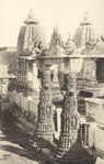 More images | |
| S-RJ-245 | Sachiya Mata Temple | Osian | Jodhpur | 26°43′34″N 72°54′45″E |  More images | |
| S-RJ-246 | Baoli (Step well known as Jalra or Jhalra) also listed as: Baori (Jalara or Jhalara)[4] |
Osian | Jodhpur | 26°43′25″N 72°54′41″E | Upload Photo | |
| S-RJ-247 | Heroes Hall "Veero Ki Dalan" | Mandore | Jodhpur | 26°21′08″N 73°01′58″E | Upload Photo | |
| S-RJ-248 | Cenotaph of Rao Mal Deva | Mandore | Jodhpur | 26°21′09″N 73°02′07″E |  | |
| S-RJ-249 | Cenotaph of Motaraja Udai Singh | Mandore | Jodhpur | 26°21′09″N 73°02′07″E | Upload Photo | |
| S-RJ-250 | Cenotaph of Sawai Raja Sur Singh | Mandore | Jodhpur | 26°21′09″N 73°02′07″E | Upload Photo | |
| S-RJ-251 | Cenotaph of Raja Gaj Singh | Mandore | Jodhpur | 26°21′09″N 73°02′07″E | Upload Photo | |
| S-RJ-252 | Cenotaph of Maharaja Jaswant Singh-I | Mandore | Jodhpur | 26°18′15″N 73°01′31″E |  | |
| S-RJ-253 | Cenotaph of Maharaj Ajeet Singh | Mandore | Jodhpur | 26°21′09″N 73°02′07″E | Upload Photo | |
| S-RJ-254 | Cenotaphes at Panch Kunda | Panch Kunda, Mandore | Jodhpur | 26°21′27″N 73°01′43″E |  More images | |
| S-RJ-255 | Kakku Deval and Kirti Stambha | Ghatiyala | Jodhpur | Upload Photo | ||
| S-RJ-256 | Sculpture of Tokeshwara Maharaja | Mandore | Jodhpur | Upload Photo | ||
| S-RJ-257 | Ravana ki Chanwari | Mandore | Jodhpur | 26°21′08″N 73°02′33″E |  More images | |
| S-RJ-258 | City wall Jodhpur | Jodhpur | Jodhpur | 26°18′21″N 73°01′48″E | Upload Photo | |
| S-RJ-259 | Shiv Mandir, Lamba | Bilara | Jodhpur | 26°12′04″N 73°33′28″E | Upload Photo | |
| S-RJ-260 | Vishnu & Shiv Mandir, Buchakala | Bilara | Jodhpur | 26°20′54″N 73°27′17″E | Upload Photo | |
| S-RJ-261 | Prachin, Mandir, Gangana | Jodhpur | Jodhpur | Upload Photo | ||
| S-RJ-262 | Prachin Mahal, Sursagar | Jodhpur | Jodhpur | Upload Photo | ||
| S-RJ-263 | Durg Phalodi | Phalodi | Jodhpur | 27°08′01″N 72°21′36″E | Upload Photo | |
| S-RJ-264 | Zanana Mahal | Mandore | Jodhpur | 26°21′11″N 73°01′58″E | Upload Photo | |
| S-RJ-265 | Harsh ka Deval (Shiv Temple) | Varna (Bilara) | Jodhpur | 26°09′19″N 73°45′14″E | Upload Photo | |
| S-RJ-266 | Prachin Shiv Temple Baori, Bhopalgarh | Bhopalgarh | Jodhpur | 26°37′04″N 73°11′08″E | Upload Photo | |
| S-RJ-267 | Prachin Shivalay, Bhundana | Bhopalgarh | Jodhpur | 26°29′42″N 73°30′17″E | Upload Photo | |
| District-Jhunjhunu | Upload Photo | |||||
| S-RJ-268 | Fort, with fortified including all structures | Khetri | Jhunjhunu | 27°59′31″N 75°46′20″E | Upload Photo | |
| S-RJ-269 | Fatehvilas Mahal, with fortified including all
structures |
Khetri | Jhunjhunu | 27°59′38″N 75°46′28″E | Upload Photo | |
| S-RJ-270 | Panna Lal Shah Talab, with fortified including all
structures |
Khetri | Jhunjhunu | 27°59′58″N 75°46′52″E | Upload Photo | |
| S-RJ-271 | Temple of Raghunath Ji, with fortified including all
structures |
Khetri | Jhunjhunu | 27°59′59″N 75°46′55″E | Upload Photo | |
| S-RJ-272 | Temple of Madan Mohan Ji, with fortified including
all structures |
Khetri | Jhunjhunu | 28°00′03″N 75°47′07″E | Upload Photo | |
| District-Karoli | Upload Photo | |||||
| S-RJ-273 | Timangarh Fort | Karoli | Karoli | 26°42′16″N 77°15′35″E |  More images | |
| S-RJ-274 | Shahi Kund | Karoli | Karoli | 26°29′35″N 77°01′59″E | More images | |
| S-RJ-275 | Tomb of Kabirshah | Karoli | Karoli | 26°29′52″N 77°01′23″E | More images | |
| District-Kota | Upload Photo | |||||
| S-RJ-276 | Brij Vilas Bhawan | Kota | Kota | 25°11′08″N 75°51′16″E | Upload Photo | |
| S-RJ-277 | Kishor Sagar and Jag Mandir | Kota | Kota | 25°10′59″N 75°50′58″E |  | |
| S-RJ-278 | Kabren of Kesar Khan and Dokar Khan | Kota | Kota | 25°11′16″N 75°50′47″E | Upload Photo | |
| S-RJ-279 | Shiv Temple | Haripura | Kota | 25°25′47″N 76°33′35″E | Upload Photo | |
| S-RJ-280 | Sun Temple | Budhadeet | Kota | 25°23′30″N 76°14′34″E |  | |
| S-RJ-281 | Badri Nath and Parshva Nath Temples group | Auwa | Kota | 24°55′48″N 76°05′57″E | Upload Photo | |
| S-RJ-282 | Cave Paintings and Rock Paintings | Alaniya | Kota | Upload Photo | ||
| S-RJ-283 | Temple group | Kanwas | Kota | Upload Photo | ||
| S-RJ-284 | The Fortification wall | Darrah | Kota | 24°48′55″N 75°59′11″E | Upload Photo | |
| S-RJ-285 | Gaipar Nath | Rata Kankara | Kota | 25°03′35″N 75°43′15″E |  | |
| S-RJ-286 | Shiv Math Mandir | Chandresal | Kota | 25°12′55″N 75°56′50″E | Upload Photo | |
| S-RJ-287 | Group of Temple | Manas | Kota | 25°13′40″N 75°59′26″E | Upload Photo | |
| S-RJ-288 | Ancient Shiv Temple | Bargu Sangod | Kota | Upload Photo | ||
| S-RJ-289 | Group of temples | Thoonpur | Kota | Upload Photo | ||
| District-Nagaur | Upload Photo | |||||
| S-RJ-290 | Fort | Nagaur | Nagaur | 27°11′57″N 73°44′15″E | .JPG) | |
| S-RJ-291 | Tarkin/Buland Darwaja | Nagaur | Nagaur | 27°12′21″N 73°44′29″E | Upload Photo | |
| S-RJ-292 | Cenotaph of Amar Singh | Nagaur | Nagaur | 27°11′48″N 73°43′40″E |  | |
| S-RJ-293 | Akabari Maszid | Nagaur | Nagaur | 27°12′04″N 73°44′32″E | Upload Photo | |
| S-RJ-294 | Malkot Fort | Merta city | Nagaur | 26°38′11″N 74°01′52″E | Upload Photo | |
| S-RJ-295 | Shiv Temple | Kekind | Nagaur | 26°27′05″N 74°05′19″E | Upload Photo | |
| S-RJ-296 | Baori and Sculptures | Choti Khatu | Nagaur | 27°09′17″N 74°21′01″E | Upload Photo | |
| S-RJ-297 | Shiv Temple | Thanwala | Nagaur | 26°33′30″N 74°27′55″E | Upload Photo | |
| S-RJ-298 | Mandir-Maszid | Ladnun | Nagaur | 27°07′36″N 74°18′45″E | Upload Photo | |
| S-RJ-299 | Dadhi Mati Mata Temple | Goth Manglod,Nagaur | Nagaur | 27°14′14″N 74°04′32″E | Upload Photo | |
| S-RJ-300 | Appaji Sindhiya ki chhatri | Tausor, Nagaur | Nagaur | 27°08′54″N 73°43′48″E | Upload Photo | |
| S-RJ-301 | Devi Mandir, Khundala | Khinvsor | Nagaur | 26°52′37″N 73°20′01″E | Upload Photo | |
| S-RJ-302 | Chhatriyan Tantvas | Khinvsor | Nagaur | Upload Photo | ||
| S-RJ-303 | Meera Mahal | Merta City | Nagaur | 26°39′18″N 74°02′27″E | Upload Photo | |
| S-RJ-304 | Rao Dudagarh | Merta City | Nagaur | 26°38′53″N 74°01′57″E | Upload Photo | |
| S-RJ-305 | Pada Mata Mandir, Gram Balia | Didvana | Nagaur | 27°21′37″N 74°34′01″E | Upload Photo | |
| S-RJ-306 | Nathon ka Math, Gram Badali | Nagaur | Nagaur | 27°12′40″N 73°44′40″E | Upload Photo | |
| S-RJ-307 | Sham Maszid | Nagaur | Nagaur | 27°11′50″N 73°44′39″E | Upload Photo | |
| S-RJ-308 | Akabari Maszid or Shahi Maszid | Nagaur | Nagaur | Upload Photo | ||
| District-Pali | Upload Photo | |||||
| S-RJ-309 | Makar Mandi Mata Temple | Nimaj | Pali | 26°08′04″N 74°01′25″E |  | |
| S-RJ-310 | Sun Temple | Pali | 25°06′52″N 73°28′13″E | | ||
| S-RJ-311 | Sojat Durg | Sojat City | Pali | 25°55′37″N 73°40′01″E | | |
| District-Pratapgarh | Upload Photo | |||||
| S-RJ-312 | Inscription with pillar of shung period in Brahami | Anwaleshwar | Pratapgarh | 24°00′54″N 74°51′55″E | Upload Photo | |
| District-Rajsamand | Upload Photo | |||||
| S-RJ-313 | Charbhuja Temple | Khamnor | Rajsamand | 24°55′17″N 73°43′19″E | Upload Photo | |
| S-RJ-314 | Durga Temple | Unwas | Rajsamand | 24°52′56″N 73°43′29″E | Upload Photo | |
| (S-RJ-202) Old Number | Group of Cenotaph ( Deleted from List) | Rajsamand | Upload Photo | |||
| (S-RJ-205) Old Number | Nadol ( Deleted from List) | Rajsamand | Upload Photo | |||
| District-Sirohi | Upload Photo | |||||
| S-RJ-315 | Sun Temple | Varman | Sirohi | 24°36′12″N 72°28′26″E | Upload Photo | |
| S-RJ-316 | Ancient fortification wall, Chandravati | Sirohi | Sirohi | 24°53′11″N 72°51′57″E | Upload Photo | |
| District-Sikar | Upload Photo | |||||
| S-RJ-317 | Fort of Fatehpur | Sikar | 27°59′45″N 74°57′15″E | Upload Photo | ||
| S-RJ-318 | Temple of Omal-Somal Devi Saledipur | Khandela Sri Madhopur | Sikar | Upload Photo | ||
| S-RJ-319 | Chand Singh ki Chhatri, Ganeri | Laxmangarh | Sikar | Upload Photo | ||
| District-Sawaimadhopur | Upload Photo | |||||
| S-RJ-320 | Rest House at Mora Sagar Bandh | Bamanwas | Sawaimadhopur | Upload Photo | ||
| S-RJ-321 | Rest House at Dheel Bandh | Bonli | Sawaimadhopur | Upload Photo | ||
| S-RJ-322 | Rest House at Gilai Sagar Bandh | Khandar | Sawaimadhopur | Upload Photo | ||
| District-Tonk | Upload Photo | |||||
| S-RJ-323 | Sunahari Kothi | Tonk | 26°09′38″N 75°46′57″E | Upload Photo | ||
| District-Udaipur | Upload Photo | |||||
| S-RJ-324 | Jagdish Temple | Udaipur | Udaipur | 24°34′47″N 73°41′01″E |  More images | |
| S-RJ-325 | Moti Magari ke Prasad | Udaipur | Udaipur | 24°36′01″N 73°40′47″E | Upload Photo | |
| S-RJ-326 | Gangodbhav Kund, Ahar | Ahar | Udaipur | 24°35′18″N 73°43′07″E |  More images | |
| S-RJ-327 | Shiv Temple group, Ahar | Ahar | Udaipur | 24°35′17″N 73°43′07″E | Upload Photo | |
| S-RJ-328 | Meera Temple, Ahar | Ahar | Udaipur | 24°35′14″N 73°43′04″E | Upload Photo | |
| S-RJ-329 | Cenotaph of Raja Rama Shah's Sons, Ahar | Ahar | Udaipur | 24°35′15″N 73°43′12″E | Upload Photo | |
| S-RJ-330 | Meera Temple, Kailashpuri | Kailashpuri (Eklingji) | Udaipur | 24°44′49″N 73°43′24″E | Upload Photo | |
| S-RJ-331 | Ramnath Temple and Baori | Jawar | Udaipur | 24°20′58″N 73°41′44″E | Upload Photo | |
| S-RJ-332 | Kesariya ji Temple | Dhooleva | Udaipur | 24°04′36″N 73°41′22″E | Upload Photo | |
| S-RJ-333 | Ambika Mata Temple | Jagat | Udaipur | 24°22′46″N 73°53′18″E | Upload Photo | |
| S-RJ-334 | Sun Temple | Toos | Udaipur | 24°36′59″N 73°54′37″E | Upload Photo | |
| S-RJ-335 | Vishnu Temple | Iswal | Udaipur | 24°44′32″N 73°38′56″E | Upload Photo | |
| S-RJ-336 | Temple | Kathadavana | Udaipur | Upload Photo | ||
| S-RJ-337 | Shiv Temple | Paladi | Udaipur | Upload Photo | ||
| S-RJ-338 | Temple of Tripurusha Deva | Ghasa | Udaipur | Upload Photo | ||
| S-RJ-339 | Sun Temple | Nandesama | Udaipur | 24°49′52″N 73°27′54″E | Upload Photo | |
| S-RJ-340 | Shiv Temple | Amarakji | Udaipur | 24°40′07″N 73°43′37″E | Upload Photo | |
| S-RJ-341 | Pratimaon Ka Chabutra (Mataji Ka Than) | Tanesar | Udaipur | 24°13′07″N 73°42′49″E | Upload Photo | |
| S-RJ-342 | Sajjangarh or Monsoon Palace | Udaipur | Udaipur | 24°35′35″N 73°38′23″E | Upload Photo |
Close
Remove ads
See also
References
Wikiwand - on
Seamless Wikipedia browsing. On steroids.
Remove ads
Remove ads