Top Qs
Timeline
Chat
Perspective
Lojing
Autonomous sub-district of Gua Musang District in Kelantan, Malaysia From Wikipedia, the free encyclopedia
Remove ads
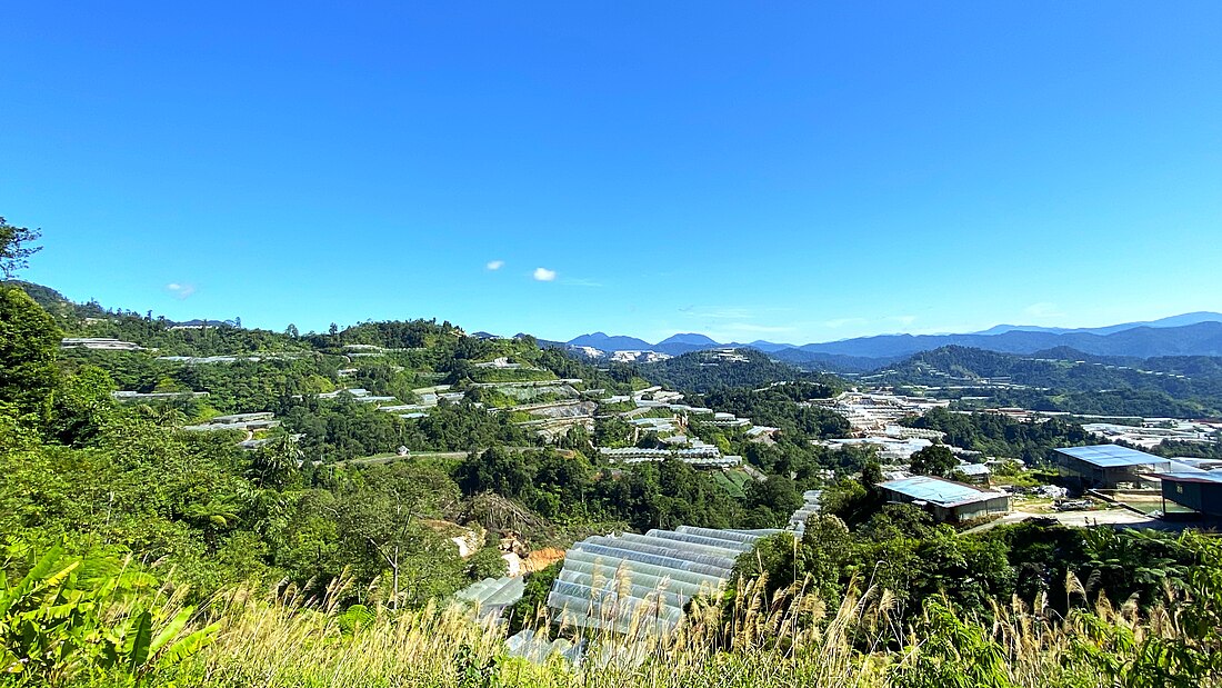
The Lojing Autonomous Sub-District (Malay: Jajahan Kecil Lojing), or colloquially known as the Lojing Highlands (Malay: Tanah Tinggj Lojing) is a mountainous region in Gua Musang District, Kelantan, Malaysia. It is located next to the famed Cameron Highlands in Pahang, along the Second East-West Highway Federal Route 185.
Remove ads
Administration

In 2010 Lojing was made an autonomous sub-district (Jajahan Kecil Lojing). Several state and federal agencies will open their branches there following the arrangement; municipal works remain under the responsibility of Gua Musang. It is divided into seven communes:
- Balar
- Blau
- Hau
- Hendrop
- Kuala Betis
- Sigar
- Tuel
Geography and demographics

Perched up high on the intersection between the Kelantanese, Pahangese and Perakian Titiwangsa, Lojing Highlands is rich in flora and fauna and is famed for its biodiversity. Its well preserved pristine hills and jungles are popular eco-tourist attraction. There are many species of high-quality tropical hardwood such as teak, mahogany, chengal and meranti located in the jungles of the Lojing Highlands. Lojing is home to the 2,181-metre-tall Yong Belar, the tallest mountain in Kelantan and third tallest in Peninsular Malaysia.
Most of the people that live in the Lojing area belong to the indigenous Orang Asli tribes, mainly the Temiar tribe of the Senoi nations.[2]
Remove ads
References
Wikiwand - on
Seamless Wikipedia browsing. On steroids.
Remove ads


