Top Qs
Timeline
Chat
Perspective
Lyutenge
River in Russia From Wikipedia, the free encyclopedia
Remove ads
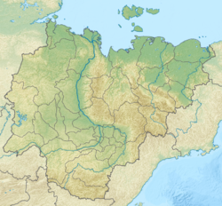
The Lyutenge (Russian: Лютенге; Yakut: Лүүтэҥкэ, Lüüteŋke, obsolete "Люютэнкэ") is a river in the Sakha Republic, Russia. It is a right tributary of the Lena and has a length of 140 km (87 mi).[1]
There are unusual rock formations by the river, the Turuuk Khaya Rocks, a protected area.[2]
Remove ads
Course
The river begins in the Byldanyany Lake, a small lake with a surface of 1 square kilometre (0.39 sq mi) located in the Lena Plateau.[3] Its upper course is in the southern part of Khangalassky District close to the A360 Lena Highway, not far from Aldan District.[4] It flows roughly southeastwards. The Lyutenge meets the right bank of the Lena by Kerdyom village, opposite the town of Pokrovsk and 1,577 km (980 mi) from the Lena's mouth.[5]
The Lyutenge River freezes between October and May. The main tributaries of the Lyutenge are the Kuon Kachah, Berdigasteheh, Kedige (Ulakhan-Kuudaly), Kuraanakh, Eselaheh and Kuuduman.[4]
 |
 |
Remove ads
See also
References
External links
Wikiwand - on
Seamless Wikipedia browsing. On steroids.
Remove ads


