Top Qs
Timeline
Chat
Perspective
Magaramkentsky District
District in Republic of Dagestan, Russia From Wikipedia, the free encyclopedia
Remove ads
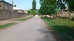
Magaramkentsky District (Russian: Магарамкентский райо́н; Lezgian: Мегьарамдхуьруьн район) is an administrative[1] and municipal[5] district (raion), one of the forty-one in the Republic of Dagestan, Russia. It is located in the southeast of the republic. The area of the district is 654.6 square kilometers (252.7 sq mi).[2] Its administrative center is the rural locality (a selo) of Magaramkent.[1] As of the 2010 Census, the total population of the district was 62,195, with the population of Magaramkent accounting for 11.2% of that number.[3]
Remove ads
Administrative and municipal status
Within the framework of administrative divisions, Magaramkentsky District is one of the forty-one in the Republic of Dagestan.[1] The district is divided into eight selsoviets which comprise thirty-three rural localities.[4] As a municipal division, the district is incorporated as Magaramkentsky Municipal District.[5] Its eight selsoviets are incorporated as twenty-two rural settlements within the municipal district.[5] The selo of Magaramkent serves as the administrative center of both the administrative[1] and municipal[10] district.
Remove ads
Settlements
Abandoned settlements
References
Wikiwand - on
Seamless Wikipedia browsing. On steroids.
Remove ads


