Top Qs
Timeline
Chat
Perspective
Mahanad
Village in West Bengal, India From Wikipedia, the free encyclopedia
Remove ads
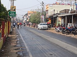
Mahanad is a gram panchayat, or village, in Polba-Dadpur, a Community development block in Chinsurah subdivision of Hooghly district in the Indian state of West Bengal.[1][2][3]
Remove ads
Geography

8km
5miles
5miles
R
Dwarhatta
R
Hooghly
River
River
R
Haripal
R
Barun Napara
R
Dadpur
R
Polba
R
Gurap
R
Dhaniakhali
CT
Borai
CT
Baruipara
CT
Jagatnagar
CT
Nasibpur
CT
Singur
CT
Balarambati
CT
Bargachhia
M
Tarakeswar
M
Champdani
M
Bhadreswar
M
Chandannagar
Cities and towns in the Chandannagore subdivision and Polba Dadpur and Dhaniakhali CD Blocks of Chinsurah subdivision in Hooghly district
M: municipal corporation/ municipal city/ town, CT: census town, R: rural/ urban centre,
Owing to space constraints in the small map, the actual locations in a larger map may vary slightly
M: municipal corporation/ municipal city/ town, CT: census town, R: rural/ urban centre,
Owing to space constraints in the small map, the actual locations in a larger map may vary slightly
Remove ads
History
Archaeological Survey of India (ASI) has found many historic artifacts dating from the Gupta Era in Mahanad. An ancient Shiva temple in Mahanad is called Jateswer Shiv Temple. Mahand has been the yogpeeth (yoga retreat) of Nath Yogis, for thousands of years.[4][5]
Mahanad has an excavated site revealing a historic Kushan presence. The exploration conducted by ASI and Paresh Pal, a local antiquarian, have led to the discovery of coins of the Kushan and Gupta dynasties and terracotta, mostly of Gupta style.[6]
Remove ads
Location
Mahanad is located at 23.00°N 88.26°E.[7] It has an average elevation of 15 metres above sea level. Mahanad is located around 19 kilometer away from its district headquarters, Hugli-Chuchura. The nearest railway station is Pandua in the Howrah-Bardhaman main line around 7 km away.[8]
Gallery
- Brohmomoyee kali maa
- Mahanad Jora Shiva Temple
- Mahanad Jateswar Shiv temple complex
- Ruins of Mahanad Rajbari at Mahanad
- Brohmomoyee Kali Temple front view
- Brohmomoyee Kali mandir, backside view
References
Wikiwand - on
Seamless Wikipedia browsing. On steroids.
Remove ads


