Top Qs
Timeline
Chat
Perspective
Masurian Lake District
Place in Poland From Wikipedia, the free encyclopedia
Remove ads
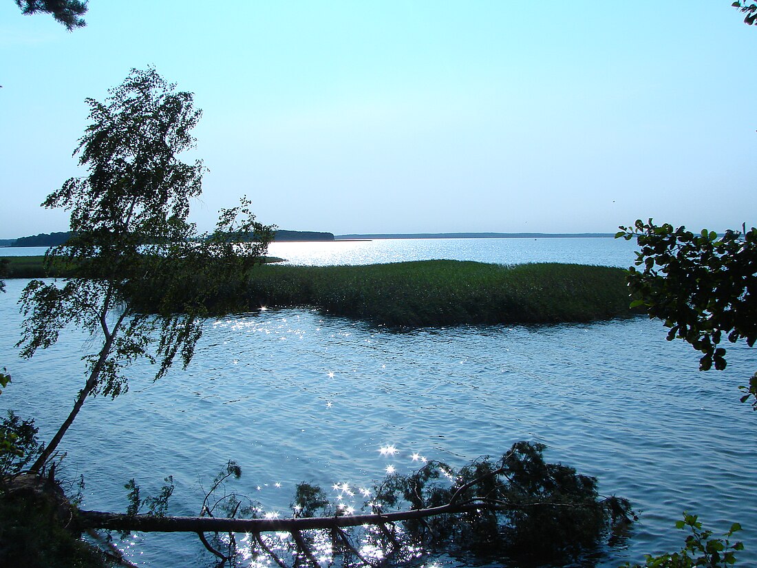
The Masurian Lake District or Masurian Lake Land (Polish: Pojezierze Mazurskie) is a lake district in northeastern Poland within the geographical region of Masuria, in the past inhabited by Masurians who spoke the Masurian dialects. It contains more than 2,000 lakes. The district had been elected as one of the 28 finalists of the New 7 Wonders of Nature.
The Lakeland extends roughly 290 km (180 mi) eastwards from the lower Vistula to the Poland–Russia border, and occupies an area of roughly 52,000 square kilometres (20,000 sq mi). Administratively, the Lake District lies within the Warmian-Masurian Voivodeship. Small parts of the district lie within the Masovian and Podlaskie Voivodeships.[1]
The lakes are well connected by rivers and canals, forming an extensive system of waterways. The 18th-century Masurian Canal links this system to the Baltic Sea. The whole area is a prime tourist destination, frequented by boating enthusiasts, canoeists, anglers, hikers, bikers and nature-lovers. It is one of the most famous lake districts in Central Europe and a popular vacation spot, with a high number of visitors every year.[1]
Remove ads
Geology
Summarize
Perspective
The lake district was shaped by glaciers during the Pleistocene ice age. Many of its hills are parts of moraines and many of its lakes are moraine-dammed lakes.
Many of the area’s hills and ridges are composed of ancient volcanic and sedimentary rocks, but their current forms were sculpted by glacial erosion. Moraines—accumulations of rock and debris left behind by retreating glaciers—are common throughout the region and are responsible for much of the Lake District’s rolling terrain. These glacial deposits often blocked valley outlets, forming moraine-dammed lakes, which now characterize the region.
Notable geological features include hanging valleys, cirques (or corries), drumlins, and roche moutonnées, all indicative of intense glacial modification. The geology also varies across the region, with harder rocks like Borrowdale volcanic group rocks in the central fells resisting erosion and forming rugged peaks, while softer sedimentary rocks in outer areas resulted in gentler landscapes.
Today, this glacially sculpted terrain not only defines the Lake District’s natural beauty but also contributes to its hydrology, soil composition, and ecological diversity.[2]
Remove ads
History
Summarize
Perspective
From the 13th century on, the Lakeland was successively part of the monastic state of the Teutonic Knights, the Duchy of Prussia, and the Prussian province of East Prussia. In modern times, while part of the German Empire, it was the location of the First Battle of the Masurian Lakes (1914) and the Second Battle of the Masurian Lakes (1915) during World War I. At the end of World War II (1945) this region fell into the Soviet Union's Zone of Occupation. Stalin arbitrarily placed this zone (excluding the Kaliningrad enclave) under communist Polish administration[3] and its German residents were then brutally expelled, all their properties confiscated.[4]
Historical population
Mother tongue of the inhabitants of Masuria, by county, during the first half of the 19th century:
Remove ads
Climate
Masuria has a temperate climate with cold winters and warm summers.[citation needed]
See also
References
External links
Wikiwand - on
Seamless Wikipedia browsing. On steroids.
Remove ads


