Top Qs
Timeline
Chat
Perspective
Mount Maines
Mountain in Enderby Land, Antarctica From Wikipedia, the free encyclopedia
Remove ads
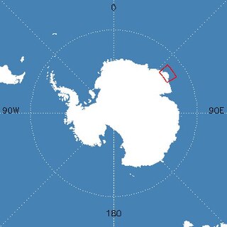
Mount Maines, also known as Stornuten, is a mountain, 2,190 metres (7,190 ft), standing roughly 13 kilometres (8.1 mi) SE of Stor Hånakken Mountain and 10 kilometres (6.2 mi) W of Mount Elkins in the Napier Mountains, Enderby Land.[1]
Remove ads
Discovery and naming
Mount Maines was mapped by Norwegian cartographers from air photos taken by the Lars Christensen Expedition, 1936–37, and named Stornuten (the big peak). Rephotographed by ANARE in 1956 and renamed by ANCA for R.L. Maines, cook at Wilkes Station in 1961.[1]
See also
References
External links
Wikiwand - on
Seamless Wikipedia browsing. On steroids.
Remove ads


