Top Qs
Timeline
Chat
Perspective
Neighbourhoods in Brussels
From Wikipedia, the free encyclopedia
Remove ads
There are several neighbourhoods in Brussels, Belgium. Their names and borders are not officially defined, and they might vary occasionally. The districts listed by the Brussels-Capital Region have a statistical purpose,[1] and therefore do not always correspond to the historic municipal districts. In addition, their borders are not necessarily identical according to regional or municipal sources, and may thus overlap.
Remove ads
City of Brussels
Summarize
Perspective
Pentagon

Central Quarter
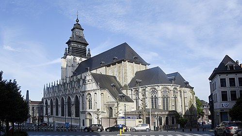
The origins of Brussels can be traced back to the heart of Saint-Géry/Sint-Goriks Island, formed by the river Senne, on which a first keep was built around 979. Nowadays, the neighbourhood around the Halles Saint-Géry/Sint-Gorikshallen, a former covered market, is one of the capital's trendiest districts.[2] In this Central Quarter (French: Quartier du Centre, Dutch: Centrumwijk), there are some vestiges of the 13th-century first walls of Brussels, which encompassed the area between the first port on the Senne, the old Romanesque church (later replaced by the Brabantine Gothic Cathedral of St. Michael and St. Gudula),[3] and the former ducal palace of Coudenberg in today's Royal Quarter. At the centre of this triangle are the Grand-Place/Grote Markt (Brussels' main square);[4] the Îlot Sacré district, which takes its name from its resistance to demolition projects, itself crossed by the Royal Saint-Hubert Galleries;[5] the Saint-Jacques/Sint-Jacobs district, which welcomed pilgrims on their way to Santiago de Compostela; as well as the former Brussels Stock Exchange building, erected on the site of a former Franciscan convent whose remains have been unearthed.[6][7]


_St._Michael_&_St._Gudula_Cathedral_Tower,_Brussels.jpg)


Royal Quarter
The Royal Quarter (French: Quartier Royal or Quartier de la Cour, Dutch: Koninklijke Wijk or Koningswijk) is so named because it houses, on the one hand, the Place Royale/Koningsplein ("Royal Square" or "King's Square"), built under Charles-Alexander of Lorraine on the Coudenberg hill, on the site of the former Palace of the Dukes of Brabant, of which certain levels of foundation still exist,[8] and on the other hand, the Royal Palace of Brussels,[9] which faces Brussels Park,[10][11] on the other side of which is the Belgian House of Parliament (Palace of the Nation).[12] Below the Royal District is Brussels-Central railway station and the Mont des Arts/Kunstberg,[13] home to the Royal Library of Belgium (KBR),[14] the Royal Belgian Film Archive (Cinematek), the Brussels Centre for Fine Arts,[15] the Museum of Cinema, the Musical Instruments Museum (MIM),[16] the BELvue Museum, and the Oldmasters Museum.[17]

 Place du Musée/Museumplein


.jpg)
Sablon/Zavel
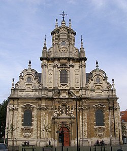
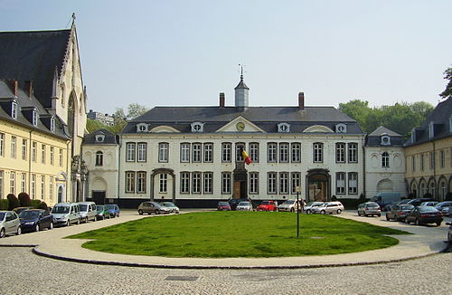
From the Place Royale/Koningsplein, the Rue de la Régence/Regentschapsstraat crosses the Sablon/Zavel Quarter (French: Quartier des Sablons, Dutch: Zavelwijk),[18] made of the larger Grand Sablon/Grote Zavel ("Large Sablon") square in the north-west[19] and the smaller Petit Sablon/Kleine Zavel ("Small Sablon") square and garden in the south-east,[20] divided by the Church of Our Lady of Victories at the Sablon.[21] It is a swanky district, where an antiques market is held, and in which antique and art dealers, as well as other luxury shops, have their businesses. Not far from there stood the Art Nouveau Maison du Peuple/Volkshuis by the famous architect Victor Horta, until its demolition in 1965. The Sablon is also home to the Egmont Palace[22] and the Royal Conservatory of Brussels.[23]

 Fountain of Minerva
 Fountain of the Counts of Egmont and Horn


Marolles/Marollen
In the shadow of the gigantic Palace of Justice lies the Marolles/Marollen Quarter (French: Quartier des Marolles, Dutch: Marollenwijk, not to be confused with the Marolle that purists delimit to only seven streets).[24] From the Place de la Chapelle/Kapellemarkt[25] to the Place du Jeu de Balle/Vossenplein, where a daily flea market known as the Old Market has been held since 1873,[26] along the Rue Haute/Hogestraat and the Rue Blaes/Blaestraat, second-hand and popular shops have for some years given way to antique dealers, marking a profound transformation of the district.[27][28] The Cité Hellemans, a remarkable example of an early 20th-century collective housing complex, was built to replace the neighbourhood's many squalid cul-de-sacs.[29] The Rue Haute, one of the city's longest and oldest streets, follows the course of an old Gallo-Roman road,[27] and runs along Saint Peter's Hospital, built in 1935 on the site of a leprosium,[30] to end at the Halle Gate, the only remaining gate in a series that allowed passage inside the second walls of Brussels.[31]


 Place du Jeu de Balle/Vossenplein, end of a market
 Cité Hellemans on the Rue Blaes/Blaesstraat


Midi–Lemonnier Quarter (Stalingrad)
It was in the heart of the Midi–Lemonnier Quarter (French: Quartier Midi–Lemonnier, Dutch: Lemmonier–Zuidwijk), where the Place Rouppe/Rouppeplein is today, that Brussels' first South Station, the terminus of the South Line, was built in 1839. It was known as Bogards' railway station for the eponymous convent whose site it was built on, and to which the Rue des Bogards/Bogaardenstraat is now the only reference.[32][33] The former presence of a station at this location also explains the unusual width of the current Avenue de Stalingrad/Stalingradlaan, which goes from the square to the Small Ring, cleared of its train tracks since the inauguration of Brussels-South railway station, built outside the Pentagon in 1869.[32][34] Because of this, the neighbourhood is sometimes called the Stalingrad Quarter (French: Quartier Stalingrad, Dutch: Stalingradwijk). At the same time, following the covering of the Senne, the district saw the construction of Haussmann-esque grand central boulevards, including the Boulevard Maurice Lemonnier/Maurice Lemonnierlaan,[35] bordered by the Place Fontainas/Fontainasplein[36] and the Place Anneessens/Anneessensplein (former location of the Old Market),[37] as well as by the Midi Palace.[38] Each Sunday morning, the Midi district hosts the second largest market in Europe.

 Place Anneessens/Anneessensplein (François Anneessens) and Haute École Francisco Ferrer
 Midi Palace on the Boulevard Maurice Lemonnier/Maurice Lemonnierlaan


Senne/Zenne Quarter (Dansaert)
The damp and marshy land around the present-day Rue de la Senne/Zennestraat and Rue des Fabriques/Fabriekstraat was occupied by craftsmen since the Middle Ages.[39][40] An arm of the river crossed the defences of the second walls at the level of the Ninove Gate via the Petite Écluse/Kleine Sluis ("Small Lock"), which served as a maritime gate, an end of which remaining there until the 1960s. Later, small industries and many artisan breweries (now disappeared) established themselves in the area, as evidenced by the names of the Rue du Houblon/Hopstraat ("Hops Street")[41] and the Rue du Vieux Marché aux Grains/Oude Graanmarktstraat ("Old Grain Market Street").[42] The Shot Tower (French: Tour à Plomb, Dutch: Loodtoren), which was used to manufacture lead shot for hunting,[43] and the Rue de la Poudrière/Kruitmolenstraat ("Gunpowder Street"),[44] also testify to the neighbourhood's former activities. Long neglected following the relocation of businesses outside the city centre, the Senne/Zenne Quarter (French: Quartier de la Senne, Dutch: Zennewijk) has in recent years been the object of renewed interest and is undergoing gentrification due to the many disused industrial premises being converted into lofts. The area around the Rue Antoine Dansaert/Antoine Dansaertstraat has become a trendy district and is attracting a younger, more well-off, and mostly Dutch-speaking population.[45] This new situation, which has resulted in rising rents, is not without problems for the neighbourhood's less fortunate inhabitants.
 Rue Antoine Dansaert/Antoine Dansaertstraat
 Place du Jardin aux Fleurs/Bloemenhofplein
 Industrial building transformed into housing (loft)


Quays Quarter (Sainte-Catherine/Sint-Katelijne)
The Quays Quarter (French: Quartier des Quais, Dutch: Kaaienwijk) is that of the old Port of Brussels, which for a long time played the role of "belly" of the city. Boats coming from the river Scheldt entered through the former Shore Gate (French: Porte du Rivage, Dutch: Oeverpoort), on the site of the present-day Place de l'Yser/Ijzerplein, to join one of the canals, whose docks were each reserved for one type of goods.[46] Filled in the late 19th century with the opening of Brussels' new port, these basins were replaced by wide boulevards, whose names on both sides still recall their former function: the Quai aux Briques/Baksteenkaai ("Brick Wharf"),[47] the Quai au Bois à Brûler/Brandhoutkaai ("Firewood Wharf"),[48] the Quai aux Pierres de Taille/Arduinkaai ("Quarry Stone Wharf"),[49] the Quai au Foin/Hooikaai ("Hay Wharf"),[50] etc., or references to the neighbourhood's commercial activities: the Rue du Magasin/Pakhuisstraat ("Warehouse Street"),[51] the Rue des Commerçants/Koopliedenstraat ("Traders Street"),[52] the Rue du Marché aux Porcs/Varkensmarktstraat ("Pig Market Street")[53] and the Quai du Commerce/Handelskaai ("Trade Wharf").[54] Along the quaysides, numerous bourgeois houses, once belonging to wealthy merchants, have preserved the entrances to the warehouses. On the Boulevard d'Ypres/Ieperlaan, one can still cross food wholesalers, now supplied by trucks that have replaced the boats.[55] The district also includes the Great Beguinage of Brussels, with the Church of St. John the Baptist[56] and the remarkable Grand Hospice Pachéco.[57]


 La Bellone
.jpg)


Marais–Jacqmain Quarter
Few of the buildings in the Marais–Jacqmain Quarter (French: Quartier Marais–Jacqmain, Dutch: Jacqmain–Broekwijk) have escaped 20th-century demolition, from the Boulevard Pachéco/Pachecolaan[58] to the Rue Neuve/Nieuwstraat.[59] They have given way to the State Administrative Centre, press printers, banking facilities, and commercial galleries. The current trend is to restore the neighbourhood's social mix by redeveloping former office buildings into housing. Despite the district's long-time grim aspect, the centuries-old Meyboom tradition has been maintained, and the former Art Nouveau Magasins Waucquez by Victor Horta have been preserved to house, since 1989, the Belgian Comic Strip Center.[60] Another preserved islet is the 18th-century neoclassical Place des Martyrs/Martelaarsplein, which has gradually been renovated.[61] The victims of the Belgian Revolution of 1830 are buried there in an open crypt with a memorial. Nearby is the Rue Neuve, one of Belgium's main shopping streets, with more than 1 km (0.62 mi) of stores on both its sides;[59] the Boulevard Adolphe Max/Adolphe Maxlaan, a traditional 19th-century artery;[62] and the Boulevard Émile Jacqmain/Émile Jacqmainlaan (where the Théâtre national Wallonie-Bruxelles has been installed since 2004),[63] close to the Place de Brouckère/De Brouckèreplein. The latter, a very busy square, is dominated at its southern end by two block-style towers, but for the rest, it has totally (Hotel Métropole and its neighbour the Hotel Atlanta) or partially (UGC cinema) retained its old facades.[64][65][66]


Freedom Quarter
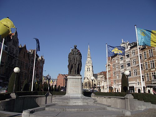
The Freedom Quarter (French: Quartier des Libertés, Dutch: Vrijheidswijk) is situated between the Belgian Parliament and the Rue Royale/Koningsstraat, not far from the crossroads with the Small Ring. Its focal point is the Congress Column (erected in memory of the National Congress of 1830–31, the founder of democratic liberties in Belgium), under which also lies the tomb of the Unknown Soldier with an eternal flame.[67] Not far from there is the Hotel Astoria, dating from 1911, which is currently being renovated and enlarged, to be reopened in the coming years.[68] Until the 19th century, the district was known as Notre-Dame-aux-Neiges/Onze-Lieve-Vrouw-ter-Sneeuw and was predominantly inhabited by working-class people.[69] The authorities' desire to clean up the squalid parts of the city led to the expulsion of the population and the neighbourhood's complete destruction.[70] A new bourgeois district was developed during the last quarter of the century.[71] The choice was made to commemorate Belgian independence: the Place de la Liberté/Vrijheidsplein ("Liberty Square"),[72] the Place des Barricades/Barricadenplein ("Barricades' Square"),[73] the Rue de la Révolution/Revolutiestraat ("Revolution Street"),[74] the Rue du Congrès/Congresstraat ("Congress Street"), etc.[75] The four streets leading off the Place de la Liberté bear the names of the four constitutional liberties, symbolised by four allegorical bronze female sculptures surrounding the Congress Column: Freedom of the Press, Worship, Association and Education.[67] This eclectic urban complex is one of the best preserved in the Pentagon.[76]
 Congress Column (Leopold I, 1859)


.jpg)


Eastern Quarters
European Quarter and Leopold Quarter
The European Quarter (French: Quartier Européen, Dutch: Europese Wijk) is located to the east of the Pentagon, around the Place du Luxembourg/Luxemburgplein and the Robert Schuman Roundabout, and includes the smaller Leopold Quarter (French: Quartier Léopold, Dutch: Leopoldswijk). The European Parliament was built near the Place du Luxembourg, on the site of the former Leopold Quarter railway station, and of which only the central building overlooking the square remains, having been replaced by the underground Brussels-Luxembourg railway station. The European Commission, housed in the Berlaymont building, is located on the Schuman Roundabout, not far from the Cinquantenaire Park. Across the street stands the Justus Lipsius building and the Europa building (part of the Residence Palace), serving as the seat of the European Council and the Council of the EU. In Leopold Park, the House of European History (HEH) initiates visitors to the social history of the European continent. There is a visitor centre in the main European Parliament building, known as the Parliamentarium, and another smaller one in the Justus Lipsius building for the European Council. It is accessible on certain days, by appointment. Many of the attractions in the European Quarter are free to visit.


 Espace Léopold buildings (European Parliament)


.jpg)


Squares Quarter
The Squares Quarter (French: Quartier des Squares, Dutch: Squareswijk) is the northern spur of the European Quarter, located between Saint-Josse-ten-Noode and the Leopold Quarter. The district is bounded by the Chaussée de Louvain/Leuvense Steenweg to the north, the Rue du Noyer/Notelaarsstraat and the Avenue de Cortenbergh/Kortenberglaan to the east, the Rue Joseph II/Jozef II-straat and the Rue Stevin/Stevinstraat to the south, as well as the Small Ring to the west. The toponym refers to the many squares in the area, in particular the Square Ambiorix/Ambiorixsquare, the Square Marguerite/Margaretasquare, the Square Marie-Louise/Maria-Louizasquare and the Avenue Palmerston/Palmerstonlaan. The area between the Small Ring and the Square Marie-Louise is sometimes considered to be part of the Leopold Quarter.
 Square Marie-Louise/Maria-Louizasquare
 Avenue Palmerston/Palmerstonlaan
 Square Ambiorix/Ambiorixsquare
.jpg)
.jpg)


Northern Quarters
Laeken/Laken
Laeken is a former municipality in the north of the Brussels-Capital Region, annexed by the City of Brussels in 1921. It is home to, among others, the Royal Domain of Laeken, the Palace of Laeken, the Royal Greenhouses of Laeken, the Church of Our Lady of Laeken (whose crypt contains the tombs of the Belgian royal family) and Laeken Cemetery, known for its wealth of monuments and sculptures.
 Former Municipal Hall of Laeken


.jpg)


Heysel/Heizel
On the territory of Laeken also lies the Heysel/Heizel Plateau, the site of the World's Fairs of 1935 and 1958, and which includes the King Baudouin Stadium, Bruparck (with the Atomium, Mini-Europe miniature park and Kinepolis cinema), the Centenary Palace, home to the Brussels Exhibition Centre (Brussels Expo), and the Port of Brussels, next to which the Monument to Work by Constantin Meunier was erected.

.jpg)


Mutsaard
Sometimes also known as the Pagoda district, the Japanese Tower district or De Wand district, Mutsaard (also spelled Mutsaert) is an old hamlet and a historic district located between Laeken and Neder-over-Heembeek and centred around the Place du Mutsaert/Mutsaertplaats or Mutsaardplein. The district was part of the former municipality of Laeken (postcode: 1020), but also a piece of Neder-over-Heembeek, annexed by Laeken in 1897. It is separated from the rest of Laeken by the Royal Domain and is the site of the Museums of the Far East. The district also extends a little into the neighbouring Flemish municipalities of Vilvoorde and Grimbergen.

 Chinese Pavilion
 Fountain of Neptune
 Avenue Mutsaard/Mutsaardlaan


Verregat
Verregat is located north of the Heysel, east of the Cité Modèle, and bordering the Flemish Region to the north. The area was developed in phases between 1922 and 1926 by the architects Henri Derée and Jules Ghobert, in a style influenced by the Amsterdam School and with picturesque character, and then from 1951 to 1953 by the same Ghobert.[77]
Neder-Over-Heembeek
Neder-Over-Heembeek is a former municipality incorporated into the City of Brussels in 1921, at the same time as Laeken and Haren. It has the distinction of having the oldest place name in the Brussels-Capital Region, as it was mentioned in an ordinance as early as the 7th century.[citation needed] This is where the Queen Astrid Military Hospital, which is the National Burns and Poisons Centre, as well as recruitment services of the Belgian Armed Forces are located.
 Old Romanesque tower in Lower Heembeek
 Church of St. Nicholas in Upper Heembeek
 Buda Bridge


Haren
Like Laeken and Neder-Over-Heembeek, the former municipality of Haren was annexed by the municipality (City) of Brussels in 1921, which allowed the extension of Schaerbeek railway station north of its territory. But it was above all the presence, south-west of the town, of an airfield, created by the Germans during the First World War, and where the former Belgian national airline Sabena was born, that precipitated the annexation of Haren. For almost fifty years, Haren has been home to NATO's headquarters. It is also the location of many other administrations and companies, such as the headquarters of Eurocontrol.
 Church of St. Elizabeth
 Headquarters of NATO
 Headquarters of Eurocontrol


Northern Quarter
The Northern Quarter (French: Quartier Nord, Dutch: Noordwijk) is Brussels' central business district and consists of a concentration of high-rise buildings where many Belgian and multinational companies have their headquarters. It is comparable to La Défense in Paris or the Docklands in London. Located between the Brussels Canal, Brussels-North railway station, and the Small Ring, the area spans Saint-Josse-ten-Noode, Schaerbeek, and the City of Brussels.[78] It contains over half of Belgium's tallest buildings, 1,200,000 m2 (13,000,000 sq ft) of office space, 40,000 workers, and 8,000 residents.


 Skyline of the Northern Quarter
.jpg)


.jpg)
Tour & Taxis
Tour & Taxis is a large former industrial site situated on the embankment of the Brussels Canal, just north-west of the Pentagon, which was annexed by the City of Brussels in 1897. The location is immediately adjacent to Laeken and Molenbeek-Saint-Jean, and about 1 kilometre (0.62 miles) west from the Northern Quarter. The site is composed of large warehouses and commercial buildings at a former freight train station called the Maritime Station (French: Gare Maritime, Dutch: Maritiem Station), and its spacious central hall known as the Royal Depot (French: Entrepôt Royal, Dutch: Koninklijk Pakhuis). The main buildings on the site are made of brick, glass and wrought iron, and are prime examples of 19th-century industrial architecture. Though the site was long disused following its loss of importance as a transshipment and customs hub, it has been partially regenerated, and is now used for shops, offices, eateries, as well as for large cultural events.[79]
 Royal Depot of Tour & Taxis
 Maritime Station of Tour & Taxis
 Brussels Environment building (left) and Herman Teirlinck building (right)
 Tour & Taxis Park

.jpg)
.jpg)
.JPG)
Southern Quarters
Louise/Louiza
The Louise/Louiza district comprises the Avenue Louise/Louizalaan and its immediate surroundings. This avenue lies on the territory of the City of Brussels, except for the part called the "Louise bottleneck" (French: le goulet Louise), which is partially in the municipalities of Saint-Gilles and Ixelles, the territory of Brussels being limited to the roadway at this point.[80] It is one of the most prestigious and expensive avenues in Brussels, lined with high-end fashion stores and boutiques. It also houses many embassies and offices.

 Place Stéphanie/Stefanieplein
 Blue Tower
 King's Garden
.jpg)


Bois de la Cambre/Ter Kamerenbos
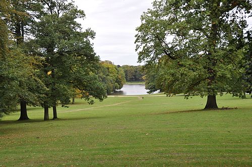
At the end of Avenue Louise lies the Bois de la Cambre/Ter Kamerenbos. This English-style park, forming a natural offshoot of the Sonian Forest, owes its name to the nearby La Cambre Abbey. At its entrance are the two neoclassical former octroi pavilions (French: pavillons d'octroi) of the Namur Gate,[81] as well as Brussels' most prestigious residential area: the Square du Bois/Bossquare.
 Chalet Robinson
 Entrance of the Square du Bois/Bossquare
 Former octroi pavilion at the entrance of the Bois de la Cambre


.jpg)

Solbosch/Solbos
The Solbosch/Solbos Plateau is located between the territory of the City of Brussels and Ixelles. In the strict sense, it concerns the north of the Boondael/Boondaal district, just east of the Bois de la Cambre and west of Ixelles Cemetery. The name is derived from 's wolfs bosch, a wood that was originally part of the Sonian Forest. The district was the site of the Brussels International Exposition of 1910, as evidenced by the Avenue des Nations/Natiënlaan (now the Avenue Franklin Roosevelt/Franklin Rooseveltlaan), and the Delune House, a former Art Nouveau café-restaurant, converted into an embassy. The Solbosch campus of the Université libre de Bruxelles (ULB), a French-speaking university, with about 20,000 students, is also situated there.

 Delune House


Remove ads
Other municipalities
Summarize
Perspective
Anderlecht
Historical centre
The historical centre of Anderlecht is the municipality's central district. Formerly known as Rinck,[82] it is divided into several sectors:
- The Saint-Guidon/Sint Guido district, also called the Vaillance/Dapperheid district, is the meeting point for those who hail to the heart of Anderlecht. It is also where the Place de la Vaillance/Dapperheidsplein (Anderlecht's central square), the Church of St. Guido, the Place de Linde/De Lindeplein, as well as Anderlecht's main schools are located. The Rue Wayez/Wayezstraat is the municipality's main shopping street. It is centred on the Place of the Resistance/Verzetsplein and some neighbouring streets.
- The smaller Aumale district in its northern part mainly comprises the Rue d'Aumale/Aumalestraat and its surrounding streets. It includes the Erasmus House (a museum devoted to the Dutch humanist writer and theologian Erasmus of Rotterdam), the old beguinage (a late medieval lay convent, now a museum dedicated to religious community life), as well as the Bibliothèque de l'Espace Maurice Carême French-language public library.

 Rue Porselein / Porseleinstraat
 Justice de Paix of Anderlecht
 Rue Wayez/Wayezstraat


.jpg)
Cureghem/Kuregem
Located in the north-east of Anderlecht,[83] Cureghem/Kuregem is one of the municipality's largest and most populated districts. It developed during the Industrial Revolution along the Brussels–Charleroi Canal and is currently in a fragile social and economic situation due to the decline of its economy and the poor quality of some of its housing. Between 1836 and 1991, the district housed the Royal School of Veterinary Medicine, now moved to Liège but often still referred to as Cureghem.[84] The old campus, listed as protected heritage,[85] is currently undergoing a large rehabilitation process.[83] Three listed buildings—the former Atlas Brewery,[86] the old power station, and the former Moulart Mill[87]—are testaments to the old industrial activities next to the waterway. The Municipal Hall of Anderlecht is located on the Place du Conseil/Raadsplein, in the heart of this district.[88][83] In its lower part, bordering the City of Brussels, are the Square de l'Aviation/Luchtvaartsquare[89] and the Parc de la Rosée/Dauwpark.[90]

 Abattoirs of Anderlecht

.jpg)


.jpg)
Meir
Located to the south of the historical centre of Anderlecht, this district is centred on the Meir Roundabout and Astrid Park, where the football club R.S.C. Anderlecht plays its home matches in the Constant Vanden Stock Stadium. Planned shortly before the First World War, the development of this residential neighbourhood took place mainly between the two world wars. Aimed at the middle class, it forms an extremely coherent and well-preserved architectural ensemble where the Art Deco style predominates.[91]
 Meir Roundabout
 Maurice Carême Museum
 Avenue Paul Janson/Paul Jansonlaan


.jpg)
.jpg)

Veeweyde/Veeweide
Veeweyde/Veeweide is centrally located in the upper part of Anderlecht, south of the Meir district. It includes the Busselenberg (a residential area centred around the park of the same name), the smaller Musicians' district (a residential area between the Chaussée de Mons/Bergensesteenweg and the Rue Félicien Rops/Félicien Ropsstraat), as well as the Aurore housing estate on the banks of the canal.
 Aurore housing estate
 Rue Félicien Rops/Félicien Ropsstraat
 Busselenberg Park
.jpg)
.jpg)
.jpg)
La Roue/Het Rad
Located in the south of Anderlecht, La Roue/Het Rad ("The Wheel") is one of the municipality's largest districts and one of Brussels' main garden cities. Mostly built in the 1920s, with its modest and picturesque houses, it offers a vision of an early 20th-century working-class neighbourhood. At its southern edge, it is also home to one of the largest agribusiness industry campuses in Belgium: the Food and Chemical Industries Education and Research Center (CERIA/COOVI),[92] as well as large department stores.
 La Roue/Het Rad garden city
 Church of St. Joseph
 Municipal School no. 21
 View along the canal in La Roue

.jpg)
.jpg)
.jpg)
Scheut
Located in the north of Anderlecht, Scheut is bounded by the border with the municipality of Molenbeek-Saint-Jean to the north, the historical centre of Anderlecht to the south, the Birmingham district to the east, the Scheutveld district to the west and the semi-natural site of the Scheutbos to the north-west. It is in this district, on the Chaussée de Ninove/Ninoofsesteenweg, that lay the foundations of the Scheutveld College, on 28 April 1863, by the Catholic priest Theophile Verbist. The congregation of Scheut Missionaries went on to evangelise China, Mongolia, the Philippines, as well as the Congo Free State/Belgian Congo (modern-day Democratic Republic of the Congo).[93][94]
 Church of St. Vincent de Paul
 Parc Forestier/Bospark
 Scheut House of the CICM Missionaries


Scheutveld
Located in the north of Anderlecht, the Scheutveld, also known as Prince of Liège district, is a quiet, residential neighbourhood centred mainly on the Rue du Potaerdenberg/Potaardenbergstraat and bounded by the Boulevard Groenickx-de-May/Maria Groeninckx-De Maylaan and the Boulevard Prince de Liège/Prins van Luiklaan.
 Scheutveld Park
 Boulevard Prince de Liège/Prins van Luiklaan
.jpg)
.jpg)
Peterbos
This section needs expansion. You can help by adding to it. (March 2025) |
Located in the north of Anderlecht, this district includes the Peterbos housing estate.
 Peterbos housing estate
.jpg)
Moortebeek
This section needs expansion. You can help by adding to it. (March 2025) |
Located in the north-west of Anderlecht.
 Moortebeek garden city

Scherdemael/Scherdemaal
This section needs expansion. You can help by adding to it. (March 2025) |
Located in the centre-west of Anderlecht.
 Scherdemael Park
 Avenue Chanoine Roose/Kanunnik Rooselaan
.jpg)
.jpg)
Bon Air/Goede Lucht
This section needs expansion. You can help by adding to it. (March 2025) |
Located in the north-west of Anderlecht.
 Bon Air/Goede Lucht garden city

Ponds Quarter
Located in the south of Anderlecht, this district's name refers to the ponds in the Parc des Étangs/Vijverpark, situated between the Avenue Marius Renard/Marius Renardlaan and the Boulevard Maurice Carême/Maurice Carêmelaan. The neighbourhood closely blends green spaces, tall apartment buildings, commercial and educational facilities, as well as single-family housing, and is thus representative of the Park system.[95]
 Parc des Étangs/Vijverpark
 Redouté-Peiffer Institute


Trèfles/Klavers
This section needs expansion. You can help by adding to it. (March 2025) |
This district lies in the south of Anderlecht, between La Roue and the Ponds Quarter. It has the particularity of being made up of terraced houses to the north and rapidly developing land to the south.
 Clos des Trèfles/Klavershoek
.jpg)
Neerpede
This section needs expansion. You can help by adding to it. (March 2025) |
Located in the south-west of Anderlecht, Neerpede lies on the western edge of the Brussels agglomeration, just outside the Brussels Ring, on the border with the Pajottenland region. It is one of the few parts of Brussels that has remained primarily rural and Dutch-speaking.
 Neerpede
 Luizenmolen
.jpg)

Vogelenzang
This section needs expansion. You can help by adding to it. (March 2025) |
Located in the south of Anderlecht.
 Vogelenzang

.jpg)

.jpg)
Petite Île/Klein Eiland
This section needs expansion. You can help by adding to it. (March 2025) |
Located in the east of Anderlecht.
 Nautilus project on the Digue du Canal/Vaartdijk


Auderghem/Oudergem
Val Duchesse/Hertoginnedal
Sometimes also known as Putdael (also spelled Putdaal), Val Duchesse/Hertoginnedal is a renowned residential area of Brussels, bordering the municipalities of Auderghem and Woluwe-Saint-Pierre. Situated between the Avenue de Tervueren/Tervurenlaan, the Chaussée de Tervueren/Tervuursesteenweg and the grounds of the Château of Val-Duchesse, from which it takes its name, this district is one of the most prestigious in the city.

 Château Sainte-Anne
 St. Anne's Chapel
 St. Anne Roundabout


Transvaal
This section needs expansion. You can help by adding to it. (March 2025) |
Located in the south of Auderghem.
 Rue Émile Rotiers/Émile Rotiersstraat
 Church of Our Lady of Blankedelle


Berchem-Sainte-Agathe/Sint-Agatha-Berchem
Historical centre
This section needs expansion. You can help by adding to it. (March 2025) |
The historical centre of Berchem-Sainte-Agathe is the municipality's central district.
 Berchem-Sainte-Agathe's Municipal Hall
 Place Docteur Schweitzer/Dokter Schweitzerplein
.jpg)
.jpg)
French Hospital
This section needs expansion. You can help by adding to it. (March 2025) |
Located in the east of Berchem-Sainte-Agathe.
 French Hospital
 Cité Moderne
.jpg)

Potaarde
This section needs expansion. You can help by adding to it. (March 2025) |
Located in the south-west of Berchem-Sainte-Agathe.
 Former Church of St. Agatha
 Berchem-Sainte-Agathe Cemetery
 Wilder Wood

.jpg)
_-_BADEAUX_1.jpg)
Zavelenberg
This section needs expansion. You can help by adding to it. (March 2025) |
Located in the north of Berchem-Sainte-Agathe.
 Zavelenberg
_-_BADEAUX.jpg)
Etterbeek
Jourdan
Situated in the north-west of Etterbeek, close to Leopold Park and the European institutions, the Place Jourdan/Jourdanplein and its surrounding streets form the district's commercial and recreational centre. The square, which owes its name to a famous local philanthropist, boasts an array of shops, bars and restaurants, including Maison Antoine, one of Belgium's most famous friteries. Of a completely different character, the Barony House dates from 1680 and is the oldest building in the municipality. At the neighbourhood's southern edge, along the Chaussée de Wavre/Waversesteenweg, lies Jean-Félix Hap Garden, home to the Bibliothèque communale Hergé French-language public library.
 Place Jourdan/Jourdanplein
 Jean-Félix Hap Garden
.jpg)
.jpg)
La Chasse/De Jacht
Located in the south of Etterbeek, La Chasse/De Jacht ("The Hunt") is best known for its military history, its diverse businesses and its mix of apartment buildings and small, formerly working-class houses. This district is centred around the Chasse crossroads where six major avenues converge. It extends over part of the Avenue d'Auderghem/Oudergemlaan to the north and goes as far as the Boulevard Général Jacques/Generaal Jacqueslaan to the south (formerly called the Boulevard Militaire/Militaire laan because it connects the Etterbeek barracks to the Avenue Louise/Louizalaan).[96][97] The Municipal Hall of Etterbeek is located on the Avenue des Casernes/Kazernenlaan, in the heart of this district.
 Etterbeek's Municipal Hall
 Church of St. Anthony of Padua
 De Witte de Haelen Barracks on the Boulevard Général Jacques/Generaal Jacqueslaan
.jpg)

.jpg)
Saint-Pierre/Sint-Pieter
This section needs expansion. You can help by adding to it. (March 2025) |
Located in the centre of Etterbeek.

 St. Stanislas Institute
 Church of Our Lady of the Sacred Heart
.jpg)

.jpg)
Saint-Michel/Sint-Michiel
This section needs expansion. You can help by adding to it. (March 2025) |
Located in the east of Etterbeek.

Evere
 Church of St. Vincent

Conscience
This section needs expansion. You can help by adding to it. (March 2025) |
Located in the centre of Evere.
 Evere's Municipal Hall
 Church of Our Lady Immaculate Received


Picardie
This section needs expansion. You can help by adding to it. (March 2025) |
Located in the north of Evere.
 Former windmill at the Brussels Mill and Food Museum
 't Hoeveke


Germinal
This section needs expansion. You can help by adding to it. (March 2025) |
Located in the centre of Evere.
Paduwa
This section needs expansion. You can help by adding to it. (March 2025) |
Located in the south of Evere.
 Church of St. Joseph
 Place Jean De Paduwa/Jan De Paduwaplaats


Forest/Vorst
Altitude Cent/Hoogte Honderd
Located in the north-east of Forest, near Duden Park, the district is so named because it stands at an altitude of one hundred metres above sea level. On the height lies the Place de l'Altitude Cent/Hoogte Honderdplein, a roundabout around the Church of St. Augustine, towards which eight of the district's major arteries converge.[98][99]

 Duden Park château


Neerstalle (Saint-Denis/Sint-Denijs)
Neerstalle is located in the south of Forest, on the border with the municipality of Uccle. It used to be a hamlet on the Geleytsbeek, near the old hamlet and lordship of Stalle. In the 19th and especially the 20th century, the previously rural area became urbanised. The smaller Saint-Denis/Sint-Denijs district, close to the square of the same name, is more working-class and lively, and offers annual gatherings such as medieval festivals.


 Place Saint-Denis/Sint-Denijsplein


.JPG)
Saint-Antoine/Sint-Antonius
This section needs expansion. You can help by adding to it. (March 2025) |
Located in the north of Forest, around the Church of St. Anthony of Padua, the Saint-Antoine/Sint-Antonius district is a working-class area home to a largely immigrant population.
 Church of St. Anthony of Padua
_6.jpg)

Ganshoren
Historical centre
This section needs expansion. You can help by adding to it. (March 2025) |
The historical centre of Ganshoren is the municipality's central district.
 Ganshoren's Municipal Hall
 Church of St. Martin


Ganshoren Villas
This section needs expansion. You can help by adding to it. (March 2025) |
Located in the north-west of Ganshoren.

Het Heideken
Located in the north-east of Ganshoren, Het Heideken is a social garden city designed by the architect Jules Ghobert and constructed between 1923 and 1925 on the site of former common land. The district is uniquely shaped like a butterfly or kite and stretches across both sides of the Avenue de l'Exposition Universelle/Wereldtentoonstellingslaan.
 Square du Centenaire/Eeuwfeestsquare

Ixelles/Elsene
Namur Gate (Matonge)
This section needs expansion. You can help by adding to it. (March 2025) |
Located in the north of Ixelles.
 Bastion Tower at the Namur Gate
 Chaussée d'Ixelles/Elsensesteenweg
 Toison d'Or Gallery on the Avenue de la Toison d'Or/Gulden-Vlieslaan

.jpg)

Saint-Boniface/Sint-Bonifatius
This section needs expansion. You can help by adding to it. (March 2025) |
Located in the north of Ixelles.
 Ixelles' Municipal Hall
 Church of St. Boniface
 Place Fernand Cocq/Fernand Cocqplein


Flagey (Malibran)
Located in the centre of Ixelles, around the Place Eugène Flagey/Eugène Flageyplein, this district includes the Cité de l'Aulne, the smaller Malibran and Gray districts, as well as several cultural sites. The former headquarters of the Belgian National Institute of Radio Broadcasting (INR/NIR) has been converted into a trendy cultural centre, largely financed by the Flemish Community; the Place Flagey is also home to the French-language architecture school La Cambre. The district also has a notable Portuguese community among its diverse immigrant population, which is conspicuous because of the Pessoa monument and bars.


Ixelles Ponds
Located to the south of the Place Flagey, the Ixelles Ponds district is the site of the former fishponds of La Cambre Abbey. Today, it offers a panorama of architecture from the mid-19th century to the immediate post-WWII period. The avenues surrounding the park feature a number of remarkable buildings in eclectic, Art Nouveau and Art Deco styles, designed by architects such as Léon Delune, Aimable Delune, Ernest Blerot and Stanislas Jasinski.


 Résidence Belle-Vue
 Monument to Charles De Coster


La Cambre–Étoile
Located in the southern part of Ixelles, this district was built around the former La Cambre Abbey. The neighbourhood used to be an independent municipality in the 18th century.[100] It is now home to the École nationale supérieure des arts visuels de La Cambre (ENSAV), also simply known as La Cambre, one of the leading visual arts and design schools in Belgium, as well as the abbey's gardens. A short walk from the abbey is the Place de l'Étoile/Sterrenplein, one of the most important intersections in Brussels, known for the remarkable Art Deco and modernist apartment buildings that line it.

 Palais de la Cambre


Little Switzerland (Ixelles Cemetery)
Located in the eastern part of Ixelles, the Little Switzerland district (French: Quartier de la Petite Suisse, Dutch: Klein Zwiterslandwijk), more recently known as the Ixelles Cemetery district (abbreviated Cim d'Ix or Cimdix), urbanised between 1870 and 1920. It is a student district with a lot of bars and restaurants, located at the strategic junction between two universities, the Dutch-speaking Vrije Universiteit Brussel (VUB) and the French-speaking Université libre de Bruxelles (ULB).

La Plaine/Het Plein
Located in the east of Ixelles, La Plaine/Het Plein ("The Plain") overlooks the Boulevard Général Jacques/Generaal Jacqueslaan to the north, the Boulevard du Triomphe/Triomflaan to the east and the Boulevard de la Plaine/Pleinlaan to the west. This 45 ha (110 acres) university campus is located on the site of a former military exercise ground, from which it takes its name.[101]
 Etterbeek campus of the Vrije Universiteit Brussel (VUB)
 Braem Building


Châtelain/Kastelein
Located in the western exclave of Ixelles, between the Chaussée de Charleroi/Charleroisesteenweg in Saint-Gilles to the west, the Chaussée de Waterloo/Waterloosesteenweg to the south, and the southern extension of Brussels with the Avenue Louise/Louizalaan and the Chaussée de Vleurgat/Vleurgatsesteenweg to the east, this district corresponds to the historic hamlet of Tenbosch/Tenbos. Today, it is well known for its fashionable restaurants, bars and craft shops, which extend around the Place du Châtelain/Kasteleinsplein and are mainly frequented by a French public.
 Church of the Holy Trinity
 Place du Châtelain/Kasteleinsplein

.jpg)
.jpg)
Berkendael/Berkendaal
Berkendael/Berkendaal, together with the Châtelain district, is located in the western exclave of Ixelles. The district lies on the border with Uccle to the south and with Forest to the south-west. It is a chic and less dense neighbourhood than the rest of Ixelles and has many early 20th-century houses in different styles such as Art Nouveau, Art Deco, eclecticism and modernism, several of which are protected.
 Berkendael Surgical Institute
 Place Georges Brugmann/Georges Brugmannplein
 Church of Our Lady of the Annunciation
 Wolfers House


Boondael/Boondaal
Boondael/Boondaal is a residential district largely located in the south of Ixelles, with pieces extending into the City of Brussels and Watermael-Boitsfort. It corresponds to the area between the Bois de la Cambre/Ter Kamerenbos and the Avenue Franklin Roosevelt/Franklin Rooseveltlaan to the west, the Solbosch district to the north, as well as the stretch of railway line 26 between Boondael railway station and the intersection with railway line 161 to the south-east. At its centre lies the Square du Vieux Tilleul/Oude-Lindesquare with the old Boondael Chapel, which is now used for artistic and cultural activities.
 Boondael Chapel on the Square du Vieux Tilleul/Oude-Lindesquare
 L'Auberge de Boendael
 Tennis Club Bois de la Cambre

_et_Sud-Est.jpg)

Jette
Miroir/Spiegel
This section is empty. You can help by adding to it. (March 2025) |
 Place Reine Astrid/Koningin Astridplein
 Church of St. Magdalene

.jpg)
Esseghem/Essegem
This section needs expansion. You can help by adding to it. (March 2025) |
Located in the east of Jette, this district includes the Esseghem/Essegem housing estate.
 René Magritte Museum (right) and Museum of Abstract Art (left)
 Church of Our Lady of Lourdes

.jpg)
Dieleghem/Dielegem
Located to the north of the historical centre of Jette, this district was built around the former Dieleghem Abbey. The neighbourhood used to be an independent municipality in the 18th century.[100] It is bordered by Dieleghem Wood.
 Abbot's mansion of Dieleghem Abbey
_2.jpg)

Koekelberg
Historical centre
This section needs expansion. You can help by adding to it. (March 2025) |
The historical centre of Koekelberg is the municipality's central district.
 Koekelberg's Municipal Hall
 Church of St. Anne
 Municipal School no. 37
 Victoria Park


Basilica Quarter (Elisabeth)
This section needs expansion. You can help by adding to it. (March 2025) |
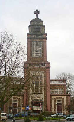
Located in the upper part of Koekelberg, this district is dominated by the National Basilica of the Sacred Heart (or Koekelberg Basilica), one of the largest Catholic churches in the world.[102]

 Lefever House
 Place Eugène Simonis/Eugène Simonisplein
 Belgian Chocolate Village
.jpg)


.jpg)
Molenbeek-Saint-Jean/Sint-Jans-Molenbeek
Historical centre
The historical centre of Molenbeek-Saint-Jean is the municipality's central district. Like Cureghem, it was once a centre of intense industrial activity, concentrated around the Brussels–Charleroi Canal. The Municipal Hall of Molenbeek is located on the Place Communale/Gemeenteplein ("Municipal Square"), in the heart of this district.[103]

 Pinwheels along the canal in Molenbeek
 Molenbeek Academy of Drawing and Visual Arts


.jpg)
.jpg)
.jpg)
Duchesse (Quatre-vents)
Located to the south of the historical centre of Molenbeek, this district is centred on the Place de la Duchesse de Brabant/Hertogin van Brabantplein. The square was created in 1847 on the grounds of the Hospices de Bruxelles, of which only the neoclassical facade remains. The hospice buildings now house a primary school (Municipal School no. 5). In 1869, the Church of St. Barbara was erected there for the Catholic worship of the new parish.[104] The Rue de Birmingham/Birminghamstraat, the Rue de Manchester/Manchesterstraat, the Rue de la Princesse/Prinsesstraat, the Rue Vanderstraeten/Vanderstraetenstraat and the Rue Isidoor Teirlinck/Isidoor Teirlinckstraat also end there.
 Place de la Duchesse de Brabant/Hertogin van Brabantplein
 Church of St. Barbara
 Brunfaut Tower
.jpg)
.jpg)
.jpg)

Heyvaert
Located in the south-east of Molenbeek, near the Abattoirs of Anderlecht (the main slaughterhouse in Brussels) and along the Charleroi Canal, Heyvaert is part of the larger Cureghem/Kuregem district. It is bounded by the Rue Nicolas Doyen/Nicolas Doyenstraat, the Rue de Birmingham, the Place de la Duchesse de Brabant, the Rue Isidoor Teirlinck, the Rue Delaunoy/Delaunoystraat, and the Rue Heyvaert/Heyvaertstraat (formerly called the Rue de l'Écluse/Sasstraat because of its proximity to the canal lock; écluse meaning "lock" in French).
 Bonne–Mariemont project on the Quai de Mariemont/Mariemontkaai
 Molenbeek lock at the Ninove Gate
 Guido Vanderhulst Footbridge


Maritime Quarter
Located in the north of Molenbeek, with a piece extending into the City of Brussels, the Maritime Quarter (French: Quartier Maritime, Dutch: Maritiemwijk) was born, around 1900, from the implementation of the Port of Brussels and the Maritime Station on the Tour & Taxis site. A number of customs agencies and handling activities mingled with homes were concentrated there and have given the neighbourhood a diverse character. The residents, historically made up of workers, as well as of the small and large bourgeoisie, were also from the outset of great diversity. In the interwar period, the Foyer Molenbeekois housing cooperative built several large-scale social housing complexes for workers and employees in the district. Many traces of this history can still be found today, including old factories and workshops, as well as Art Deco and modernist apartment buildings, designed by architects such as Joseph Diongre, Armand de Saulnier and François Van Meulecom.[105][106]
 Jubilee Bridge on the Boulevard du Jubilé/Jubelfeestlaan
 Church of St. Remigius
 Vaartkapoen


.jpg)


Karreveld
Located in the north of the upper part of Molenbeek, Karreveld Park and its surrounding district are named after the former domain of Karreveld Castle, which now covers 3 ha (7.4 acres). Today, it is a mostly residential neighbourhood between the Avenue de la Liberté/Vrijheidslaan, the Chaussée de Gand/Gentsesteenweg and the railroad.

 Karreveld Park
 Avenue du Karreveld/Karreveldlaan
.jpg)
.jpg)
.jpg)
Korenbeek
Located in the north-east of Molenbeek, Korenbeek is home to Molenbeek Cemetery between the Chaussée de Gand and the Boulevard Louis Mettewie/Louis Mettewielaan. This cemetery was inaugurated on 16 August 1864 to replace the old parish cemetery around the Church of St. John the Baptist, which had become too small, and whose last remains were cleared in 1932.[107][108][109]

 Columbarium of Molenbeek Cemetery
 Diongre garden city
.jpg)
.jpg)

Machtens (Marie-José)
Located in the upper part of Molenbeek, this district lies in the valley of the Maalbeek (or Molenbeek) that gave the municipality its name. Originally, the area was part of the former Oostendaal estate. In 1920, it was purchased by the municipality and partly turned into two parks, Albert Park and Marie-José Park, in the triangle formed by the Boulevard Edmond Machtens/Edmond Machtenslaan, the Avenue De Roovere/De Rooverelaan and the Boulevard Joseph Baeck/Joseph Baecklaan. They were designed by the architect and urban planner Louis Van der Swaelmen, and are named after King Albert I and his daughter, Princess Marie-José, the last Queen of Italy.
 Boulevard Edmond Machtens/Edmond Machtenslaan
 Albert Park
.jpg)

Osseghem/Ossegem
Osseghem/Ossegem is centrally located in the upper part of Molenbeek, west of the municipality's historical centre. The neighbourhood used to be a rural hamlet.[110] The name is of Germanic (Frankish) origin and is composed of Odso + -inga + heim, meaning "residence/domain of the family of Odso". An old country road, today's Rue d'Osseghem/Ossegemstraat, which led to the Chaussée de Gand near the current Osseghem/Ossegem metro station, connected the hamlet to Molenbeek and Brussels.
 Avenue Brigade Piron/Brigade Pironlaan
 Gulden Bodem garden city
 Muses Park
.jpg)
.jpg)
.jpg)
Scheutbos (Mettewie)
Located in the extreme west of Molenbeek, near the Boulevard Louis Mettewie, the Scheutbos (or Scheutbosch) is the municipality's remaining "green" area, home to the likewise named semi-natural site of the Scheutbos.[111][112]
 L'Écluse Tower on the Boulevard Louis Mettewie/Louis Mettewielaan
 Scheutbos


Saint-Gilles/Sint-Gillis
Historical centre
This section needs expansion. You can help by adding to it. (March 2025) |
The historical centre of Saint-Gilles is the municipality's central district.
 Church of St. Gilles
 Aegidium


.jpg)
Haut Saint-Gilles/Hoog Sint-Gillis
This section needs expansion. You can help by adding to it. (March 2025) |
Located in the south of Saint-Gilles.

.JPG)

Saint-Josse-ten-Noode/Sint-Joost-ten-Node
This section is empty. You can help by adding to it. (March 2025) |
 Saint-Josse-ten-Noode's Municipal Hall
 Church of St. Josse
 Saint-Josse-ten-Noode railway station
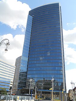


Schaerbeek/Schaarbeek
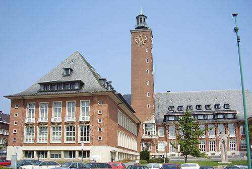
Colignon
The Colignon district (French: Quartier Colignon, Dutch: Colignonwijk) is the historical centre of Schaerbeek. Its focal point, the Place Colignon/Colignonplein, is dominated by the imposing Municipal Hall of Schaerbeek. The area has undergone profound transformations over the decades and it is now a vibrant commercial and residential neighbourhood.

 Church of St. Servatius
 Avenue Louis Bertrand/Louis Bertrandlaan
_-_2264-0007-0.jpg)
.01.jpg)

Brabant Quarter
This section needs expansion. You can help by adding to it. (March 2025) |
Located in the west of Schaerbeek, the Brabant Quarter (French: Quartier Brabant, Dutch: Brabantwijk) is the district east of Brussels-North railway station.
 Church of St. John and St. Nicholas
 Ahavat Shalom Synagogue


Little Anatolia (Sainte-Marie/Sint-Maria)
Located in the south-west of Schaerbeek, the area around St. Mary's Royal Church is home to Brussels' large Belgian Turkish community. It is dubbed the "Little Anatolia" (French: la petite Anatolie, Dutch: het Klein Anatolië) because of all the Turkish restaurants and shops on the Chaussée de Haecht/Haachtsesteenweg.[113] The area is also home to a significant Belgian Moroccan population and other immigrant communities such as Spanish, Congolese, and Asian immigrants. However, the district offers a social mix because of the numerous schools and cultural centres like the Halles de Schaerbeek/Hallen van Schaarbeek, as well as the proximity of the Rue Royale/Koningsstraat.


 La Maison des Arts


Dailly
The Dailly district (French: Quartier Dailly, Dutch: Daillywijk), formerly known as Monrose, is located in the southern part of Schaerbeek, on the border with Saint-Josse-ten-Noode. It is bounded by the Avenue Rogier/Rogierlaan, the Chaussée de Louvain/Leuvensesteenweg and the Avenue Paul Deschanel/Paul Deschanellaan. It owes its name in part to the Place Dailly/Daillyplein and the Avenue Dailly/Daillylaan, which runs through the neighbourhood. The focal point is undoubtedly the site of the former Prince Baudouin Barracks, called the Dailly Barracks by the people of Brussels. This imposing military building was partially demolished at the end of the 1990s and its front part has been converted into luxury housing and shops. The district is mainly made up of housing, but also includes shops and small industries.
 Prince Baudouin Barracks and Dailly Fountain
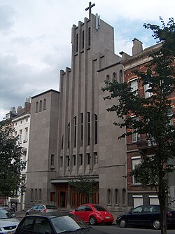 Church of St. Alice
 Place des Bienfaiteurs/Weldoenersplein


Plasky (Diamant)
The Plasky district (French: Quartier Plasky, Dutch: Plaskywijk) or Diamant district (French: Quartier Diamant, Dutch: Diamantwijk), formerly Linthout, is located in the south-east of Schaerbeek. It is bounded by the Chaussée de Louvain/Leuvensesteenweg to the north, the Rue du Noyer/Notelaarsstraat to the west, the Avenue de Roodebeek/Roodebeeklaan to the south and the Boulevard Auguste Reyers/Auguste Reyerslaan to the east. It is so named because it is crossed by the Avenue du Diamant/Diamantlaan and other streets are named after precious stones. In the middle of this district is the Square des Griottiers/Morelleboomsquare, formed by the intersection of the Avenue Émile Max/Émile Maxlaan, the Avenue Milcamps/Milcampslaan and the Avenue Félix Marchal/Félix Marchallaan.
 Church of St. Albert
 Avenue Milcamps/Milcampslaan


Josaphat
This section needs expansion. You can help by adding to it. (March 2025) |
Located in the centre of Schaerbeek.
 Josaphat School
 Mast of Lalaing


.jpg)
Flowers Quarter
The Flowers Quarter (French: Quartier des Fleurs, Dutch: Bloemenwijk), built from the 1930s onwards, is mostly residential. It is so named because its streets are almost all named after flowers. Bordered on one side by Josaphat Park and on the other by the Terdelt district, it is overlooked by the Church of St. Susanna. The district also features a number of Art Deco buildings.
 Church of St. Susanna
 Boulevard Lambermont/Lambermontlaan


Monplaisir
Monplaisir is located in the eastern part of Schaerbeek. It is named after the former Château Monplaisir, a 17th-century estate built by Baron Pierre-Ferdinand Roose near the Senne. The château was later leased to Prince Charles Alexander of Lorraine, who used it for royal hunts and hosted the region's first horse races. In 1786, it briefly housed Brussels' first porcelain factory before being demolished in 1907.

 Avenue Monplaisir/Monplaisirlaan
.jpg)
.jpg)
Helmet
This section needs expansion. You can help by adding to it. (March 2025) |
Located in the north of Schaerbeek.
 Church of the Holy Family
 Place de Helmet/Helmetseplein


Terdelt
This section needs expansion. You can help by adding to it. (March 2025) |
Located in the north-east of Schaerbeek.
 Terdelt garden city
 Avenue Charles Gilisquet/Charles Gilisquetlaan


Reyers (Mediapark)
This section needs expansion. You can help by adding to it. (March 2025) |
Located in the south-east of Schaerbeek.
 Reyers Tower
 Place des Carabiniers/Karabiniersplein
.JPG)


Uccle/Ukkel
Historical centre
The historical centre of Uccle is the municipality's central district. Located near the Chaussée d'Alsemberg/Alsembergse Steenweg, it is a lively area with many small shops. At any time of day, there is a fairly dense crowd of people shopping there. During the week, many schoolchildren from nearby schools pass through. The Municipal Hall of Uccle is located on the Place Jean Vander Elst/Jean Vander Elstplein, in the heart of this district. The Church of St. Peter is also not far away, on the Parvis Saint-Pierre/Sint-Pietersvoorplein. Connecting the two is the Rue Xavier de Bue/Xavier de Buestraat, with its succession of luxury boutiques and chain stores.
 Uccle's Municipal Hall
 Church of St. Peter
 Le Vieux Cornet
 World War I memorial on the Square des Héros/Heldensquare


Churchill
Located in the north of Uccle, between the Bois de la Cambre/Ter Kamerenbos to the east, the Rue Vanderkindere/Vanderkinderestraat to the north and the Avenue Brugmann/Brugmannlaan to the west, this residential neighbourhood received its name from its main thoroughfare, the Avenue Winston Churchill/Winston Churchilllaan (formerly known as the Avenue Longchamp/Langeveldlaan), itself named after the British statesman and former prime minister Sir Winston Churchill. The area is home to several well-known restaurants such as Brasseries Georges. It is also there that the Van Buuren Museum & Gardens are located (an emblematic example of the Amsterdam School), as well as the Royal Léopold Club tennis and hockey club, commonly known as Le Léo.
 Avenue Winston Churchill/Winston Churchilllaan
 Villa Pelseneer
 Montjoie Park


Vert Chasseur/Groene Jager
Located in the north-east of Uccle, this district lies on the edge of the Bois de la Cambre, along the Chaussée de Waterloo/Waterloosesteenweg. The place used to be part of the lordship of Carloo and is said to have been named after the café-restaurant-boarding house Le Vert Chasseur, which existed at the beginning of the 20th century at the current location of the service station at no. 964, chaussée de Waterloo, and was related to the development of the Bois de la Cambre. A residential neighbourhood, it now houses several restaurants including the renowned La Villa Lorraine. In addition, it is home to the Royal Étrier belge equestrian centre and the Royal Brussels Lawn Tennis Club. The European School of Brussels I, the second oldest European school in Europe, is also located there.
 La Villa Lorraine
 Résidence Eden Green


Vivier d'Oie/Diesdelle
Located further down the Chaussée de Waterloo, close to where the Bois de la Cambre becomes the Sonian Forest, this residential neighbourhood has the highest average income in the entire region.[114] The Dutch name Diesdelle is a deformation of Dieversdelle, which could be translated as "valley of the inhabitant of the deep place", namely the Geleytsbeek. This was mistaken for Die-vijver, which gave rise to the French name Vivier d'Oie, literally "Goose Pond".[115] The listed Stade du Vivier d'Oie was built in 1902 for the then top football club Racing Club de Bruxelles, which played there until after the Second World War.

 Avenue du Prince de Ligne/Prins de Lignelaan

.jpg)
Saint-Job/Sint-Job
Located to the west of Vivier d'Oie, the Saint-Job/Sint-Job district is centred around the Place de Saint-Job/Sint-Jobsplein, where a multitude of small shops are clustered. The neighbourhood retains the characteristics of the small village it once was, with paths leading from the square to green spaces and meadows like the Avijl Plateau. The neo-Gothic Church of St. Job is the work of the Antwerp architects Jules Bilmeyer and Van Riel.
 Church of St. Job
 Russian Orthodox Church of Saint-Job
 Typical house on the Avijl Plateau
.JPG)


Fort Jaco
Located in the east of Uccle, this district is named after the former Fort Jaco, itself named in honour of Jacques Pastur. A peaceful and affluent neighbourhood, it is home to many shops. Its location (not far from the Prince of Orange and the Place de Saint-Job) makes the immediate surroundings of the Chaussée de Waterloo very lively and congested during the week and on Saturdays. However, once rush hour has passed, the neighbourhood becomes peaceful again.

 Drève du Fort Jaco/Fort Jacodreef


Dieweg
Located in the south of Uccle, this district is centred on the Dieweg, a street extending from the Royal Observatory to Uccle-Calevoet railway station. The neighbourhood itself is centred around the upper part of Wolvendael Park, Uccle Cemetery (also called Dieweg Cemetery), and the shops that line it. It is a wealthy neighbourhood, although there is a certain social mix.
 Uccle Cemetery

.JPG)
Stalle
This section needs expansion. You can help by adding to it. (March 2025) |
Stalle is located in the west of Uccle, near the border with Forest.
 Stalle Chapel
 Headquarters of the Belgian Red Cross


Calevoet/Kalevoet
This section needs expansion. You can help by adding to it. (March 2025) |
This district lies in the south-west of Uccle, bordering the Flemish municipalities of Drogenbos, Beersel, and Linkebeek.
 Nekkersgat Mill
 Bait-ul-Mujeeb Mosque


Prince of Orange
This section needs expansion. You can help by adding to it. (March 2025) |
Located in the south of Uccle.
 Avenue du Prince d'Orange/Prins van Oranjelaan
 Church of St. Anne
.jpg)

Petite-Espinette/Kleine Hut
Situated on the southern border of Uccle, where the Chaussée de Waterloo meets the Drève Saint-Hubert/Sint-Hubertusdreef and the Flemish municipality of Sint-Genesius-Rode, the district takes its name either from a small hut once located there and from the thorny bushes that characterised the landscape. Originally the site of an inn and the terminus of Belgium's first electrified tram line, the area is now recognised for its prestigious residential character and shopping amenities.
 Drève Saint-Hubert/Sint-Hubertusdreef

Watermael-Boitsfort/Watermaal-Bosvoorde
This section is empty. You can help by adding to it. (March 2025) |
 Watermael-Boitsfort's Municipal Hall


Le Logis
This section is empty. You can help by adding to it. (March 2025) |
 Le Logis garden city

Floréal
This section is empty. You can help by adding to it. (March 2025) |
 Floréal garden city

Coin du Balai/Bezemhoek
This section is empty. You can help by adding to it. (March 2025) |
Woluwe-Saint-Lambert/Sint-Lambrechts-Woluwe
 Woluwe-Saint-Lambert's Municipal Hall
 Chapel of Lenneke
 Church of St. Lambert
.jpg)


Roodebeek
This section needs expansion. You can help by adding to it. (March 2025) |
Located in the centre of Woluwe-Saint-Lambert.
 Villa Montald
 Roodebeek Park
 Wolubilis

.jpg)

Kapelleveld
This section needs expansion. You can help by adding to it. (March 2025) |
Located in the east of Woluwe-Saint-Lambert.
 Kapelleveld garden city
 Church of Our Lady of the Assumption

.jpg)
Woluwe-Saint-Pierre/Sint-Pieters-Woluwe
This section is empty. You can help by adding to it. (March 2025) |
 Woluwe-Saint-Pierre's Municipal Hall
 Church of St. Peter

.jpg)

Chant d'Oiseau/Vogelzang
This section needs expansion. You can help by adding to it. (March 2025) |
Located in the south-west of Woluwe-Saint-Pierre.
 Church of Our Lady of Grace
 Avenue des Linottes/Vlasvinkenlaan


Stockel/Stokkel
This section needs expansion. You can help by adding to it. (March 2025) |
Located in the north-east of Woluwe-Saint-Pierre.
 Church of Our Lady of Stockel
 Place Dumon/Dumonplein


Joli-Bois/Mooi-Bos
This section needs expansion. You can help by adding to it. (March 2025) |
Located in the south-east of Woluwe-Saint-Pierre.
 Church of St. Alice

Remove ads
References
External links
Wikiwand - on
Seamless Wikipedia browsing. On steroids.
Remove ads