Top Qs
Timeline
Chat
Perspective
Onguday
Selo in Altai Republic, Russia From Wikipedia, the free encyclopedia
Remove ads
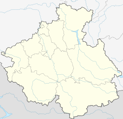
Onguday (Russian: Онгуда́й; Altay: Оҥдой, Oñdoy) is a rural locality (a selo) and the administrative center of Ongudaysky District in the Altai Republic, Russia, located on the Ursul River, 210 kilometers (130 mi) from Gorno-Altaysk, the capital of the republic. As of the 2010 Census, its population was 5,655,[3] consisting mainly of the Altai people and Russians.[citation needed]


Remove ads
Etymology
Local name Ongdoy (from mongolian onge — "cave, cavity", doy — possession affix;literally — "having cave, cavities"
History
It was founded in 1626.[citation needed] In 1856-1857, the camp-settlement of the Altai spiritual mission of the Russian Orthodox Church was founded. In 1860, the first school was opened, for which a building was built in 1881. In 1879, the Assumption Church was built and consecrated in 1881. In 1908 the Church of St. Innocent of Irkutsk was built. In 1910, about 800 people lived in the village.
Remove ads
Climate
Summarize
Perspective
Onguday has a monsoon-influenced humid continental climate (Köppen climate classification Dwb) with warm, humid summers and severely cold, dry winters.[citation needed] The warmest month of the year is July, when the average temperature is +16.9 °C (62.4 °F), the highest temperature recorded being +39.7 °C (103.5 °F).[citation needed] The coldest month of the year is January, when the average temperature is −19.5 °C (−3.1 °F), with the record low of −43.9 °C (−47.0 °F).[citation needed]
References
Wikiwand - on
Seamless Wikipedia browsing. On steroids.
Remove ads


