Top Qs
Timeline
Chat
Perspective
Puerto Rico Highway 181
Highway in Puerto Rico From Wikipedia, the free encyclopedia

Remove ads
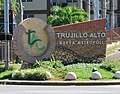
Puerto Rico Highway 181 (PR-181), also known as Expreso Trujillo Alto (Trujillo Alto Expressway),[3] is a road in Puerto Rico connecting the municipality of San Juan on the northeastern coastal plain with Patillas on the southeastern coastal plain. Beginning in the Rio Piedras district of barrio Oriente in San Juan at Jesus de Piñero Avenue (PR-17), it runs through Trujillo Alto, Gurabo and San Lorenzo on the Caguas Valley, and western Yabucoa and eastern Patillas on the Sierra de Cayey, before ending in the Patillas Pueblo downtown area on the southeastern coastal plain of Puerto Rico. PR-181 is a four-lane highway from San Juan through the Trujillo Alto Pueblo downtown area, and completely rural on the way to Patillas with the exception of a small tract in Gurabo where it intersects PR-30. Along with PR-10, PR-149, PR-1 and PR-52, it is one of the longest roads crossing the main island from north to south.


Remove ads
Route description
Rural road

 Trujillo Alto marker on PR-181
 PR-181 north in Gurabo


In Trujillo Alto, near Gurabo, it turns into a rural road with very narrow lanes per direction and hard curves, making it dangerous and requiring low speed limits. In Gurabo, it becomes divided in about 1 kilometer as it intersects Puerto Rico Highway 30, and then quickly turns rural. In San Lorenzo its makes intersection with Puerto Rico Highway 183. For the rest of its length it is still rural. In Yabucoa, PR-182 begins to connect to the main town, while PR-181 continues and as it enters Patillas, it borders lake Carite, before arriving to downtown Patillas, where it meets PR-3.[1]
Remove ads
Major intersections
 PR-30 east at exit 7 to PR-181 in Gurabo
.jpg)
Remove ads
See also
References
External links
Wikiwand - on
Seamless Wikipedia browsing. On steroids.
Remove ads