Top Qs
Timeline
Chat
Perspective
Puerto Rico Highway 149
Highway in Puerto Rico From Wikipedia, the free encyclopedia

Remove ads
Puerto Rico Highway 149 (PR-149) is a secondary highway in Puerto Rico that connects the towns of Manatí in the north coast of Puerto Rico to Juana Díaz in the south coast. The road begins at PR-22 and ends at PR-1, passing trough Ciales, Orocovis and Villalba municipalities in the Cordillera Central.[3]

Remove ads
Route description
After Manatí, PR-149 goes through Ciales, and is a divided highway and a wide rural highway between that municipality and Manatí, as it is also from Juana Díaz to Villalba. From Ciales to Villalba, it is an extremely dangerous mountain road, with very high areas and poor safety barriers. From Ciales to Villalba it passes through the Salto de Doña Juana, a spot with a small waterfall and a small creek where people can jump and swim. It is one of the longest highways going south to north, perhaps the longest excluding PR-1 and PR-52.[4]
The highway also makes intersections with PR-2 just 2 kilometers south from its beginning in PR-22, and an intersection with PR-52 about 8 kilometers north from the terminus at PR-1.
- Puerto Rico Highway 149
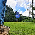 Southbound sign in Coto Norte, Manatí
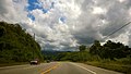 Heading south in Coto Sur, Manatí
 Heading south in Río Arriba Saliente, Manatí
.jpg)
.jpg)
.jpg)
Remove ads
Major intersections
 PR-2 west near its junction with PR-149 in Coto Norte, Manatí
 PR-149 south approaching PR-670 in Coto Norte, Manatí

.jpg)
.jpg)
Remove ads
Related route
Puerto Rico Highway 149R (Spanish: Carretera Ramal 149, abbreviated Ramal PR-149 or PR-149R) is a business loop road that branches off from PR-149 and leads into downtown Villalba, Puerto Rico. This road used to be signed PR-149, but became 149R when a new road bypassing the downtown area was built around the town center.[3] The entire route is located in Villalba.
See also
References
External links
Wikiwand - on
Seamless Wikipedia browsing. On steroids.
Remove ads