Top Qs
Timeline
Chat
Perspective
Pasil
Municipality in Kalinga, Philippines From Wikipedia, the free encyclopedia
Remove ads
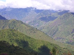
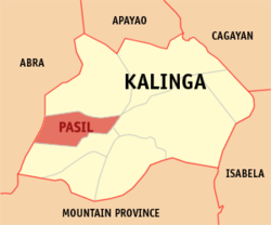
Pasil, officially the Municipality of Pasil, is a municipality in the southwestern part of the Kalinga. According to the 2024 census, it has a population of 10,690 people.[5]
Remove ads
Geography
Summarize
Perspective
It is bounded on the north by the municipality of Balbalan, on the south by the municipality of Tinglayan, on the east by Tabuk, and on the west by the province of Abra and south-western part of the municipality of Sadanga, Mountain Province.
Pasil is situated 51.39 kilometres (31.93 mi) from the provincial capital Tabuk, and 516.83 kilometres (321.14 mi) from the country's capital city of Manila.
Barangays
Pasil is politically subdivided into 14 barangays.[6] Each barangay consists of puroks and some have sitios.
- Ableg
- Bagtayan
- Balatoc
- Balenciagao Sur
- Balinciagao Norte
- Cagaluan
- Colayo
- Dalupa
- Dangtalan
- Galdang (Casaloan)
- Guina-ang (Poblacion)
- Magsilay
- Malucsad
- Pugong
Climate
Remove ads
Demographics
In the 2020 census, the population of Pasil was 10,577 people,[13] with a density of 56 inhabitants per square kilometre or 150 inhabitants per square mile.
Remove ads
Economy
Poverty incidence of Pasil
10
20
30
40
50
60
70
80
2000
61.91
61.91
2003
70.01
70.01
2006
44.80
44.80
2009
26.52
26.52
2012
41.18
41.18
2015
27.68
27.68
2018
18.15
18.15
2021
11.69
11.69
Source: Philippine Statistics Authority[14][15][16][17][18][19][20][21]
Government
Local government
Pasil, belonging to the lone congressional district of the province of Kalinga, is governed by a mayor designated as its local chief executive and by a municipal council as its legislative body in accordance with the Local Government Code. The mayor, vice mayor, and the councilors are elected directly by the people through an election which is being held every three years.
Elected officials
Remove ads
Folklore
In an earlier time, Kabunian–the supreme deity of the Kalinga–left a drop of water upon an ancient tree he passed on one of his travels. This drop trickled down and with a great force akin to magnetism, attracted nearby brooks and rivulets to form what is now the Pasil River.[23]
Education
The Pasil Schools District Office governs all educational institutions within the municipality. It oversees the management and operations of all private and public, from primary to secondary schools.[24]
Primary and elementary schools
- Ableg Elementary School
- Bagtayan Elementary School
- Balatoc Elementary School
- Batong Buhay Elementary School
- Balinciagao Elementary School
- Balinciagao Elementary School - Wagas Primary School Annex
- Cagaluan Elementary School
- Cagaluan Elementary School Annex (Da-o Primary School)
- Cagaluan Elementary School Annex (Putao Primary School)
- Colayo Elementary School
- Dalupa Elementary School
- Dangtalan Elementary School
- Galdang Elementary School
- Magsilay Elementary School
- Pasil Central School
- Pasil Central School (Guinaang Annex)
- Pasil Central School (Malucsad Annex)
- Pasil Central School ( Pugong Annex)
- Balinciagao Elementary School - Limood Annex
Secondary schools
- Batong Buhay National High School
- Central Pasil National High School
- Pasil National High School
Remove ads
References
External links
Wikiwand - on
Seamless Wikipedia browsing. On steroids.
Remove ads


