Top Qs
Timeline
Chat
Perspective
Puerto Rico Highway 130
Highway in Puerto Rico From Wikipedia, the free encyclopedia

Remove ads
Puerto Rico Highway 130 (PR-130) is the main north–south route within the municipality of Hatillo, Puerto Rico. This road extends from PR-119 in downtown Hatillo to PR-129 in Campo Alegre barrio.[4]
Remove ads
Route description
The highway starts from the downtown area (from PR-119), crossing the neighborhoods of Capáez, Naranjito, Buena Vista and Campo Alegre until its end at Carretera Mariana Bracetti (PR-129).[5] In downtown, the highway runs through Calle Luis H. Lacomba and Avenida Pablo J. Aguilar until it crosses PR-2 in a southerly direction. This route is part of the caravan of the Hatillo Mask Festival.
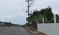
 Puerto Rico highway 130 heading north
 One of many dairy farms located along PR-130


Communities served
The following are the barrios through which PR-130 passes from north to south:[2]
- Hatillo barrio-pueblo
- Hatillo barrio
- Capáez
- Naranjito
- Buena Vista (northeast corner)
- Corcovado (southwest corner)
- Campo Alegre
Remove ads
Major intersections
The entire route is located in Hatillo.
 PR-488 and PR-130 junction in Hatillo
 PR-130 north at PR-492 intersection
 "Hatillo Mask Festival" statue located at downtown entrance
 PR-2 west at PR-130 junction in downtown Hatillo


.jpg)
Remove ads
See also
References
External links
Wikiwand - on
Seamless Wikipedia browsing. On steroids.
Remove ads