Top Qs
Timeline
Chat
Perspective
Quebec Route 138
Highway in Quebec From Wikipedia, the free encyclopedia

Remove ads
Route 138 is a major highway in the Canadian province of Quebec, following the entire north shore of the St. Lawrence River past Montreal to the temporary eastern terminus in Kegashka on the Gulf of St. Lawrence. The western terminus is in Elgin, at the border with New York State south-west of Montreal (connecting with New York State Route 30 at the Trout River Border Crossing). Part of this highway is known as the Chemin du Roy,[2] or King's Highway, which is one of the oldest highways in Canada.[2][3]
You can help expand this article with text translated from the corresponding article in French. Click [show] for important translation instructions.
|


It passes through the Montérégie, Montreal, Lanaudière, Mauricie, Capitale-Nationale and Côte-Nord regions of Quebec. In Montreal, Highway 138 runs via Sherbrooke Street, crosses the Pierre Le Gardeur Bridge to Charlemagne and remains a four-lane road until exiting Repentigny.
This highway takes a more scenic route than the more direct Autoroute 40 between Montreal and Quebec City. It crosses the Saguenay River via a ferry which travels between Baie-Sainte-Catherine and Tadoussac; in the event of a closure of this ferry, drivers must take a significant detour via Quebec Route 172 and Quebec Route 170 to the city of Saguenay in order to cross the river by bridge.
Remove ads
The Whale Route
Summarize
Perspective
From Tadoussac to Blanc-Sablon,[4] at the beginning of the 20th century, the first routes of what would become Route 138 (formerly Route 15) were laid in the vicinity of Sept-Îles. In 1961, a section was added from the Franquelin region to the tip of the Moisie River, some 20 kilometres east of Sept-Îles.
On the north shore of the Gulf of St. Lawrence, until 1976, there was no continuous route to go further east than the Moisie River. Only bits of paths here and there connect a few coastal villages to each other, Natashquan connects to Aguanish by a dirt road (1959).
Route 138, from Tadoussac to Havre-Saint-Pierre, opened in the spring of 1976, from there access to the islands of the Mingan Archipelago by sea.
In 1984, to commemorate the 450th anniversary of Jacques Cartier's arrival in New France, the Commission de toponymie gave this name to the part of Route 138 located east of the Saguenay River, that is, the part that extends from Tadoussac to Havre-Saint-Pierre.[5][6]
- The Whale route - Route Jacques-Cartier - Route 138 East 1976

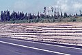 Fill of Highway No. 138, Sept-Îles (City), Hamlet Matamec
 Roadside restaurant sign
 Pole transport by helicopter


Remove ads
From Havre-Saint-Pierre to Natashquan
Summarize
Perspective

Until the mid-1990s, the highway's eastern terminus was Havre-Saint-Pierre, but in 1996 the extension to Natashquan was completed. A 40 km gravel section between Natashquan and Kegaska opened on September 26, 2013, with the inauguration of a bridge across the Natashquan River.[8][9]
When planning Route 138, from Havre-Saint-Pierre to the Pashashibou River, the Quebec Ministry of Transport planned the installation of lookouts. Visual openness, proximity to an exceptional landscape, educational potential, as well as a tourist vocation play a determining role in the choice of sites.
The arrangement of lookouts invites travelers to stop in safe observation places, close to the road, preferably elevated and exposed to the winds to avoid the presence of insects.[10]
Over the 150.5 km that separate Havre-Saint-Pierre and Pashashibou River, Route 138 offers visual openings towards the Gulf of St. Laurent, Pontbriand River, the villages of Baie-Johan-Beetz and Natashquan, etc.[11]
A second segment of about 17 km extends from Tête-à-la-Baleine's airport, east through Tête-à-la-Baleine, to the ferry terminal southeast of Tête-à-la-Baleine. There is also a 10.7 km roadway, la route Mecatina, from Mutton Bay to a ferry terminal in La Tabatière and continuing beyond.
A third segment of Route 138 extends from Old Fort to the Newfoundland and Labrador border (connecting with Newfoundland and Labrador Provincial Route 510), near Blanc-Sablon on the eastern end of the Côte-Nord.[12]

Blanc-Sablon is located on the north coast of the Gulf of St. Lawrence near the entrance of the Strait of Belle Isle.
A gap remains between Kegaska and Old Fort, through isolated communities accessible only by coastal ferry. On August 25, 2006, the Quebec government announced a 10-year project to connect the two segments by building 425 km of highway along the Lower North Shore. In 2011, the Quebec government announced an additional $122 million investment for the project over five years as part of the Plan Nord.[13] However, by 2013 difficulties ensued between the Quebec Ministry of Transport and the Pakatan Corporation, who was previously responsible for managing the funding for this project, leading to the termination of agreement between the two. By this time only 12 km of this road had been built, plus some additional engineering work and deforestation.[14] The construction of two segments of the highway (Kegaska–La Romaine and Tête-à-la-Baleine–La Tabatière) was set to begin in 2019. A total of $232 million will be contributed to this project.[15] In 2024 the province awarded contracts for engineering and construction of the route and bridges for the road segment between Kegaska and La Romaine.[16][17]
Remove ads
Municipalities along Route 138
Summarize
Perspective

Major intersections
Remove ads
Fauna
From Tadoussac to Blanc-Sablon, along The Whale Route (Route 138), it is possible to admire marine mammals with both feet on the ground. Several observation sites will allow you to meet these exceptional sea creatures!
Cetaceans: Beluga, Minke whale, Fin whale, Porpoise, Blue whale.
Seals: Grey seal, harbour seal, harp seal.[4]
- Tadoussac - Sentier Pointe de l'Islet
- Sacré-Coeur - Baie Sainte-Marguerite
- Les Bergeronnes - Centre d'interprétation et d'observation du Cap-Bon-Désir
- Les Escoumins - Centre découverte du milieu marin
- Portneuf-sur-Mer - Pointe-des-Fortin
- Colombier - Cap Colombier
- Ragueneau - Archipel des iles de Ragueneau
- Baie-Comeau - Quai de Baie-Comeau
- Baie-Comeau - Baie St-Pancrace
- Franquelin - Pointe à la croix
- Godbout - Baie de Godbout
- Baie-Trinité - Phare de Pointe-des-Monts
- Port-Cartier - Quai des pêcheurs
- Sept-Îles - Secteur des plages
- Sept-Îles - Parc du Vieux-Quai
- Rivière-au-Tonnerre - Belvédère Coste
- Magpie - Belvédère de Magpie
- Longue-Pointe-de-Mingan - Promenade sur le bord du fleuve
- Anticosti - Phare de la Pointe Carleton
- Bonne-Espérance - Secteur du Vieux-Fort[4]
Remove ads
See also
- Quebec Route 2 (historical) and Chemin du Roy
- List of Quebec provincial highways
References
External links
Wikiwand - on
Seamless Wikipedia browsing. On steroids.
Remove ads