Top Qs
Timeline
Chat
Perspective
Rachna Doab
Region of Punjab From Wikipedia, the free encyclopedia
Remove ads
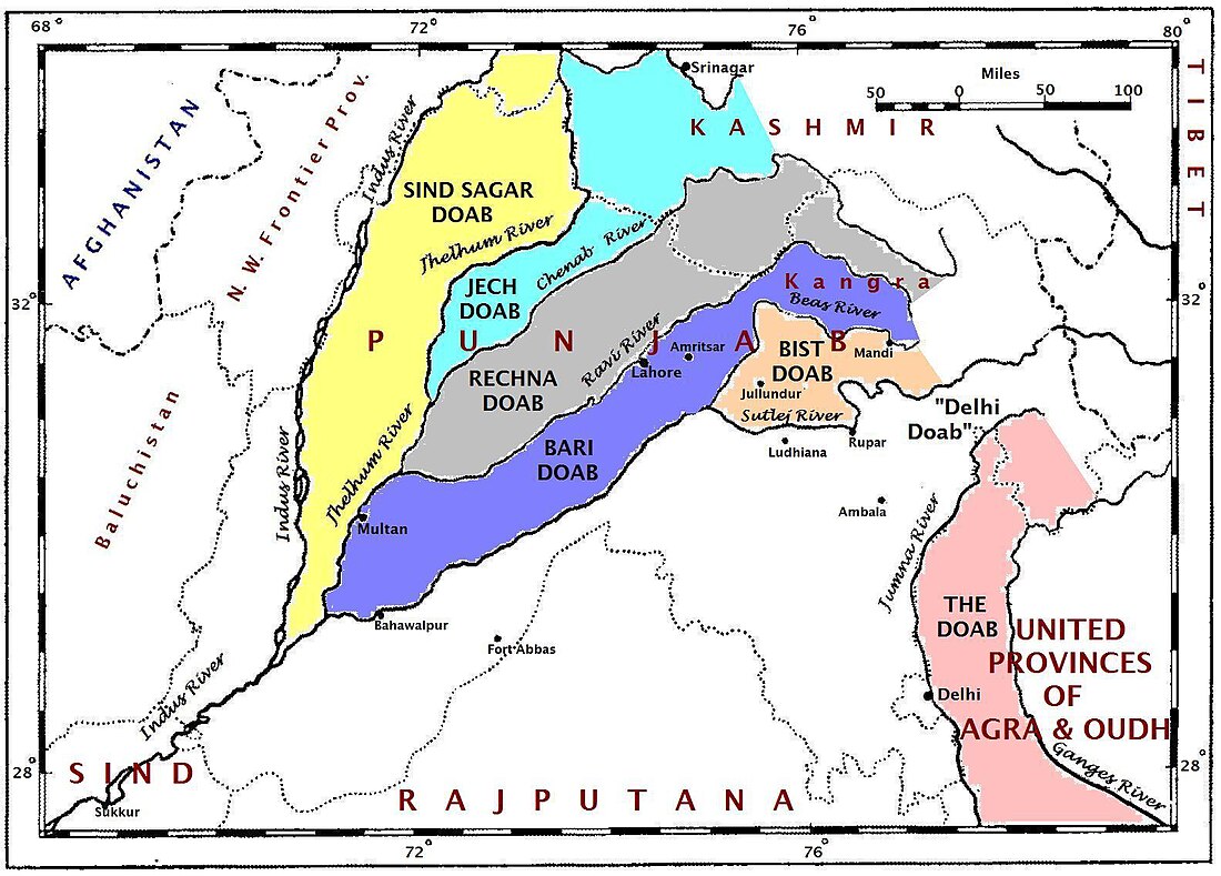
Rachna Doab (Punjabi: رچنا دوآب), also spelt as Rachena Doab,[1] can be classified as one of the main regions of Punjab, Pakistan.[2] Punjab historically has been divided into regions based on its various rivers, since the name Punjab is based on its five main rivers. Rachna Doab is a Doab or tract of land in the Punjab region, encompassing all the area lying between the Ravi and Chenab Rivers, all the way from the Jammu Division till their confluence south of the town of Ahmadpur Sial in Punjab, Pakistan. It lies between 30° 35' and 32° 50' N. and 71° 50' and 75° 3' E. The name was given by the Mughal emperor Akbar, by combining the first syllables of the names of the two rivers. This is the most densely-populated region in Punjab, Pakistan, home to large cities such as Lahore and Gujranwala.[1]
This article needs additional citations for verification. (May 2022) |
Remove ads
Geography
The doab receives more rainfall than other parts of Punjab, Pakistan and is also irrigated by the Lower Chenab Canal.[1] In the south of the doab, there are the cities of Khanewal and Jhang.[1] The north-eastern part of the doab connects to the Grand Trunk Road.[1] The upper area of the Rachna Doab is densely-populated.[1]
History
The Chenab Colony was established in this doab with Faisalabad (formerly Lyallpur) at its centre during the British-period.[1]
Districts
Rachna doab covers Narowal District, Sialkot District, Jammu District, Kathua District, Samba district, Udhampur district, Gujranwala District, Hafizabad District, Sheikhupura District, Nankana Sahib District, Faisalabad District, Toba Tek Singh District, Chiniot District (excluding Lalian Tehsil) and Jhang District (excluding Athara Hazari Tehsil and Ahmedpur Sial Tehsil).
Major cities
See also
References
Wikiwand - on
Seamless Wikipedia browsing. On steroids.
Remove ads


