Top Qs
Timeline
Chat
Perspective
Rural City of Wangaratta
Local government area in Victoria, Australia From Wikipedia, the free encyclopedia
Remove ads
The Rural City of Wangaratta is a local government area in the Hume region of Victoria, Australia, located in the north-east part of the state. It covers an area of 3,645 square kilometres (1,407 sq mi) and, in August 2021, had a population of 29,808.[1] It includes the towns of Cheshunt, Eldorado, Everton, Glenrowan, Greta, Greta West, Milawa, Moyhu, Oxley, Tarrawingee, Wangaratta and Whitfield. It was formed in 1994 from the amalgamation of the City of Wangaratta, Shire of Wangaratta, Shire of Oxley, and parts of the United Shire of Beechworth, Shire of Benalla and Shire of Yarrawonga. When formed the municipality was originally called the Shire of Milawa, but a few months later, was renamed to its current name.[2]

The Rural City is governed and administered by the Wangaratta Rural City Council; its seat of local government and administrative centre is located at the council headquarters in Wangaratta. The Rural City is named after the main urban settlement located in the north of the LGA, that is Wangaratta, which is also the LGA's most populous urban centre with a population of around 18,500.[3]
Remove ads
Council
Summarize
Perspective
Current composition
The council is composed of seven single-councillor wards.[4] As of the 2024 election, the seven councillors are:[5]
History
The election of Councillors in 2016 followed a three year period where the Council was governed by Administrators. Administrators had been appointed by an Act of Parliament, following the dismissal of the Councillors elected at the 2012 general election.[6] A panel of three administrators, by an Act of Parliament, was appointed to oversee the council until the 2016 municipal elections.[7][8]
In 2023, the Victoria Electoral Commission commenced an electoral structure review into the existing Ward structures of the Rural City of Wangaratta to satisfy the requirements of the Local Government Act 2020 (Vic). As a result of this review, the council moved to seven single-councillor wards for the 2024 election. Previously, the council was divided into 4 wards, including a four-councillor city ward.[4]
Administration and governance
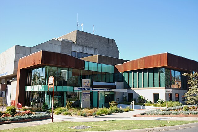
The councillors meet in the council chambers at the council headquarters in the Wangaratta Government Centre, which is also the location of the council's administrative activities. It also provides customer services at its administrative centre in Wangaratta.
Remove ads
Townships and localities
Summarize
Perspective
The 2021 census, the rural city had a population of 29,808 up from 28,310 in the 2016 census[9]
^ - Territory divided with another LGA
Remove ads
See also
References
External links
Wikiwand - on
Seamless Wikipedia browsing. On steroids.
Remove ads


