Top Qs
Timeline
Chat
Perspective
Sadni Falls
Waterfall in Jharkhand, India From Wikipedia, the free encyclopedia
Remove ads
Sadni Falls (also called Sadnighagh Falls) is a waterfall located about 3 kilometres (1.9 mi) from Rajadera village in Gumla district in the Indian state of Jharkhand.[2]
Remove ads
Geography

17km
10.6miles
10.6miles
C
H
H
A
T
T
I
S
G
A
R
H
X
North Karo
River
River
W
Sankh River
V
South Koel
River
River
T
Palkot
Wildlife
Sanctuary
Wildlife
Sanctuary
T
Sadni
Falls
Falls
H
Nagfeni
H
Navratangarh
H
Marda
B
Serangdag
B
Jalim
B
Gurdari
CT
Toto
CT
Ghaghra
M
Gumla
R
Sisai
R
Raidih
R
Palkot
R
Kamdara
R
Jari
R
Dumri
R
Chainpur
R
Bishunpur
R
Bharno
R
Basia
Cities, towns and locations in Gumla district in South Chotanagpur Division
M: municipality, CT: census town, R: rural/ urban centre, H: historical/ religious centre, T: tourist centre, B: Bauxite mining centre
Owing to space constraints in the small map, the actual locations in a larger map may vary slightly
M: municipality, CT: census town, R: rural/ urban centre, H: historical/ religious centre, T: tourist centre, B: Bauxite mining centre
Owing to space constraints in the small map, the actual locations in a larger map may vary slightly
Location
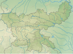
Sadni Falls is located at 23.2833°N 84.2333°E
Remove ads
The Falls
The 60 metres (200 ft) falls on the Sankh River is a scarp fall. It is referred to as a snake type falls and is a popular picnic spot.[3][4] Its surroundings are spectacular with hillocks, forests and streams.[5]
History
Once upon a time, active diamond mines existed at Sadni Falls. These mines yielded many large and fine stones in the sixteenth and the seventeenth centuries.[6]
Transport
By rail
The nearest town Netarhat does not have a railway station. The closest railway station is at Ranchi, which is 110 kilometres away.[7]
By road
There are regular bus services between Ranchi, the state capital and Netarhat. Sadni falls lie at a distance of 35 kilometres from Netarhat.[7]
See also
References
Wikiwand - on
Seamless Wikipedia browsing. On steroids.
Remove ads

