Top Qs
Timeline
Chat
Perspective
Samrong Nuea
Tambon in Samut Prakan, Thailand From Wikipedia, the free encyclopedia
Remove ads
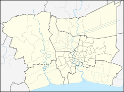
Samrong Nuea (Thai: สำโรงเหนือ, pronounced [sǎm.rōːŋ nɯ̌a]), also popularly called for short Samrong (pronounced [sǎm.rōːŋ][2]) is a tambon (sub-district) and neighbourhood of Mueang Samut Prakan District, Samut Prakan Province on eastern outskirts Bangkok.
Remove ads
Description
Its name meaning "northern Samrong" after Khlong Samrong, a main watercourse flowing through the area.[2]
The area is the northernmost part of the district. It borders Bang Na Tai in Bang Na District of Bangkok to the north.
Administration & population
Samrong Nuea is part of the administrative area of Samrong Nuea Subdistrict Municipality.
The area also consists of nine administrative muban (village).


It has a total population of 55,389 people in 18,989 households.[1]
Remove ads
Places
- Imperial World Samrong
- Samrong General Hospital
- Wat Dan Samrong
- Mathayomwat Dansamrong School
- Makro Srinagarindra
Transportation
The area served by nearby the Bearing (E14) and Samrong Stations (E15) of the BTS skytrain, whose Sukhumvit Line runs above Sukhumvit Road (Highway 3).
Samrong Nuea is also a transit and departure point for many BMTA bus routes such as 2 (Samrong – Pak Khlong Talat), 23 (Samrong – Thewet), 25 (Pak Nam – Sanam Luang), as well as a large number of songthaew (local bus).[3]
Sukhumvit, Srinagarindra (Highway 3344), Bearing (Soi Sukhumvit 107), Thang Rotfai Sai Kao Paknam Roads are the main road.[4]
Remove ads
See also
- Pu Chao Saming Phrai – adjacent area is collectively referred to as "Samrong" as well.
References
External links
Wikiwand - on
Seamless Wikipedia browsing. On steroids.
Remove ads


