Top Qs
Timeline
Chat
Perspective
Saskatchewan Highway 10
Provincial highway in Saskatchewan, Canada From Wikipedia, the free encyclopedia
Remove ads
Highway 10 is a provincial paved undivided highway in the Canadian province of Saskatchewan.[2][3] It runs from Highway 1 near Balgonie until it transitions into PTH 5 at the Manitoba border. Highway 10 is about 225 km (140 mi) long. It passes through Fort Qu'Appelle, Balcarres, Melville, and Yorkton. It intersects Highway 1 and Highway 16.[1]
.svg)
The highway is a component of Canada's National Highway System. Between Highway 1 the intersection with Highway 9 / Highway 16 concurrency in Yorkton, it is designated as a Core Route.[4]
The Melville–Yorkton section of Highway 10 used to go through Willowbrook; in the 1960s Highway 10 was realigned to a more direct route with the bypassed section becoming part of Highway 47 and Highway 52.[5][6]
Remove ads
Photo gallery
 Echo Valley Scenic Route Hwy 10
 Scenic Route
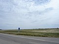 Adopt a Highway along Hwy 10.


Major intersections
Summarize
Perspective
From west to east:[7]
Remove ads
Highway 10A
Summarize
Perspective
Highway 10A is a highway in the Canadian province of Saskatchewan serving the city of Yorkton. It runs from Highway 10 at the city's southwestern limits to Highway 16 / Highway 9 / Highway 10. Like most alternate routes, it was the original configuration for Highway 10 through Yorkton.
The highway travels northeast for approximately 2 km (1 mi) from Highway 10 (Queen Street) to Highway 52, where it travels east along Broadway Street. At Gladstone Avenue, Highway 16A joins Broadway Street, and the two highways run concurrently to its eastern terminus as Highway 16 / Highway 9 / Highway 10. Highway 10 continues east along Broadway Street.
Highway 10A is about 5 km (3 mi) long.[1]
Major intersections
From west to east. The entire route is in Yorkton.
See also
References
External links
Wikiwand - on
Seamless Wikipedia browsing. On steroids.
Remove ads