Top Qs
Timeline
Chat
Perspective
South Yadkin River
River in North Carolina, United States From Wikipedia, the free encyclopedia
Remove ads
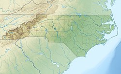
The South Yadkin River is a 75 mi (121 km) long river that flows through Alexander, Davie, Iredell, Rowan, and Wilkes counties of North Carolina. The mouth is located north of High Rock Lake, where the South Yadkin River meets the Yadkin River. Major cities along the course of the South Yadkin River include, Statesville in Iredell County and Cooleemee in Davie County. The South Yadkin River forms the border of Davie and Rowan counties.[1][2] High Rock Lake begins at the confluence of the South Yadkin River and the similarly named and larger Yadkin River.
Remove ads
Tributaries
Major tributaries of the South Yadkin River include:[3]
- Hunting Creek
- Fourth Creek (see also Fourth Creek Congregation)
- Third Creek
- Second Creek and tributaries: Withrow's Creek, Back Creek, Cathy's Creek, and Sill's Creek
Sill's Creek was named for an early settler, John Sill, who settled there in 1749. Cathy's Creek was named for James Cathey, another early Rowan County settler. The Back Creek Presbyterian Church, named for the Creek, was founded in 1805.[4][5]
Remove ads
References
External links
Wikiwand - on
Seamless Wikipedia browsing. On steroids.
Remove ads


