Top Qs
Timeline
Chat
Perspective
Spiess Rocks
Submerged rock formation of Bouvet Island From Wikipedia, the free encyclopedia
Remove ads
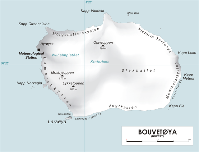
Spiess Rocks (54°25′S 3°29′E) is a group of submerged rocks which extend up to 0.4 nautical miles (0.7 km) northeast of Cape Lollo on the island of Bouvetøya. First charted in December 1927 by a Norwegian expedition under Captain Harald Horntvedt. Named by the Norwegians for Captain Fritz A. Spiess, leader of the German expedition which visited Bouvetoya on board the Meteor in 1926. [1] [2]

Remove ads
References
Other sources
Wikiwand - on
Seamless Wikipedia browsing. On steroids.
Remove ads
