Top Qs
Timeline
Chat
Perspective
Tagoloan, Lanao del Sur
Municipality in Lanao del Sur, Philippines From Wikipedia, the free encyclopedia
Remove ads
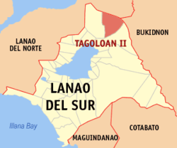
Tagoloan, officially the Municipality of Tagoloan (Maranao: Inged a Tagoloan; Tagalog: Bayan ng Tagoloan) and also known as Tagoloan II, is a municipality in the province of Lanao del Sur, Philippines. According to the 2020 census, it has a population of 12,602 people.[5]
Remove ads
Etymology
Tagoloan is a compound word composed of Maranao terms tago, referring to something inside i.e. inhabitants, and oloan, "leader", referring to Sultan Sharif Alawi.
The municipality's name is not to be confused with eponymous municipalities of Lanao del Norte and Misamis Oriental, both called Tagoloan.
History
Sharif Alawi established the Sultanate of Tagoloan in 1500. Some local historians say it was in the year 1515[6] while his younger brother Sultan Sharif Kabunsuan was enthroned as the First Sultan of Maguindanao in the year 1520 (see Confederation of sultanates in Lanao).
Sharif Alawi and Sharif Kabunsuan came from Johore, a state in Malaysia and first landed in Mindanao in the year 1475 at an islet (now Agutayan reef, in Jasaan, Misamis Oriental,[7] visible from the seaport of the Municipality of Tagoloan in the Province of Misamis Oriental, Northern Mindanao. The brothers arrived in Mindanao in the year 1464[6]
Sultan Sharif Alawi spread Islam (prior to the arrival of Christianity in Philippine in 1521), in this town towards Surigao, Butuan, Bukidnon, Davao, Lanao del Sur and Norte, stretching towards Misamis Occidental in western Mindanao. Sultan Sharif Kabunsuan only preached Islam in Maguindanao.
Remove ads
Geography
Summarize
Perspective
It is situated in the northern part of the Province of Lanao del Sur, containing a total land area of 60,214 hectares, more or less. This area is based on the territorial jurisdiction covered by those barangays (39 Barangays) named in the Presidential Decree 1548 dated June 11, 1978,[8] otherwise known as the "charter creation of the Municipality of Tagoloan in the Province of Lanao del Sur" which hereby described as follows;
Bounded on the east by the Cagayan River (Talakag, Bukidnon); on the south by Bubong, Lanao del Sur; on the south-west by Kapai, Lanao del Sur, and Tagoloan, Lanao del Norte; on the west by Iligan; on the north by Cagayan de Oro.
Barangays
Tagoloan is politically subdivided into 19 barangays. Each barangay consists of puroks while some have sitios.
It was originally subdivided into 39 barangays under the P.D. 1548 dated June 11, 1978[8] and was then reduced into 19 barangays, as affected by E.O. No. 108, Series of 1986.[9]
- Bago-ah Ingud
- Bantalan
- Bayog
- Cadayonan
- Dagonalan
- Domalama
- Gayakay
- Inudaran
- Kalilangan
- Kianibong
- Kinggan
- Kita-o-an
- Malinao
- Malingun
- Mama-an Pagalongan
- Marawi
- Mimbaguiang
- Sigayan
- Tagoloan Poblacion
Climate
Demographics
Economy
Poverty Incidence of Tagoloan
10
20
30
40
50
60
70
80
90
2000
73.50 2003
58.12 2006
45.70 2009
59.26 2012
60.75 2015
78.23 2018
85.01 2021
18.92 Source: Philippine Statistics Authority[16][17][18][19][20][21][22][23] |
References
External links
Wikiwand - on
Seamless Wikipedia browsing. On steroids.
Remove ads


